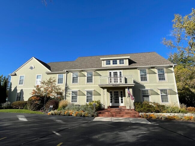
Property Record
N48w16550 Lisbon Rd, Menomonee Falls, WI 53051


NEARBY LISTINGS FOR SALE OR LEASE
Property Detail
N48w16550 Lisbon Rd
Milwaukee-Waukesha-West Allis, WI
Fair Oak Manor Addition
MNFV-0135-025
LOT 1 CSM #5292 VOL 42/597 REC AS DOC #1443999 LOTS 1 & 2 BLK 13 FAIR OAK MANOR ADDITION NO 2 PT SW1/4 SEC 34 T8N R20E
Commercialnec
Waukesha
X
Wisconsin
55133C0226H
1,2
2024
1.44 AC
2024
NE/Menomonee Falls
200500
Milwaukee/Madison
12,180 SF
DEMOGRAPHICS near N48w16550 Lisbon Rd
1 Mile
3 Mile
5 Mile
2024 Total Population
7,212
34,933
126,496
2029 Population
7,440
36,294
128,310
Pop Growth 2024-2029
+ 3.16%
+ 3.90%
+ 1.43%
Average Age
43
43
41
2024 Total Households
2,722
13,333
50,788
HH Growth 2024-2029
+ 2.98%
+ 3.88%
+ 1.37%
Median Household Inc
$129,116
$111,168
$86,682
Avg Household Size
2.60
2.60
2.40
2024 Avg HH Vehicles
2.00
2.00
2.00
Median Home Value
$391,047
$367,824
$321,487
Median Year Built
1990
1979
1970
Nearby Places
Map Layers
Map Styles
 Street
 Aerial
- Restaurants
- Banks
- Shops
- Fitness
- Groceries
PUBLIC TRANSPORTATION
AIRPORT
General Mitchell International
DRIVE
WALK
Distance
General Mitchell International
34 min
21.1 mi
Freight Ports
Port Milwaukee
DRIVE
WALK
Distance
Port Milwaukee
28 min
17.3 mi
SALE & LEASE HISTORY
LISTING DATE
SALE/LEASE

Nov 21, 2023
For Sale
Nearby Properties
Address
Land Use
TOTAL SIZE
Lot Size
Zoning
Address
Land Use
TOTAL SIZE
Lot Size
Zoning
26.49 AC
Address
Land Use
TOTAL SIZE
Lot Size
Zoning
864,365 SF
50.22 AC
Address
Land Use
TOTAL SIZE
Lot Size
Zoning
387,379 SF
20.25 AC
Address
Land Use
TOTAL SIZE
Lot Size
Zoning
21.87 AC
Address
Land Use
TOTAL SIZE
Lot Size
Zoning
145,844 SF
27.98 AC
Address
Land Use
TOTAL SIZE
Lot Size
Zoning
358,699 SF
24.97 AC
Address
Land Use
TOTAL SIZE
Lot Size
Zoning
192,963 SF
16.43 AC
Address
Land Use
TOTAL SIZE
Lot Size
Zoning
16.01 AC
Address
Land Use
TOTAL SIZE
Lot Size
Zoning
Address
Land Use
TOTAL SIZE
Lot Size
Zoning
11.66 AC
C2
Address
Land Use
TOTAL SIZE
Lot Size
Zoning
4.94 AC
Address
Land Use
TOTAL SIZE
Lot Size
Zoning
12.48 AC
IL1
Address
Land Use
TOTAL SIZE
Lot Size
Zoning
11.09 AC
Address
Land Use
TOTAL SIZE
Lot Size
Zoning
42.07 AC
IL1
Address
Land Use
TOTAL SIZE
Lot Size
Zoning
181,083 SF
8.50 AC
Address
Land Use
TOTAL SIZE
Lot Size
Zoning
115,500 SF
13.08 AC
Address
Land Use
TOTAL SIZE
Lot Size
Zoning
515,706 SF
26.65 AC
Address
Land Use
TOTAL SIZE
Lot Size
Zoning
28.28 AC
M2
Address
Land Use
TOTAL SIZE
Lot Size
Zoning
157,152 SF
21.09 AC
Address
Land Use
TOTAL SIZE
Lot Size
Zoning
Address
Land Use
TOTAL SIZE
Lot Size
Zoning
Address
Land Use
TOTAL SIZE
Lot Size
Zoning
8.65 AC
C2
Address
Land Use
TOTAL SIZE
Lot Size
Zoning
144,400 SF
10.16 AC
Address
Land Use
TOTAL SIZE
Lot Size
Zoning
3,385 SF
8.16 AC
Address
Land Use
TOTAL SIZE
Lot Size
Zoning
13.04 AC
Address
Land Use
TOTAL SIZE
Lot Size
Zoning
Address
Land Use
TOTAL SIZE
Lot Size
Zoning
Address
Land Use
TOTAL SIZE
Lot Size
Zoning
5.91 AC
Address
Land Use
TOTAL SIZE
Lot Size
Zoning
3.48 AC
Address
Land Use
TOTAL SIZE
Lot Size
Zoning
10.78 AC
The World's #1 Commercial Real Estate Marketplace
Connect with us
© 2025 CoStar Group
The information above has been obtained from sources believed reliable. While we do not doubt its accuracy we have not verified it and make no guarantee, warranty or representation about it. It is your responsibility to independently confirm its accuracy and completeness. Any projections, opinions, assumptions, or estimates used are for example only and do not represent the current or future performance of the property. The value of this transaction to you depends on tax and other factors which should be evaluated by your tax, financial, and legal advisors. You and your advisors should conduct a careful, independent investigation of the property to determine to your satisfaction the suitability of the property for your needs.