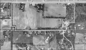
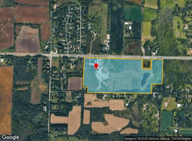
Property Record
N96w21627 County Line Rd, Menomonee Falls, WI 53051
NEARBY LISTINGS FOR SALE OR LEASE
Property Detail
N96w21627 County Line Rd
MNFV-0021-990-001
PT NW1/4 & NE1/4 SEC 6 T8N R20E; COM N1/4 COR; N8926E 1461.20 FT; S0043W 951.40 FT; S8906W 376.74 FT; S0043W 347.00 FT; S885330W 1017.11 FT; S892030W 1305.52 FT; N0017E 198.00 FT; S892030W 165.00 FT; N0017E 1124.06 FT; N8951E 1412.00 FT TO BGN :: EX
Agriculturalland
Waukesha
X
Wisconsin
55133C0083H
8
2024
75.62 AC
2024
North/Sussex
200300
Milwaukee/Madison
1,326 SF
Milwaukee-Waukesha, WI
DEMOGRAPHICS near N96w21627 County Line Rd
1 Mile
3 Mile
5 Mile
2024 Total Population
1,003
14,975
57,931
2029 Population
1,026
15,124
58,026
Pop Growth 2024-2029
+ 2.29%
+ 0.99%
+ 0.16%
Average Age
44
43
43
2024 Total Households
379
5,946
23,950
HH Growth 2024-2029
+ 2.11%
+ 0.89%
+ 0.04%
Median Household Inc
$106,731
$99,981
$92,379
Avg Household Size
2.60
2.50
2.40
2024 Avg HH Vehicles
3.00
2.00
2.00
Median Home Value
$405,217
$305,556
$306,715
Median Year Built
1979
1973
1981
Nearby Places
Map Layers
Map Styles
 Street
 Aerial
- Restaurants
- Banks
- Shops
- Fitness
- Groceries
PUBLIC TRANSPORTATION
AIRPORT
General Mitchell International
DRIVE
WALK
Distance
General Mitchell International
44 min
28.6 mi
Freight Ports
Port Milwaukee
DRIVE
WALK
Distance
Port Milwaukee
38 min
24.9 mi
Nearby Properties
Address
Land Use
TOTAL SIZE
Lot Size
Zoning
Address
Land Use
TOTAL SIZE
Lot Size
Zoning
244,996 SF
16.82 AC
Address
Land Use
TOTAL SIZE
Lot Size
Zoning
145,836 SF
11 AC
Address
Land Use
TOTAL SIZE
Lot Size
Zoning
294,486 SF
12.78 AC
Address
Land Use
TOTAL SIZE
Lot Size
Zoning
186,372 SF
22.16 AC
Address
Land Use
TOTAL SIZE
Lot Size
Zoning
Address
Land Use
TOTAL SIZE
Lot Size
Zoning
152,006 SF
12.92 AC
Address
Land Use
TOTAL SIZE
Lot Size
Zoning
153,383 SF
17.43 AC
Address
Land Use
TOTAL SIZE
Lot Size
Zoning
53,681 SF
38.43 AC
Address
Land Use
TOTAL SIZE
Lot Size
Zoning
14.12 AC
Address
Land Use
TOTAL SIZE
Lot Size
Zoning
Address
Land Use
TOTAL SIZE
Lot Size
Zoning
28,800 SF
3.51 AC
Address
Land Use
TOTAL SIZE
Lot Size
Zoning
112,642 SF
10.73 AC
Address
Land Use
TOTAL SIZE
Lot Size
Zoning
106,514 SF
8.12 AC
Address
Land Use
TOTAL SIZE
Lot Size
Zoning
117,834 SF
10.80 AC
Address
Land Use
TOTAL SIZE
Lot Size
Zoning
92,692 SF
8.27 AC
Address
Land Use
TOTAL SIZE
Lot Size
Zoning
31,144 SF
26.95 AC
Address
Land Use
TOTAL SIZE
Lot Size
Zoning
94,963 SF
13.30 AC
Address
Land Use
TOTAL SIZE
Lot Size
Zoning
63,850 SF
7.25 AC
Address
Land Use
TOTAL SIZE
Lot Size
Zoning
10.17 AC
Address
Land Use
TOTAL SIZE
Lot Size
Zoning
67,777 SF
20.22 AC
Address
Land Use
TOTAL SIZE
Lot Size
Zoning
Address
Land Use
TOTAL SIZE
Lot Size
Zoning
30,726 SF
8.28 AC
Address
Land Use
TOTAL SIZE
Lot Size
Zoning
Address
Land Use
TOTAL SIZE
Lot Size
Zoning
27,148 SF
5.92 AC
Address
Land Use
TOTAL SIZE
Lot Size
Zoning
15,822 SF
6.73 AC
Address
Land Use
TOTAL SIZE
Lot Size
Zoning
28,794 SF
1.80 AC
Address
Land Use
TOTAL SIZE
Lot Size
Zoning
14,906 SF
4.25 AC
Address
Land Use
TOTAL SIZE
Lot Size
Zoning
Address
Land Use
TOTAL SIZE
Lot Size
Zoning
Address
Land Use
TOTAL SIZE
Lot Size
Zoning
35,794 SF
4.13 AC
The World's #1 Commercial Real Estate Marketplace
Connect with us
© 2026 CoStar Group
The information above has been obtained from sources believed reliable. While we do not doubt its accuracy we have not verified it and make no guarantee, warranty or representation about it. It is your responsibility to independently confirm its accuracy and completeness. Any projections, opinions, assumptions, or estimates used are for example only and do not represent the current or future performance of the property. The value of this transaction to you depends on tax and other factors which should be evaluated by your tax, financial, and legal advisors. You and your advisors should conduct a careful, independent investigation of the property to determine to your satisfaction the suitability of the property for your needs.