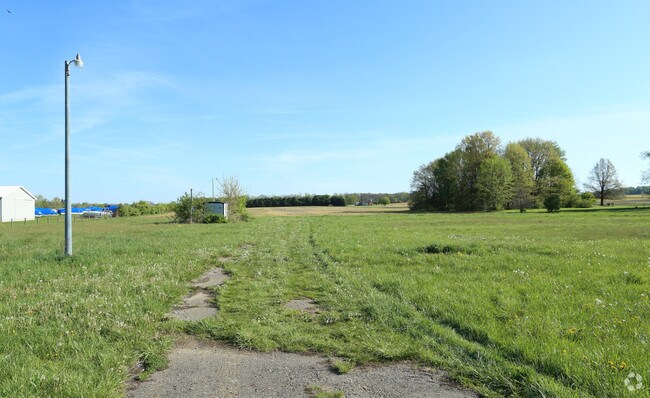
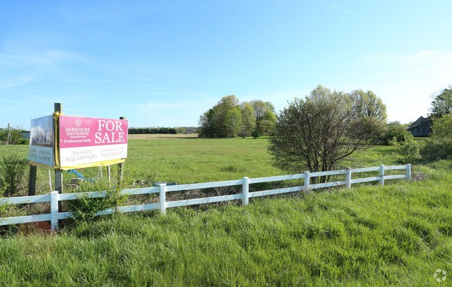
Property Record
National Rd, Hebron, OH 43025

Property Detail
National Rd
Columbus, OH
23.643 AC SEC 4 R18 T17
073-330132-00.003
LICKING
Commercialacreage
Ohio
AE The base floodplain where base flood elevations are provided. AE Zones are now used on new format FIRMs instead of A1-A30 Zones.
23.64 AC
2025
Licking County
2025
Columbus
759101
NEARBY LISTINGS FOR SALE OR LEASE
-
-
View all Hebron listings for sale on LoopNet.com
DEMOGRAPHICS near National Rd
1 mile
3 mile
5 mile
2025 Total Population
183
4,537
18,238
2030 Population
187
4,690
19,018
Pop Growth 2025-2030
+ 2.19%
+ 3.37%
+ 4.28%
Average Age
44
43
44
2025 Total Households
77
1,917
7,524
HH Growth 2025-2030
+ 2.60%
+ 3.60%
+ 4.60%
Median Household Inc
$61,875
$80,705
$82,555
Avg Household Size
2.40
2.30
2.40
2025 Avg HH Vehicles
2.00
2.00
2.00
Median Home Value
$322,727
$285,172
$313,724
Median Year Built
1978
1975
1976
Nearby Places
Map Layers
Map Styles
 Street
 Aerial
Layers
 Traffic
 Biking
Places
Listings with unknown addresses are not visible on the map
- Restaurants
- Banks
- Shops
- Fitness
- Groceries
PUBLIC TRANSPORTATION
AIRPORT
John Glenn Columbus International
Drive
Walk
Distance
John Glenn Columbus International
36 min
27.3 mi
Rickenbacker International
Drive
Walk
Distance
Rickenbacker International
39 min
29.5 mi
Freight Ports
Port of Toledo
Drive
Walk
Distance
Port of Toledo
200 min
162.4 mi
Nearby Properties
Address
Land Use
TOTAL SIZE
Lot Size
Zoning
Address
Land Use
TOTAL SIZE
Lot Size
Zoning
22,425 SF
45.87 AC
Address
Land Use
TOTAL SIZE
Lot Size
Zoning
59,992 SF
118.45 AC
Address
Land Use
TOTAL SIZE
Lot Size
Zoning
398,678 SF
12.04 AC
Address
Land Use
TOTAL SIZE
Lot Size
Zoning
1,936 SF
130.89 AC
Address
Land Use
TOTAL SIZE
Lot Size
Zoning
192,701 SF
10.28 AC
Address
Land Use
TOTAL SIZE
Lot Size
Zoning
91.99 AC
Address
Land Use
TOTAL SIZE
Lot Size
Zoning
2,421,019 SF
96.80 AC
Address
Land Use
TOTAL SIZE
Lot Size
Zoning
101,429 SF
8.86 AC
Address
Land Use
TOTAL SIZE
Lot Size
Zoning
112,001 SF
10.35 AC
Address
Land Use
TOTAL SIZE
Lot Size
Zoning
96,407 SF
5 AC
Address
Land Use
TOTAL SIZE
Lot Size
Zoning
80,000 SF
5.10 AC
Address
Land Use
TOTAL SIZE
Lot Size
Zoning
18,819 SF
215.48 AC
Address
Land Use
TOTAL SIZE
Lot Size
Zoning
48,609 SF
18 AC
Address
Land Use
TOTAL SIZE
Lot Size
Zoning
82,028 SF
25.03 AC
Address
Land Use
TOTAL SIZE
Lot Size
Zoning
24,446 SF
17.36 AC
Address
Land Use
TOTAL SIZE
Lot Size
Zoning
54,000 SF
15.72 AC
Address
Land Use
TOTAL SIZE
Lot Size
Zoning
44,277 SF
9.37 AC
Address
Land Use
TOTAL SIZE
Lot Size
Zoning
640 SF
6 AC
Address
Land Use
TOTAL SIZE
Lot Size
Zoning
3,112 SF
217.39 AC
Address
Land Use
TOTAL SIZE
Lot Size
Zoning
6,528 SF
15.03 AC
Address
Land Use
TOTAL SIZE
Lot Size
Zoning
11,787 SF
11.39 AC
Address
Land Use
TOTAL SIZE
Lot Size
Zoning
1,700 SF
243.84 AC
Address
Land Use
TOTAL SIZE
Lot Size
Zoning
40,602 SF
3.25 AC
Address
Land Use
TOTAL SIZE
Lot Size
Zoning
1,988 SF
7.73 AC
Address
Land Use
TOTAL SIZE
Lot Size
Zoning
1,544 SF
5.21 AC
Address
Land Use
TOTAL SIZE
Lot Size
Zoning
173.96 AC
Address
Land Use
TOTAL SIZE
Lot Size
Zoning
98.52 AC
Address
Land Use
TOTAL SIZE
Lot Size
Zoning
17,788 SF
10.87 AC
Address
Land Use
TOTAL SIZE
Lot Size
Zoning
11,753 SF
4 AC
Address
Land Use
TOTAL SIZE
Lot Size
Zoning
15,100 SF
2.33 AC
The World's #1 Commercial Real Estate Marketplace
Connect with us
© 2026 CoStar Group
The information above has been obtained from sources believed reliable. While we do not doubt its accuracy we have not verified it and make no guarantee, warranty or representation about it. It is your responsibility to independently confirm its accuracy and completeness. Any projections, opinions, assumptions, or estimates used are for example only and do not represent the current or future performance of the property. The value of this transaction to you depends on tax and other factors which should be evaluated by your tax, financial, and legal advisors. You and your advisors should conduct a careful, independent investigation of the property to determine to your satisfaction the suitability of the property for your needs.