Property Record
Nc 39 Hwy, Bunn, NC 27508
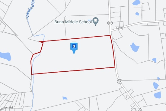

Property Detail
Nc 39 Hwy
000461
FRANKLIN
Vacantlandnec
North Carolina
R 1
9
AE The base floodplain where base flood elevations are provided. AE Zones are now used on new format FIRMs instead of A1-A30 Zones.
100 AC
2025
Franklin County
2025
Raleigh/Durham
060801
Raleigh-Cary, NC
NEARBY LISTINGS FOR SALE OR LEASE
-
-
View all Bunn listings for sale on LoopNet.com
DEMOGRAPHICS near Nc 39 Hwy
1 mile
3 mile
5 mile
2025 Total Population
444
4,697
14,905
2030 Population
499
5,287
16,915
Pop Growth 2025-2030
+ 12.39%
+ 12.56%
+ 13.49%
Average Age
41
41
43
2025 Total Households
158
1,672
5,836
HH Growth 2025-2030
+ 13.92%
+ 13.64%
+ 14.22%
Median Household Inc
$62,500
$60,639
$72,286
Avg Household Size
2.60
2.60
2.50
2025 Avg HH Vehicles
2.00
2.00
2.00
Median Home Value
$306,452
$304,683
$292,817
Median Year Built
1989
1989
1995
Nearby Places
Map Layers
Map Styles
 Street
 Aerial
Layers
 Traffic
 Biking
Places
Listings with unknown addresses are not visible on the map
- Restaurants
- Banks
- Shops
- Fitness
- Groceries
PUBLIC TRANSPORTATION
AIRPORT
Raleigh-Durham International
Drive
Walk
Distance
Raleigh-Durham International
57 min
39.1 mi
Freight Ports
Virginia Port Authority - Richmond
Drive
Walk
Distance
Virginia Port Authority - Richmond
164 min
139.8 mi
SALE & LEASE HISTORY
LISTING DATE
SALE/LEASE

Aug 26, 2022
For Sale
Nearby Properties
Address
Land Use
TOTAL SIZE
Lot Size
Zoning
Address
Land Use
TOTAL SIZE
Lot Size
Zoning
26,056 SF
43.53 AC
C 1
Address
Land Use
TOTAL SIZE
Lot Size
Zoning
100,643 SF
40 AC
R 1
Address
Land Use
TOTAL SIZE
Lot Size
Zoning
1,024 SF
92.61 AC
I 1
Address
Land Use
TOTAL SIZE
Lot Size
Zoning
13,803 SF
23.04 AC
FCO R-30
Address
Land Use
TOTAL SIZE
Lot Size
Zoning
29,262 SF
4.72 AC
C 3
Address
Land Use
TOTAL SIZE
Lot Size
Zoning
828 SF
0.34 AC
R 2
Address
Land Use
TOTAL SIZE
Lot Size
Zoning
4,501 SF
11.76 AC
FCO R-30
Address
Land Use
TOTAL SIZE
Lot Size
Zoning
13,975 SF
15 AC
FCO R-30
Address
Land Use
TOTAL SIZE
Lot Size
Zoning
7,225 SF
5.14 AC
FCO R-30
Address
Land Use
TOTAL SIZE
Lot Size
Zoning
12,390 SF
1.58 AC
C 3
Address
Land Use
TOTAL SIZE
Lot Size
Zoning
322.90 AC
FCO R-30
Address
Land Use
TOTAL SIZE
Lot Size
Zoning
145.15 AC
FCO R-30
Address
Land Use
TOTAL SIZE
Lot Size
Zoning
298.70 AC
FCO AR
Address
Land Use
TOTAL SIZE
Lot Size
Zoning
684 SF
128.38 AC
FCO R-30
Address
Land Use
TOTAL SIZE
Lot Size
Zoning
5,332 SF
2.59 AC
R 2
Address
Land Use
TOTAL SIZE
Lot Size
Zoning
10,000 SF
7.82 AC
FCO R-30
Address
Land Use
TOTAL SIZE
Lot Size
Zoning
2,083 SF
0.69 AC
C 1
Address
Land Use
TOTAL SIZE
Lot Size
Zoning
1,595 SF
47.02 AC
I 2
Address
Land Use
TOTAL SIZE
Lot Size
Zoning
2,668 SF
1.41 AC
C 3
Address
Land Use
TOTAL SIZE
Lot Size
Zoning
5,770 SF
1.60 AC
C 1
Address
Land Use
TOTAL SIZE
Lot Size
Zoning
155 AC
FCO R-30
Address
Land Use
TOTAL SIZE
Lot Size
Zoning
125.78 AC
FCO R-30
Address
Land Use
TOTAL SIZE
Lot Size
Zoning
2,400 SF
0.89 AC
C 1
Address
Land Use
TOTAL SIZE
Lot Size
Zoning
2,206 SF
101.51 AC
FCO R-30
Address
Land Use
TOTAL SIZE
Lot Size
Zoning
12,520 SF
5.52 AC
C 1
Address
Land Use
TOTAL SIZE
Lot Size
Zoning
139.21 AC
FCO R-30
Address
Land Use
TOTAL SIZE
Lot Size
Zoning
1,498 SF
174.49 AC
FCO R-30
Address
Land Use
TOTAL SIZE
Lot Size
Zoning
3,046 SF
103.59 AC
R 1
Address
Land Use
TOTAL SIZE
Lot Size
Zoning
109 AC
FCO R-30
Address
Land Use
TOTAL SIZE
Lot Size
Zoning
95.06 AC
FCO R-30
The World's #1 Commercial Real Estate Marketplace
Connect with us
© 2026 CoStar Group
The information above has been obtained from sources believed reliable. While we do not doubt its accuracy we have not verified it and make no guarantee, warranty or representation about it. It is your responsibility to independently confirm its accuracy and completeness. Any projections, opinions, assumptions, or estimates used are for example only and do not represent the current or future performance of the property. The value of this transaction to you depends on tax and other factors which should be evaluated by your tax, financial, and legal advisors. You and your advisors should conduct a careful, independent investigation of the property to determine to your satisfaction the suitability of the property for your needs.