Property Record
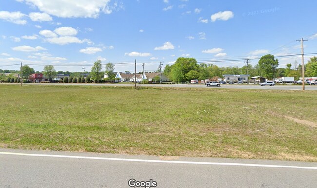
Nc Hwy 49 S, Harrisburg, NC 28075

NEARBY LISTINGS FOR SALE OR LEASE
Property Detail
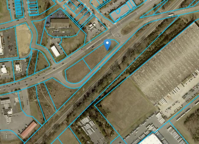
Nc Hwy 49 S
Charlotte-Concord-Gastonia, NC-SC
Harrisburg
5517-06-8779-0000
PARCEL E TIMOTHY N & DIANNE C TALLENT
Commercialnec
Cabarrus
X
North Carolina
3710551700K
1.11 AC
2025
Cabarrus County
2025
Charlotte
041505
DEMOGRAPHICS near Nc Hwy 49 S
1 Mile
3 Mile
5 Mile
2024 Total Population
3,859
34,218
105,931
2029 Population
4,327
38,023
116,672
Pop Growth 2024-2029
+ 12.13%
+ 11.12%
+ 10.14%
Average Age
40
38
37
2024 Total Households
1,438
11,637
37,462
HH Growth 2024-2029
+ 10.78%
+ 9.83%
+ 9.15%
Median Household Inc
$106,925
$106,235
$87,552
Avg Household Size
2.70
2.90
2.80
2024 Avg HH Vehicles
2.00
2.00
2.00
Median Home Value
$262,468
$320,425
$294,461
Median Year Built
2002
2002
2001
Nearby Places
Map Layers
Map Styles
 Street
 Aerial
- Restaurants
- Banks
- Shops
- Fitness
- Groceries
PUBLIC TRANSPORTATION
AIRPORT
Concord-Padgett Regional
DRIVE
WALK
Distance
Concord-Padgett Regional
17 min
8.5 mi
Charlotte/Douglas International
DRIVE
WALK
Distance
Charlotte/Douglas International
37 min
23.0 mi
Freight Ports
Port of Wilmington
DRIVE
WALK
Distance
Port of Wilmington
254 min
202.3 mi
SALE & LEASE HISTORY
LISTING DATE
SALE/LEASE

Sep 19, 2023
For Sale
Nearby Properties
Address
Land Use
TOTAL SIZE
Lot Size
Zoning
Address
Land Use
TOTAL SIZE
Lot Size
Zoning
333,498 SF
17.66 AC
R3
Address
Land Use
TOTAL SIZE
Lot Size
Zoning
196,893 SF
43.82 AC
MDR
Address
Land Use
TOTAL SIZE
Lot Size
Zoning
226,355 SF
99.26 AC
O-I
Address
Land Use
TOTAL SIZE
Lot Size
Zoning
350,339 SF
77.60 AC
RM-1
Address
Land Use
TOTAL SIZE
Lot Size
Zoning
175,978 SF
63.81 AC
O-I
Address
Land Use
TOTAL SIZE
Lot Size
Zoning
142,368 SF
13.32 AC
MX2
Address
Land Use
TOTAL SIZE
Lot Size
Zoning
21,714 SF
15.02 AC
RC
Address
Land Use
TOTAL SIZE
Lot Size
Zoning
152,554 SF
29.94 AC
O-I
Address
Land Use
TOTAL SIZE
Lot Size
Zoning
127,078 SF
10.66 AC
O-I
Address
Land Use
TOTAL SIZE
Lot Size
Zoning
360,400 SF
20.32 AC
EC
Address
Land Use
TOTAL SIZE
Lot Size
Zoning
125,245 SF
21.47 AC
O-I
Address
Land Use
TOTAL SIZE
Lot Size
Zoning
304,000 SF
17.30 AC
EC
Address
Land Use
TOTAL SIZE
Lot Size
Zoning
160,357 SF
26.85 AC
O-I
Address
Land Use
TOTAL SIZE
Lot Size
Zoning
4,588 SF
550.66 AC
I-2
Address
Land Use
TOTAL SIZE
Lot Size
Zoning
209,420 SF
32.12 AC
EC
Address
Land Use
TOTAL SIZE
Lot Size
Zoning
123,800 SF
43.87 AC
CUI-1
Address
Land Use
TOTAL SIZE
Lot Size
Zoning
184,784 SF
16.30 AC
I-1
Address
Land Use
TOTAL SIZE
Lot Size
Zoning
48,888 SF
15.29 AC
GC
Address
Land Use
TOTAL SIZE
Lot Size
Zoning
12,486 SF
232.04 AC
O-I
Address
Land Use
TOTAL SIZE
Lot Size
Zoning
174,732 SF
29.05 AC
LI
Address
Land Use
TOTAL SIZE
Lot Size
Zoning
105,130 SF
5.03 AC
Address
Land Use
TOTAL SIZE
Lot Size
Zoning
8,656 SF
10.01 AC
RC
Address
Land Use
TOTAL SIZE
Lot Size
Zoning
54,503 SF
9.32 AC
EC
Address
Land Use
TOTAL SIZE
Lot Size
Zoning
12,150 SF
7.23 AC
GI
Address
Land Use
TOTAL SIZE
Lot Size
Zoning
220,121 SF
10.99 AC
I-2
Address
Land Use
TOTAL SIZE
Lot Size
Zoning
29,954 SF
17.75 AC
GC
Address
Land Use
TOTAL SIZE
Lot Size
Zoning
38,274 SF
15.29 AC
PUD
Address
Land Use
TOTAL SIZE
Lot Size
Zoning
54.02 AC
Address
Land Use
TOTAL SIZE
Lot Size
Zoning
29,725 SF
100.58 AC
I-1
Address
Land Use
TOTAL SIZE
Lot Size
Zoning
86,460 SF
13.73 AC
I-2
The World's #1 Commercial Real Estate Marketplace
Connect with us
© 2025 CoStar Group
The information above has been obtained from sources believed reliable. While we do not doubt its accuracy we have not verified it and make no guarantee, warranty or representation about it. It is your responsibility to independently confirm its accuracy and completeness. Any projections, opinions, assumptions, or estimates used are for example only and do not represent the current or future performance of the property. The value of this transaction to you depends on tax and other factors which should be evaluated by your tax, financial, and legal advisors. You and your advisors should conduct a careful, independent investigation of the property to determine to your satisfaction the suitability of the property for your needs.