Property Record
Ne Williams Ave, Arcadia, FL 34266
Property Detail
Ne Williams Ave
25-36-24-0000-0020-0000
N1/2 LYG E OF R/W OF ARCADIA- LIMESTONE RD SUBJ TO ESMT AS IN OR 290/814 INST:201714001911
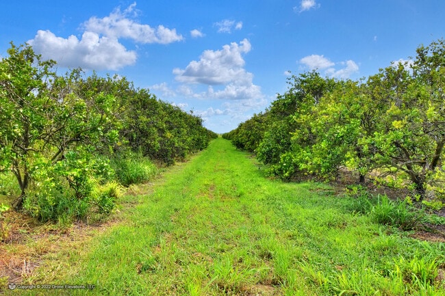
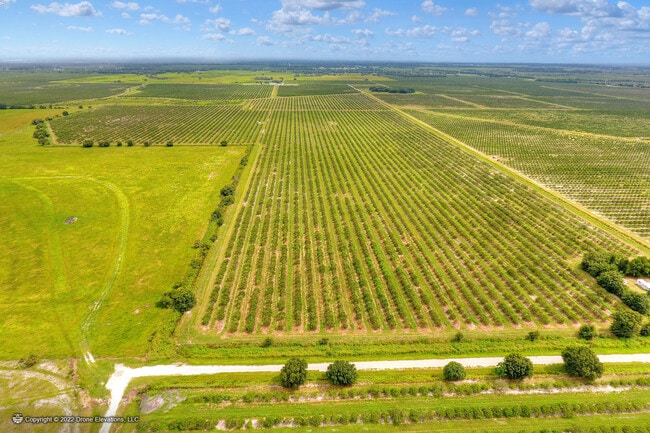
Pasture
DESOTO
A-10
Florida
A Areas with a 1% annual chance of flooding and a 26% chance of flooding over the life of a 30-year mortgage.
320 AC
2024
Florida Central South Area
2024
Other Market Areas
010302
Arcadia, FL
NEARBY LISTINGS FOR SALE OR LEASE
-
-
View all Arcadia listings for sale on LoopNet.com
DEMOGRAPHICS near Ne Williams Ave
1 mile
3 mile
5 mile
2025 Total Population
10
258
1,001
2030 Population
10
261
1,007
Pop Growth 2025-2030
0.00%
+ 1.16%
+ 0.60%
Average Age
37
42
44
2025 Total Households
4
90
352
HH Growth 2025-2030
0.00%
+ 1.11%
0.00%
Median Household Inc
$67,500
$56,428
$62,045
Avg Household Size
2.50
2.50
2.40
2025 Avg HH Vehicles
2.00
2.00
2.00
Median Home Value
$199,999
$295,454
$328,846
Median Year Built
1989
1985
1994
Nearby Places
Map Layers
Map Styles
 Street
 Aerial
Layers
 Traffic
 Biking
Places
Listings with unknown addresses are not visible on the map
- Restaurants
- Banks
- Shops
- Fitness
- Groceries
PUBLIC TRANSPORTATION
AIRPORT
Punta Gorda
Drive
Walk
Distance
Punta Gorda
62 min
37.0 mi
Freight Ports
Port Manatee
Drive
Walk
Distance
Port Manatee
93 min
61.5 mi
SALE & LEASE HISTORY
LISTING DATE
SALE/LEASE

Aug 24, 2022
For Sale
Nearby Properties
Address
Land Use
TOTAL SIZE
Lot Size
Zoning
Address
Land Use
TOTAL SIZE
Lot Size
Zoning
18,236 SF
45.92 AC
TTRVC
Address
Land Use
TOTAL SIZE
Lot Size
Zoning
9,382 SF
27.25 AC
MHP
Address
Land Use
TOTAL SIZE
Lot Size
Zoning
29.23 AC
TTRVC
Address
Land Use
TOTAL SIZE
Lot Size
Zoning
8,376 SF
27.28 AC
A-10
Address
Land Use
TOTAL SIZE
Lot Size
Zoning
5,000 SF
4.31 AC
TTRVC
Address
Land Use
TOTAL SIZE
Lot Size
Zoning
23,212 SF
6.56 AC
RMF-M
Address
Land Use
TOTAL SIZE
Lot Size
Zoning
7,937 SF
3.62 AC
IL
Address
Land Use
TOTAL SIZE
Lot Size
Zoning
9,626 SF
29.28 AC
A-10
Address
Land Use
TOTAL SIZE
Lot Size
Zoning
4,041 SF
28.65 AC
A-10
Address
Land Use
TOTAL SIZE
Lot Size
Zoning
5,376 SF
436.77 AC
A-10
Address
Land Use
TOTAL SIZE
Lot Size
Zoning
20.39 AC
A-10
Address
Land Use
TOTAL SIZE
Lot Size
Zoning
2,825 SF
314.74 AC
A-10
Address
Land Use
TOTAL SIZE
Lot Size
Zoning
3,017 SF
47.16 AC
A-10
Address
Land Use
TOTAL SIZE
Lot Size
Zoning
16,265 SF
15.26 AC
A-10
Address
Land Use
TOTAL SIZE
Lot Size
Zoning
1,188 SF
75 AC
A-10
Address
Land Use
TOTAL SIZE
Lot Size
Zoning
72.89 AC
A-10
Address
Land Use
TOTAL SIZE
Lot Size
Zoning
11.55 AC
TTRVC
Address
Land Use
TOTAL SIZE
Lot Size
Zoning
51.22 AC
A-10
Address
Land Use
TOTAL SIZE
Lot Size
Zoning
3,188 SF
40 AC
A-10
Address
Land Use
TOTAL SIZE
Lot Size
Zoning
351.93 AC
A-10
Address
Land Use
TOTAL SIZE
Lot Size
Zoning
4,736 SF
3.33 AC
RM
Address
Land Use
TOTAL SIZE
Lot Size
Zoning
4,546 SF
42.56 AC
A-10
Address
Land Use
TOTAL SIZE
Lot Size
Zoning
67.31 AC
A-10
Address
Land Use
TOTAL SIZE
Lot Size
Zoning
5,860 SF
10.44 AC
A-10
Address
Land Use
TOTAL SIZE
Lot Size
Zoning
4,690 SF
35.76 AC
A-5
Address
Land Use
TOTAL SIZE
Lot Size
Zoning
4,534 SF
114.17 AC
A-10
Address
Land Use
TOTAL SIZE
Lot Size
Zoning
3,640 SF
145.10 AC
A-10
Address
Land Use
TOTAL SIZE
Lot Size
Zoning
5,237 SF
45 AC
A-10
Address
Land Use
TOTAL SIZE
Lot Size
Zoning
2,942 SF
5 AC
A-10
Address
Land Use
TOTAL SIZE
Lot Size
Zoning
8,736 SF
0.47 AC
A-10
The World's #1 Commercial Real Estate Marketplace
Connect with us
© 2026 CoStar Group
The information above has been obtained from sources believed reliable. While we do not doubt its accuracy we have not verified it and make no guarantee, warranty or representation about it. It is your responsibility to independently confirm its accuracy and completeness. Any projections, opinions, assumptions, or estimates used are for example only and do not represent the current or future performance of the property. The value of this transaction to you depends on tax and other factors which should be evaluated by your tax, financial, and legal advisors. You and your advisors should conduct a careful, independent investigation of the property to determine to your satisfaction the suitability of the property for your needs.