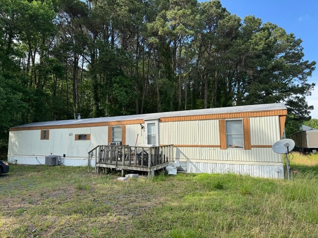
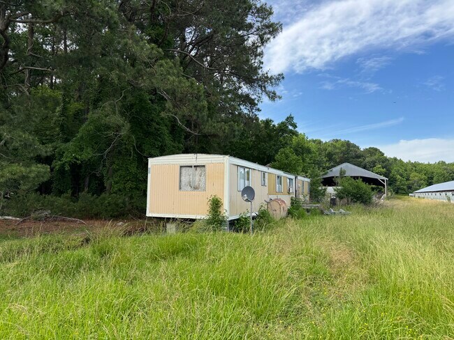
Property Record
Neal Parker Rd, Withams, VA 23488
NEARBY LISTINGS FOR SALE OR LEASE
-
-
View all Withams listings for sale on LoopNet.com
Property Detail
Neal Parker Rd
010-00-A0-00-0035-B0
NEAL PARKER RD MARSHALL LOT 1 12.46 AC
Commercialnec
Accomack
AE
Virginia
24047C0450H
1
2025
12.46 AC
2025
Virginia Regional
090202
Other Market Areas
DEMOGRAPHICS near Neal Parker Rd
1 Mile
3 Mile
5 Mile
2024 Total Population
41
785
2,582
2029 Population
41
778
2,547
Pop Growth 2024-2029
0.00%
(0.89%)
(1.36%)
Average Age
40
40
43
2024 Total Households
17
320
1,078
HH Growth 2024-2029
0.00%
(1.56%)
(1.86%)
Median Household Inc
$40,833
$41,587
$42,738
Avg Household Size
2.20
2.30
2.30
2024 Avg HH Vehicles
2.00
2.00
2.00
Median Home Value
$137,500
$152,857
$149,636
Median Year Built
1974
1972
1970
Nearby Places
Map Layers
Map Styles
 Street
 Aerial
- Restaurants
- Banks
- Shops
- Fitness
- Groceries
PUBLIC TRANSPORTATION
AIRPORT
Salisbury-Ocean City Wicomico Regional
DRIVE
WALK
Distance
Salisbury-Ocean City Wicomico Regional
65 min
38.0 mi
Freight Ports
Virginia Port Authority - Newport News
DRIVE
WALK
Distance
Virginia Port Authority - Newport News
161 min
110.9 mi
SALE & LEASE HISTORY
LISTING DATE
SALE/LEASE

Nov 13, 2025
For Sale
Jul 08, 2025
For Sale
Nearby Properties
Address
Land Use
TOTAL SIZE
Lot Size
Zoning
Address
Land Use
TOTAL SIZE
Lot Size
Zoning
87.38 AC
Address
Land Use
TOTAL SIZE
Lot Size
Zoning
944 SF
371.45 AC
Address
Land Use
TOTAL SIZE
Lot Size
Zoning
158.28 AC
Address
Land Use
TOTAL SIZE
Lot Size
Zoning
178.50 AC
Address
Land Use
TOTAL SIZE
Lot Size
Zoning
161.56 AC
Address
Land Use
TOTAL SIZE
Lot Size
Zoning
3,346 SF
270.12 AC
Address
Land Use
TOTAL SIZE
Lot Size
Zoning
20.50 AC
Address
Land Use
TOTAL SIZE
Lot Size
Zoning
1,928 SF
109.31 AC
Address
Land Use
TOTAL SIZE
Lot Size
Zoning
75.45 AC
Address
Land Use
TOTAL SIZE
Lot Size
Zoning
134.43 AC
Address
Land Use
TOTAL SIZE
Lot Size
Zoning
Address
Land Use
TOTAL SIZE
Lot Size
Zoning
130.10 AC
Address
Land Use
TOTAL SIZE
Lot Size
Zoning
111.37 AC
Address
Land Use
TOTAL SIZE
Lot Size
Zoning
455.47 AC
Address
Land Use
TOTAL SIZE
Lot Size
Zoning
5,714 SF
280 AC
Address
Land Use
TOTAL SIZE
Lot Size
Zoning
3,750 SF
29 AC
Address
Land Use
TOTAL SIZE
Lot Size
Zoning
178.50 AC
Address
Land Use
TOTAL SIZE
Lot Size
Zoning
4,734 SF
59.50 AC
Address
Land Use
TOTAL SIZE
Lot Size
Zoning
Address
Land Use
TOTAL SIZE
Lot Size
Zoning
2,016 SF
165.06 AC
Address
Land Use
TOTAL SIZE
Lot Size
Zoning
187.73 AC
Address
Land Use
TOTAL SIZE
Lot Size
Zoning
2,828 SF
92.25 AC
Address
Land Use
TOTAL SIZE
Lot Size
Zoning
2,002 SF
20.12 AC
Address
Land Use
TOTAL SIZE
Lot Size
Zoning
4,386 SF
28.37 AC
Address
Land Use
TOTAL SIZE
Lot Size
Zoning
80.29 AC
Address
Land Use
TOTAL SIZE
Lot Size
Zoning
Address
Land Use
TOTAL SIZE
Lot Size
Zoning
61.31 AC
Address
Land Use
TOTAL SIZE
Lot Size
Zoning
3,838 SF
77.96 AC
Address
Land Use
TOTAL SIZE
Lot Size
Zoning
Address
Land Use
TOTAL SIZE
Lot Size
Zoning
219.41 AC
The World's #1 Commercial Real Estate Marketplace
Connect with us
© 2025 CoStar Group
The information above has been obtained from sources believed reliable. While we do not doubt its accuracy we have not verified it and make no guarantee, warranty or representation about it. It is your responsibility to independently confirm its accuracy and completeness. Any projections, opinions, assumptions, or estimates used are for example only and do not represent the current or future performance of the property. The value of this transaction to you depends on tax and other factors which should be evaluated by your tax, financial, and legal advisors. You and your advisors should conduct a careful, independent investigation of the property to determine to your satisfaction the suitability of the property for your needs.