No Photo
Property Record
W State St, Eagle, ID 83616
NEARBY LISTINGS FOR SALE OR LEASE
Property Detail
W State St
S0507427890
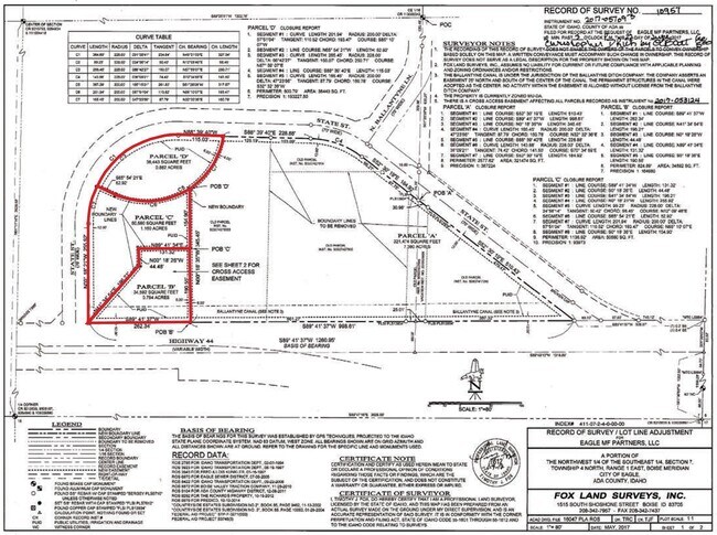
PAR #7860 OF SE4 SEC 7 4N 1E PARCEL B ROS 10957 #427855-S
Commercialacreage
Ada
X
Idaho
16001C0134J
0.88 AC
2024
Eagle
2025
Boise City/Nampa
010232
Boise City, ID
DEMOGRAPHICS near W State St
1 Mile
3 Mile
5 Mile
2024 Total Population
8,331
45,692
149,179
2029 Population
9,533
51,886
169,498
Pop Growth 2024-2029
+ 14.43%
+ 13.56%
+ 13.62%
Average Age
45
44
41
2024 Total Households
3,411
16,863
54,322
HH Growth 2024-2029
+ 14.81%
+ 13.92%
+ 13.91%
Median Household Inc
$80,759
$103,470
$91,566
Avg Household Size
2.40
2.70
2.70
2024 Avg HH Vehicles
2.00
2.00
2.00
Median Home Value
$547,138
$574,697
$486,482
Median Year Built
2001
2001
2001
Nearby Places
- Restaurants
- Banks
- Shops
- Fitness
- Groceries
PUBLIC TRANSPORTATION
AIRPORT
Boise Air Trml/Gowen Field
DRIVE
WALK
Distance
Boise Air Trml/Gowen Field
38 min
20.5 mi
Freight Ports
Port of Portland
DRIVE
WALK
Distance
Port of Portland
468 min
422.8 mi
SALE & LEASE HISTORY
LISTING DATE
SALE/LEASE

Oct 05, 2020
For Sale
Nearby Properties
Address
Land Use
TOTAL SIZE
Lot Size
Zoning
Address
Land Use
TOTAL SIZE
Lot Size
Zoning
342,567 SF
19.16 AC
MU-DA
Address
Land Use
TOTAL SIZE
Lot Size
Zoning
98,738 SF
4.25 AC
CBD
Address
Land Use
TOTAL SIZE
Lot Size
Zoning
152,123 SF
6 AC
MU-DA
Address
Land Use
TOTAL SIZE
Lot Size
Zoning
170,333 SF
14.65 AC
C-3-DA
Address
Land Use
TOTAL SIZE
Lot Size
Zoning
69,546 SF
4.26 AC
MU-DA
Address
Land Use
TOTAL SIZE
Lot Size
Zoning
65,034 SF
4.44 AC
MU-DA
Address
Land Use
TOTAL SIZE
Lot Size
Zoning
98,612 SF
5.38 AC
MU-DA
Address
Land Use
TOTAL SIZE
Lot Size
Zoning
36,454 SF
3.18 AC
MU
Address
Land Use
TOTAL SIZE
Lot Size
Zoning
81,591 SF
2.88 AC
MU-DA
Address
Land Use
TOTAL SIZE
Lot Size
Zoning
165,295 SF
7.01 AC
MU-DA
Address
Land Use
TOTAL SIZE
Lot Size
Zoning
59,778 SF
3.68 AC
C-3-DA
Address
Land Use
TOTAL SIZE
Lot Size
Zoning
125,400 SF
12.68 AC
ZC-243
Address
Land Use
TOTAL SIZE
Lot Size
Zoning
68,707 SF
2.83 AC
C-3-DA
Address
Land Use
TOTAL SIZE
Lot Size
Zoning
74,296 SF
4.86 AC
CBD
Address
Land Use
TOTAL SIZE
Lot Size
Zoning
2,496 SF
222.96 AC
R-2-DA
Address
Land Use
TOTAL SIZE
Lot Size
Zoning
80,913 SF
8 AC
C-C
Address
Land Use
TOTAL SIZE
Lot Size
Zoning
34,602 SF
2.61 AC
MU-DA
Address
Land Use
TOTAL SIZE
Lot Size
Zoning
56,809 SF
5.95 AC
C-1-DA
Address
Land Use
TOTAL SIZE
Lot Size
Zoning
93,791 SF
6.41 AC
MU-DA
Address
Land Use
TOTAL SIZE
Lot Size
Zoning
56,382 SF
3.94 AC
C-C
Address
Land Use
TOTAL SIZE
Lot Size
Zoning
58,267 SF
3.65 AC
MU-DA
Address
Land Use
TOTAL SIZE
Lot Size
Zoning
104,234 SF
8 AC
MU-DA
Address
Land Use
TOTAL SIZE
Lot Size
Zoning
49,508 SF
1.34 AC
MU-DA
Address
Land Use
TOTAL SIZE
Lot Size
Zoning
85,852 SF
10.04 AC
MU
Address
Land Use
TOTAL SIZE
Lot Size
Zoning
3,840 SF
19.22 AC
R-3-DA-P
Address
Land Use
TOTAL SIZE
Lot Size
Zoning
30,034 SF
1.43 AC
MU-DA
Address
Land Use
TOTAL SIZE
Lot Size
Zoning
6,237 SF
1.83 AC
C-C
Address
Land Use
TOTAL SIZE
Lot Size
Zoning
33,881 SF
3.68 AC
MU-DA
Address
Land Use
TOTAL SIZE
Lot Size
Zoning
48,943 SF
4.41 AC
MU
Address
Land Use
TOTAL SIZE
Lot Size
Zoning
40,340 SF
2.63 AC
R-15
The World's #1 Commercial Real Estate Marketplace
Connect with us
© 2025 CoStar Group
The information above has been obtained from sources believed reliable. While we do not doubt its accuracy we have not verified it and make no guarantee, warranty or representation about it. It is your responsibility to independently confirm its accuracy and completeness. Any projections, opinions, assumptions, or estimates used are for example only and do not represent the current or future performance of the property. The value of this transaction to you depends on tax and other factors which should be evaluated by your tax, financial, and legal advisors. You and your advisors should conduct a careful, independent investigation of the property to determine to your satisfaction the suitability of the property for your needs.