Property Record
Needles Hwy, Needles, CA 92363
Property Detail
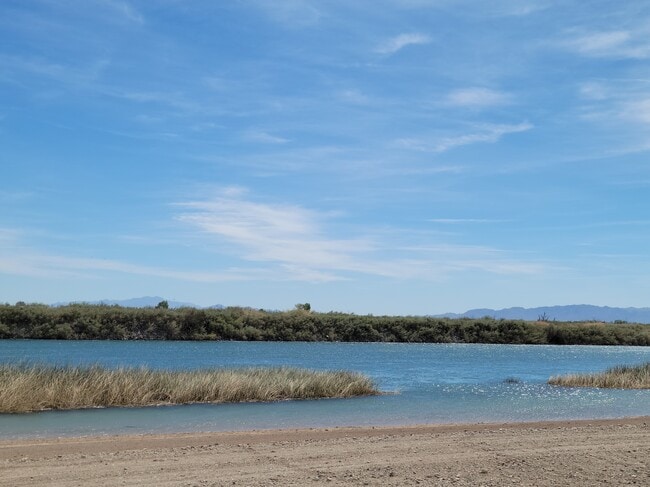
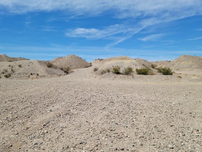
Needles Hwy
Riverside-San Bernardino-Ontario, CA
BEGINNG AT THE WEST QUARTER CORNER OF SECTION 1, TOWNSHIP 9 NORTH, RANGE 22 EAST, SAN BERNARDINO BASE AND MERIDIAN, IN THE COUNTY OF SAN BERNARDINO, CITY OF NEEDLES; THENCE ALONG THE NORTH LINE OF THE SOUTH HALF OF SECTION 1 NORTH 89 DEG 52 14 EAST 1
0660-241-15
SAN BERNARDINO
Wellsiteagricultural
California
AE The base floodplain where base flood elevations are provided. AE Zones are now used on new format FIRMs instead of A1-A30 Zones.
11.47 AC
2025
San Bernardino Outlying
2025
Inland Empire (California)
025100
NEARBY LISTINGS FOR SALE OR LEASE
-
-
View all Needles listings for sale on LoopNet.com
DEMOGRAPHICS near Needles Hwy
1 mile
3 mile
5 mile
2025 Total Population
1,602
10,302
13,265
2030 Population
1,672
11,016
14,187
Pop Growth 2025-2030
+ 4.37%
+ 6.93%
+ 6.95%
Average Age
45
44
44
2025 Total Households
694
4,181
5,390
HH Growth 2025-2030
+ 4.18%
+ 6.91%
+ 6.96%
Median Household Inc
$49,999
$53,860
$55,681
Avg Household Size
2.30
2.40
2.40
2025 Avg HH Vehicles
2.00
2.00
2.00
Median Home Value
$185,226
$185,327
$205,651
Median Year Built
1987
1987
1987
Nearby Places
Map Layers
Map Styles
 Street
 Aerial
Layers
 Traffic
 Biking
Places
Listings with unknown addresses are not visible on the map
- Restaurants
- Banks
- Shops
- Fitness
- Groceries
PUBLIC TRANSPORTATION
COMMUTER RAIL
Needles Amtrak (Southwest Chief - Amtrak)
Drive
Walk
Distance
Needles Amtrak (Southwest Chief - Amtrak)
11 min
6.3 mi
AIRPORT
Laughlin/Bullhead International
Drive
Walk
Distance
Laughlin/Bullhead International
46 min
27.5 mi
Freight Ports
Port of San Diego
Drive
Walk
Distance
Port of San Diego
356 min
320.3 mi
SALE & LEASE HISTORY
LISTING DATE
SALE/LEASE

Mar 24, 2022
For Sale
Nearby Properties
Address
Land Use
TOTAL SIZE
Lot Size
Zoning
Address
Land Use
TOTAL SIZE
Lot Size
Zoning
22,900 SF
3.43 AC
Address
Land Use
TOTAL SIZE
Lot Size
Zoning
80,944 SF
10 AC
Address
Land Use
TOTAL SIZE
Lot Size
Zoning
Address
Land Use
TOTAL SIZE
Lot Size
Zoning
46,400 SF
21.61 AC
Address
Land Use
TOTAL SIZE
Lot Size
Zoning
138,537 SF
6.30 AC
Address
Land Use
TOTAL SIZE
Lot Size
Zoning
19,906 SF
9.77 AC
Address
Land Use
TOTAL SIZE
Lot Size
Zoning
107,868 SF
13 AC
Address
Land Use
TOTAL SIZE
Lot Size
Zoning
3.07 AC
Address
Land Use
TOTAL SIZE
Lot Size
Zoning
43.77 AC
Address
Land Use
TOTAL SIZE
Lot Size
Zoning
7,952 SF
1.12 AC
Address
Land Use
TOTAL SIZE
Lot Size
Zoning
3,951 SF
1.12 AC
Address
Land Use
TOTAL SIZE
Lot Size
Zoning
122,921 SF
11.43 AC
Address
Land Use
TOTAL SIZE
Lot Size
Zoning
3,291 SF
1.22 AC
Address
Land Use
TOTAL SIZE
Lot Size
Zoning
3,409 SF
1.33 AC
Address
Land Use
TOTAL SIZE
Lot Size
Zoning
10,500 SF
3.33 AC
Address
Land Use
TOTAL SIZE
Lot Size
Zoning
9,150 SF
1.58 AC
Address
Land Use
TOTAL SIZE
Lot Size
Zoning
11.61 AC
Address
Land Use
TOTAL SIZE
Lot Size
Zoning
222.91 AC
Address
Land Use
TOTAL SIZE
Lot Size
Zoning
58,500 SF
4.60 AC
Address
Land Use
TOTAL SIZE
Lot Size
Zoning
Address
Land Use
TOTAL SIZE
Lot Size
Zoning
5.03 AC
Address
Land Use
TOTAL SIZE
Lot Size
Zoning
9,647 SF
1.51 AC
Address
Land Use
TOTAL SIZE
Lot Size
Zoning
49,440 SF
1.32 AC
Address
Land Use
TOTAL SIZE
Lot Size
Zoning
2,038 SF
0.49 AC
Address
Land Use
TOTAL SIZE
Lot Size
Zoning
13,174 SF
3.34 AC
Address
Land Use
TOTAL SIZE
Lot Size
Zoning
14,591 SF
1.68 AC
Address
Land Use
TOTAL SIZE
Lot Size
Zoning
122.59 AC
Address
Land Use
TOTAL SIZE
Lot Size
Zoning
3.03 AC
The World's #1 Commercial Real Estate Marketplace
Connect with us
© 2026 CoStar Group
The information above has been obtained from sources believed reliable. While we do not doubt its accuracy we have not verified it and make no guarantee, warranty or representation about it. It is your responsibility to independently confirm its accuracy and completeness. Any projections, opinions, assumptions, or estimates used are for example only and do not represent the current or future performance of the property. The value of this transaction to you depends on tax and other factors which should be evaluated by your tax, financial, and legal advisors. You and your advisors should conduct a careful, independent investigation of the property to determine to your satisfaction the suitability of the property for your needs.