Property Record
821 Newark Rd, Avondale, PA 19311


NEARBY LISTINGS FOR SALE OR LEASE
Property Detail
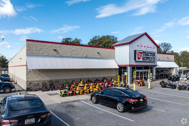
821 Newark Rd
Philadelphia-Camden-Wilmington, PA-NJ-DE-MD
Wayside
60-003-0116.0000
2.72 AC COMM BLDG LOT 1
Commercialnec
Chester
X
Pennsylvania
42029C0335G
1
2024
2.72 AC
2025
Outer Chester County
306504
Philadelphia
18,750 SF
DEMOGRAPHICS near 821 Newark Rd
1 Mile
3 Mile
5 Mile
2024 Total Population
1,784
23,587
63,428
2029 Population
1,820
24,375
65,462
Pop Growth 2024-2029
+ 2.02%
+ 3.34%
+ 3.21%
Average Age
38
40
41
2024 Total Households
555
7,841
21,908
HH Growth 2024-2029
+ 2.16%
+ 3.55%
+ 3.32%
Median Household Inc
$139,062
$136,688
$130,550
Avg Household Size
3.00
2.90
2.80
2024 Avg HH Vehicles
2.00
2.00
2.00
Median Home Value
$450,000
$448,184
$446,650
Median Year Built
1994
1992
1987
Nearby Places
Map Layers
Map Styles
 Street
 Aerial
- Restaurants
- Banks
- Shops
- Fitness
- Groceries
PUBLIC TRANSPORTATION
AIRPORT
Philadelphia International
DRIVE
WALK
Distance
Philadelphia International
52 min
33.1 mi
Freight Ports
Port of Wilmington, RI
DRIVE
WALK
Distance
Port of Wilmington, RI
30 min
17.0 mi
SALE & LEASE HISTORY
LISTING DATE
SALE/LEASE

Sep 25, 2016
For Lease
Sep 24, 2016
For Sale
May 22, 2017
For Sale
Mar 24, 2020
For Sale
Nearby Properties
Address
Land Use
TOTAL SIZE
Lot Size
Zoning
Address
Land Use
TOTAL SIZE
Lot Size
Zoning
204,007 SF
79 AC
R1
Address
Land Use
TOTAL SIZE
Lot Size
Zoning
258,320 SF
42.68 AC
CI
Address
Land Use
TOTAL SIZE
Lot Size
Zoning
105,405 SF
17 AC
R1
Address
Land Use
TOTAL SIZE
Lot Size
Zoning
451,182 SF
94.70 AC
BP
Address
Land Use
TOTAL SIZE
Lot Size
Zoning
114,126 SF
18.10 AC
CI
Address
Land Use
TOTAL SIZE
Lot Size
Zoning
69,351 SF
25 AC
UD
Address
Land Use
TOTAL SIZE
Lot Size
Zoning
66,899 SF
21.40 AC
RR
Address
Land Use
TOTAL SIZE
Lot Size
Zoning
200,337 SF
14 AC
CI
Address
Land Use
TOTAL SIZE
Lot Size
Zoning
2,664 SF
11.60 AC
CR
Address
Land Use
TOTAL SIZE
Lot Size
Zoning
87,680 SF
11.40 AC
CI
Address
Land Use
TOTAL SIZE
Lot Size
Zoning
106,200 SF
10.40 AC
CI
Address
Land Use
TOTAL SIZE
Lot Size
Zoning
175,250 SF
50 AC
SA
Address
Land Use
TOTAL SIZE
Lot Size
Zoning
106,210 SF
11.70 AC
UD
Address
Land Use
TOTAL SIZE
Lot Size
Zoning
262,839 SF
59.75 AC
R1
Address
Land Use
TOTAL SIZE
Lot Size
Zoning
70,448 SF
11.40 AC
CI
Address
Land Use
TOTAL SIZE
Lot Size
Zoning
33,620 SF
1.13 AC
R2A
Address
Land Use
TOTAL SIZE
Lot Size
Zoning
32,576 SF
9.30 AC
CI
Address
Land Use
TOTAL SIZE
Lot Size
Zoning
104,344 SF
9.20 AC
UD
Address
Land Use
TOTAL SIZE
Lot Size
Zoning
71,830 SF
22.40 AC
R2
Address
Land Use
TOTAL SIZE
Lot Size
Zoning
58,773 SF
11.04 AC
CI
Address
Land Use
TOTAL SIZE
Lot Size
Zoning
29,614 SF
28.29 AC
R1
Address
Land Use
TOTAL SIZE
Lot Size
Zoning
150,423 SF
44.22 AC
R1
Address
Land Use
TOTAL SIZE
Lot Size
Zoning
50,846 SF
10 AC
CI
Address
Land Use
TOTAL SIZE
Lot Size
Zoning
64,044 SF
69.21 AC
BP
Address
Land Use
TOTAL SIZE
Lot Size
Zoning
100,807 SF
83.99 AC
BP
Address
Land Use
TOTAL SIZE
Lot Size
Zoning
21,910 SF
8.75 AC
R1
Address
Land Use
TOTAL SIZE
Lot Size
Zoning
84,830 SF
10.66 AC
CI
Address
Land Use
TOTAL SIZE
Lot Size
Zoning
15,680 SF
2.50 AC
C2
Address
Land Use
TOTAL SIZE
Lot Size
Zoning
26,274 SF
1.81 AC
R1
Address
Land Use
TOTAL SIZE
Lot Size
Zoning
13,092 SF
2.60 AC
CI
The World's #1 Commercial Real Estate Marketplace
Connect with us
© 2026 CoStar Group
The information above has been obtained from sources believed reliable. While we do not doubt its accuracy we have not verified it and make no guarantee, warranty or representation about it. It is your responsibility to independently confirm its accuracy and completeness. Any projections, opinions, assumptions, or estimates used are for example only and do not represent the current or future performance of the property. The value of this transaction to you depends on tax and other factors which should be evaluated by your tax, financial, and legal advisors. You and your advisors should conduct a careful, independent investigation of the property to determine to your satisfaction the suitability of the property for your needs.