Property Record
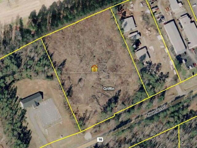
Newnan Rd, Griffin, GA 30223

Property Detail
Newnan Rd
Atlanta-Sandy Springs-Roswell, GA
HWY 16/NEWNAN RD 4.813 AC PB 25/230
080A-01-002
SPALDING
Commercialacreage
Georgia
PCD
79
B and X Area of moderate flood hazard, usually the area between the limits of the 100-year and 500-year floods.
4.81 AC
2025
Spalding County
2025
Atlanta
160402
NEARBY LISTINGS FOR SALE OR LEASE
-
-
-
-
-
-
-
No Photo
-
View all Griffin listings for sale on LoopNet.com
DEMOGRAPHICS near Newnan Rd
1 mile
3 mile
5 mile
2025 Total Population
1,657
22,359
48,856
2030 Population
1,717
23,354
50,990
Pop Growth 2025-2030
+ 3.62%
+ 4.45%
+ 4.37%
Average Age
39
38
39
2025 Total Households
565
8,421
18,455
HH Growth 2025-2030
+ 4.07%
+ 4.58%
+ 4.42%
Median Household Inc
$72,499
$48,606
$56,586
Avg Household Size
2.50
2.50
2.60
2025 Avg HH Vehicles
2.00
2.00
2.00
Median Home Value
$256,923
$204,745
$223,884
Median Year Built
1995
1983
1978
Nearby Places
Map Layers
Map Styles
 Street
 Aerial
Transit
 Traffic
 Biking
Places
Listings with unknown addresses are not visible on the map
- Restaurants
- Banks
- Shops
- Fitness
- Groceries
PUBLIC TRANSPORTATION
AIRPORT
Hartsfield - Jackson Atlanta International
Drive
Walk
Distance
Hartsfield - Jackson Atlanta International
50 min
32.1 mi
Nearby Properties
Address
Land Use
TOTAL SIZE
Lot Size
Zoning
Address
Land Use
TOTAL SIZE
Lot Size
Zoning
210,196 SF
14.92 AC
PCD
Address
Land Use
TOTAL SIZE
Lot Size
Zoning
112,554 SF
40.27 AC
C2
Address
Land Use
TOTAL SIZE
Lot Size
Zoning
46,074 SF
30.36 AC
OI
Address
Land Use
TOTAL SIZE
Lot Size
Zoning
56,415 SF
0.56 AC
PCD
Address
Land Use
TOTAL SIZE
Lot Size
Zoning
200,880 SF
21.14 AC
PCD
Address
Land Use
TOTAL SIZE
Lot Size
Zoning
31,328 SF
58.43 AC
PID
Address
Land Use
TOTAL SIZE
Lot Size
Zoning
31,328 SF
58.43 AC
PID
Address
Land Use
TOTAL SIZE
Lot Size
Zoning
89,096 SF
22.41 AC
PCD
Address
Land Use
TOTAL SIZE
Lot Size
Zoning
2,876 SF
19.98 AC
HDRB
Address
Land Use
TOTAL SIZE
Lot Size
Zoning
70,817 SF
0.79 AC
CBD
Address
Land Use
TOTAL SIZE
Lot Size
Zoning
133.41 AC
INST
Address
Land Use
TOTAL SIZE
Lot Size
Zoning
305,123 SF
37 AC
C2
Address
Land Use
TOTAL SIZE
Lot Size
Zoning
221,554 SF
23.89 AC
PCD
Address
Land Use
TOTAL SIZE
Lot Size
Zoning
89.45 AC
INST
Address
Land Use
TOTAL SIZE
Lot Size
Zoning
96,787 SF
13.42 AC
LDRB
Address
Land Use
TOTAL SIZE
Lot Size
Zoning
2,374 SF
38.28 AC
HDRB
Address
Land Use
TOTAL SIZE
Lot Size
Zoning
10,000 SF
11.82 AC
PCD
Address
Land Use
TOTAL SIZE
Lot Size
Zoning
54,980 SF
1.09 AC
CBD
Address
Land Use
TOTAL SIZE
Lot Size
Zoning
52,636 SF
2.69 AC
PCD
Address
Land Use
TOTAL SIZE
Lot Size
Zoning
118,410 SF
15.42 AC
LDRB
Address
Land Use
TOTAL SIZE
Lot Size
Zoning
3,069 SF
15 AC
HDR-B
Address
Land Use
TOTAL SIZE
Lot Size
Zoning
55.08 AC
R-1
Address
Land Use
TOTAL SIZE
Lot Size
Zoning
3,716 SF
12.03 AC
PRD
Address
Land Use
TOTAL SIZE
Lot Size
Zoning
20,383 SF
2.93 AC
HDRA/PCD
Address
Land Use
TOTAL SIZE
Lot Size
Zoning
47,652 SF
2.59 AC
PCD
Address
Land Use
TOTAL SIZE
Lot Size
Zoning
57,929 SF
11.90 AC
Address
Land Use
TOTAL SIZE
Lot Size
Zoning
1,537 SF
7 AC
HDRA
Address
Land Use
TOTAL SIZE
Lot Size
Zoning
43,440 SF
23.20 AC
AR-1
Address
Land Use
TOTAL SIZE
Lot Size
Zoning
102,102 SF
10.84 AC
PCD
Address
Land Use
TOTAL SIZE
Lot Size
Zoning
41,194 SF
25.19 AC
C-1
The World's #1 Commercial Real Estate Marketplace
Connect with us
© 2026 CoStar Group
The information above has been obtained from sources believed reliable. While we do not doubt its accuracy we have not verified it and make no guarantee, warranty or representation about it. It is your responsibility to independently confirm its accuracy and completeness. Any projections, opinions, assumptions, or estimates used are for example only and do not represent the current or future performance of the property. The value of this transaction to you depends on tax and other factors which should be evaluated by your tax, financial, and legal advisors. You and your advisors should conduct a careful, independent investigation of the property to determine to your satisfaction the suitability of the property for your needs.