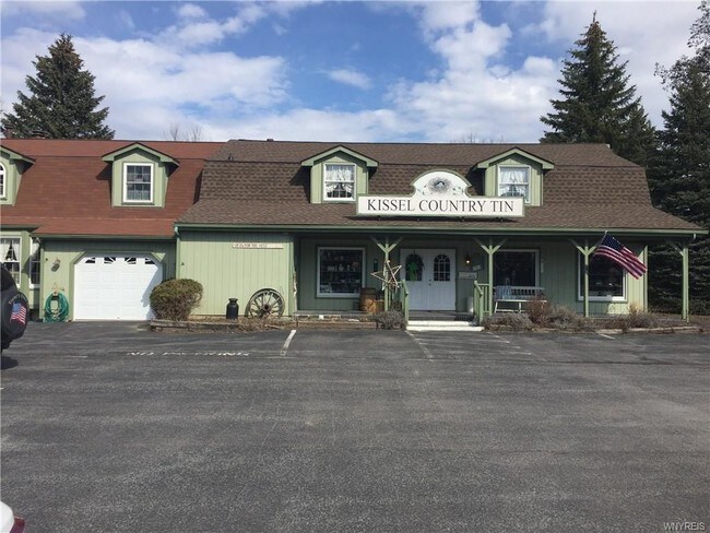
Property Record
7296 Schultz Rd, North Tonawanda, NY 14120


NEARBY LISTINGS FOR SALE OR LEASE
Property Detail
7296 Schultz Rd
Buffalo-Cheektowaga, NY
Niagara
294000-163-000-0002-019-000
New York
Sfr
1.60 AC
AE
Outlying Niagara County
36063C0353E
Buffalo/Niagara Falls
3,496 SF
DEMOGRAPHICS near 7296 Schultz Rd
1 Mile
3 Mile
5 Mile
2024 Total Population
6,840
40,498
98,777
2029 Population
6,719
39,649
97,456
Pop Growth 2024-2029
(1.77%)
(2.10%)
(1.34%)
Average Age
44
43
43
2024 Total Households
2,584
17,330
43,296
HH Growth 2024-2029
(1.78%)
(2.16%)
(1.35%)
Median Household Inc
$93,269
$73,827
$69,490
Avg Household Size
2.60
2.30
2.20
2024 Avg HH Vehicles
2.00
2.00
2.00
Median Home Value
$211,601
$183,043
$190,821
Median Year Built
1970
1960
1964
Nearby Places
Map Layers
Map Styles
 Street
 Aerial
- Restaurants
- Banks
- Shops
- Fitness
- Groceries
PUBLIC TRANSPORTATION
AIRPORT
Niagara Falls International
DRIVE
WALK
Distance
Niagara Falls International
9 min
5.4 mi
Buffalo Niagara International
DRIVE
WALK
Distance
Buffalo Niagara International
25 min
13.1 mi
SALE & LEASE HISTORY
LISTING DATE
SALE/LEASE

Nov 17, 2020
For Sale
Jul 10, 2018
For Sale
Feb 25, 2022
For Sale
Nearby Properties
Address
Land Use
TOTAL SIZE
Lot Size
Zoning
Address
Land Use
TOTAL SIZE
Lot Size
Zoning
5,472 SF
70.10 AC
Address
Land Use
TOTAL SIZE
Lot Size
Zoning
4,707 SF
13.60 AC
WD NT
Address
Land Use
TOTAL SIZE
Lot Size
Zoning
11,248 SF
21.70 AC
MFR-5
Address
Land Use
TOTAL SIZE
Lot Size
Zoning
173,303 SF
24.40 AC
R1-2
Address
Land Use
TOTAL SIZE
Lot Size
Zoning
112,256 SF
38.33 AC
00000
Address
Land Use
TOTAL SIZE
Lot Size
Zoning
96,554 SF
10.90 AC
Address
Land Use
TOTAL SIZE
Lot Size
Zoning
137,878 SF
23.60 AC
R1-2
Address
Land Use
TOTAL SIZE
Lot Size
Zoning
Address
Land Use
TOTAL SIZE
Lot Size
Zoning
Address
Land Use
TOTAL SIZE
Lot Size
Zoning
175,793 SF
27.30 AC
M-1
Address
Land Use
TOTAL SIZE
Lot Size
Zoning
137,200 SF
3.56 AC
WD
Address
Land Use
TOTAL SIZE
Lot Size
Zoning
28,448 SF
4.30 AC
GB
Address
Land Use
TOTAL SIZE
Lot Size
Zoning
96,458 SF
7.94 AC
GB
Address
Land Use
TOTAL SIZE
Lot Size
Zoning
57,000 SF
4.02 AC
Address
Land Use
TOTAL SIZE
Lot Size
Zoning
47,400 SF
10.03 AC
MS
Address
Land Use
TOTAL SIZE
Lot Size
Zoning
34,100 SF
15.75 AC
C-1
Address
Land Use
TOTAL SIZE
Lot Size
Zoning
51,232 SF
2.55 AC
WD
Address
Land Use
TOTAL SIZE
Lot Size
Zoning
8.20 AC
R2
Address
Land Use
TOTAL SIZE
Lot Size
Zoning
60,985 SF
4.38 AC
C-1
Address
Land Use
TOTAL SIZE
Lot Size
Zoning
154,516 SF
29.20 AC
Address
Land Use
TOTAL SIZE
Lot Size
Zoning
64,815 SF
5.90 AC
Address
Land Use
TOTAL SIZE
Lot Size
Zoning
36,005 SF
0.83 AC
Address
Land Use
TOTAL SIZE
Lot Size
Zoning
119,392 SF
6.40 AC
R-2
Address
Land Use
TOTAL SIZE
Lot Size
Zoning
Address
Land Use
TOTAL SIZE
Lot Size
Zoning
45,397 SF
10.03 AC
R1-2
Address
Land Use
TOTAL SIZE
Lot Size
Zoning
62,528 SF
10.30 AC
R1-2
Address
Land Use
TOTAL SIZE
Lot Size
Zoning
19,024 SF
2.52 AC
GB
Address
Land Use
TOTAL SIZE
Lot Size
Zoning
4,880 SF
318.14 AC
R1-2
Address
Land Use
TOTAL SIZE
Lot Size
Zoning
23,100 SF
5.80 AC
M-1
Address
Land Use
TOTAL SIZE
Lot Size
Zoning
The World's #1 Commercial Real Estate Marketplace
Connect with us
© 2026 CoStar Group
The information above has been obtained from sources believed reliable. While we do not doubt its accuracy we have not verified it and make no guarantee, warranty or representation about it. It is your responsibility to independently confirm its accuracy and completeness. Any projections, opinions, assumptions, or estimates used are for example only and do not represent the current or future performance of the property. The value of this transaction to you depends on tax and other factors which should be evaluated by your tax, financial, and legal advisors. You and your advisors should conduct a careful, independent investigation of the property to determine to your satisfaction the suitability of the property for your needs.