No Photo
Property Record
Croton Lake Rd, Mount Kisco, NY 10549
NEARBY LISTINGS FOR SALE OR LEASE
Property Detail
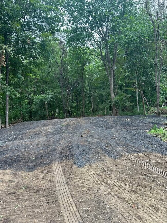
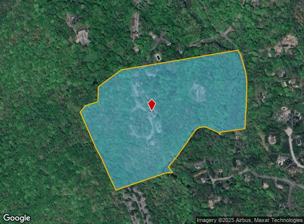
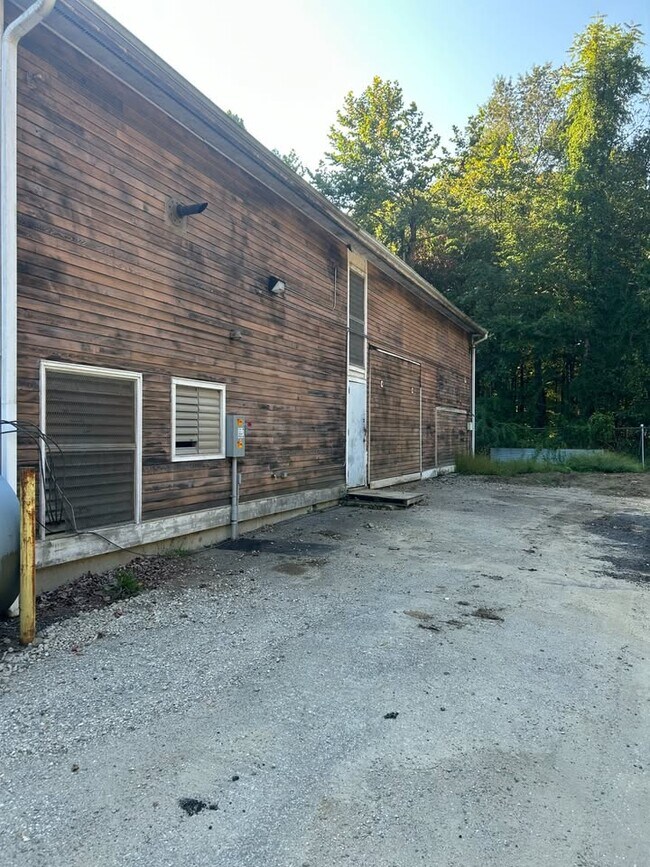
Croton Lake Rd
3600-071-005-00002-000-0001
Westchester
Residentialacreage
New York
AE
1.000
36119C0151F
47.10 AC
0
North
2024
Westchester/So Connecticut
012900
New York-Jersey City-White Plains, NY-NJ
DEMOGRAPHICS near Croton Lake Rd
1 Mile
3 Mile
5 Mile
2024 Total Population
2,668
25,126
53,978
2029 Population
2,691
25,355
54,649
Pop Growth 2024-2029
+ 0.86%
+ 0.91%
+ 1.24%
Average Age
42
42
42
2024 Total Households
875
8,949
18,383
HH Growth 2024-2029
+ 0.80%
+ 0.92%
+ 1.21%
Median Household Inc
$160,096
$132,165
$168,636
Avg Household Size
2.90
2.70
2.80
2024 Avg HH Vehicles
2.00
2.00
2.00
Median Home Value
$813,440
$735,306
$789,520
Median Year Built
1972
1966
1965
Nearby Places
Map Layers
Map Styles
 Street
 Aerial
- Restaurants
- Banks
- Shops
- Fitness
- Groceries
PUBLIC TRANSPORTATION
COMMUTER RAIL
Mount Kisco Station (Harlem Line - Metro-North Commuter Railroad Company (Metro-North))
DRIVE
WALK
Distance
Mount Kisco Station (Harlem Line - Metro-North Commuter Railroad Company (Metro-North))
8 min
2.4 mi
Bedford Hills Station (Harlem Line - Metro-North Commuter Railroad Company (Metro-North))
DRIVE
WALK
Distance
Bedford Hills Station (Harlem Line - Metro-North Commuter Railroad Company (Metro-North))
9 min
3.6 mi
AIRPORT
Westchester County
DRIVE
WALK
Distance
Westchester County
27 min
15.0 mi
New York Stewart International
DRIVE
WALK
Distance
New York Stewart International
70 min
39.2 mi
Freight Ports
NY - Red Hook Container Terminal
DRIVE
WALK
Distance
NY - Red Hook Container Terminal
72 min
48.6 mi
Nearby Properties
Address
Land Use
TOTAL SIZE
Lot Size
Zoning
Address
Land Use
TOTAL SIZE
Lot Size
Zoning
12.77 AC
H
Address
Land Use
TOTAL SIZE
Lot Size
Zoning
31 AC
ML
Address
Land Use
TOTAL SIZE
Lot Size
Zoning
85.40 AC
R-1A
Address
Land Use
TOTAL SIZE
Lot Size
Zoning
Address
Land Use
TOTAL SIZE
Lot Size
Zoning
4.86 AC
OG
Address
Land Use
TOTAL SIZE
Lot Size
Zoning
3.70 AC
OG
Address
Land Use
TOTAL SIZE
Lot Size
Zoning
4.29 AC
OG
Address
Land Use
TOTAL SIZE
Lot Size
Zoning
2.20 AC
CB-2
Address
Land Use
TOTAL SIZE
Lot Size
Zoning
11.71 AC
Address
Land Use
TOTAL SIZE
Lot Size
Zoning
143.80 AC
Address
Land Use
TOTAL SIZE
Lot Size
Zoning
7.62 AC
RM-29
Address
Land Use
TOTAL SIZE
Lot Size
Zoning
3.67 AC
CL
Address
Land Use
TOTAL SIZE
Lot Size
Zoning
3.13 AC
MG
Address
Land Use
TOTAL SIZE
Lot Size
Zoning
2.20 AC
CB-2
Address
Land Use
TOTAL SIZE
Lot Size
Zoning
2.05 AC
RT-6
Address
Land Use
TOTAL SIZE
Lot Size
Zoning
6.26 AC
GC
Address
Land Use
TOTAL SIZE
Lot Size
Zoning
Address
Land Use
TOTAL SIZE
Lot Size
Zoning
2.38 AC
CR
Address
Land Use
TOTAL SIZE
Lot Size
Zoning
4.20 AC
MG
Address
Land Use
TOTAL SIZE
Lot Size
Zoning
3.21 AC
CL
Address
Land Use
TOTAL SIZE
Lot Size
Zoning
3.99 AC
RT-6
Address
Land Use
TOTAL SIZE
Lot Size
Zoning
4.49 AC
MRD
Address
Land Use
TOTAL SIZE
Lot Size
Zoning
130.31 AC
Address
Land Use
TOTAL SIZE
Lot Size
Zoning
Address
Land Use
TOTAL SIZE
Lot Size
Zoning
12.31 AC
MRD
Address
Land Use
TOTAL SIZE
Lot Size
Zoning
2.85 AC
OG
Address
Land Use
TOTAL SIZE
Lot Size
Zoning
0.74 AC
CB-1
Address
Land Use
TOTAL SIZE
Lot Size
Zoning
Address
Land Use
TOTAL SIZE
Lot Size
Zoning
39.37 AC
R-1A
Address
Land Use
TOTAL SIZE
Lot Size
Zoning
3.65 AC
MRD
The World's #1 Commercial Real Estate Marketplace
Connect with us
© 2026 CoStar Group
The information above has been obtained from sources believed reliable. While we do not doubt its accuracy we have not verified it and make no guarantee, warranty or representation about it. It is your responsibility to independently confirm its accuracy and completeness. Any projections, opinions, assumptions, or estimates used are for example only and do not represent the current or future performance of the property. The value of this transaction to you depends on tax and other factors which should be evaluated by your tax, financial, and legal advisors. You and your advisors should conduct a careful, independent investigation of the property to determine to your satisfaction the suitability of the property for your needs.