Property Record
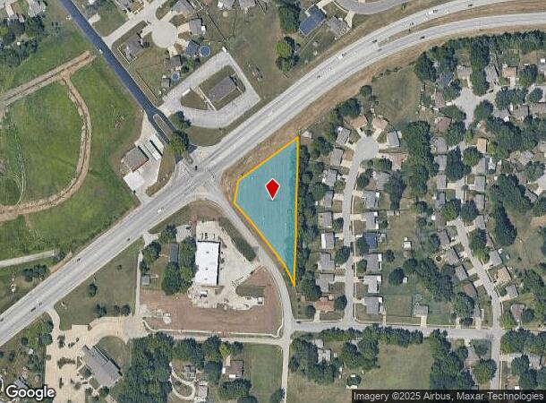
No Address Assigned By City Rd, Independence, MO 64056
NEARBY LISTINGS FOR SALE OR LEASE
-
-
View all Independence listings for sale on LoopNet.com
Property Detail
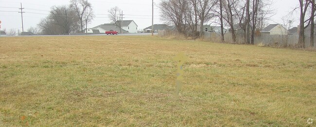
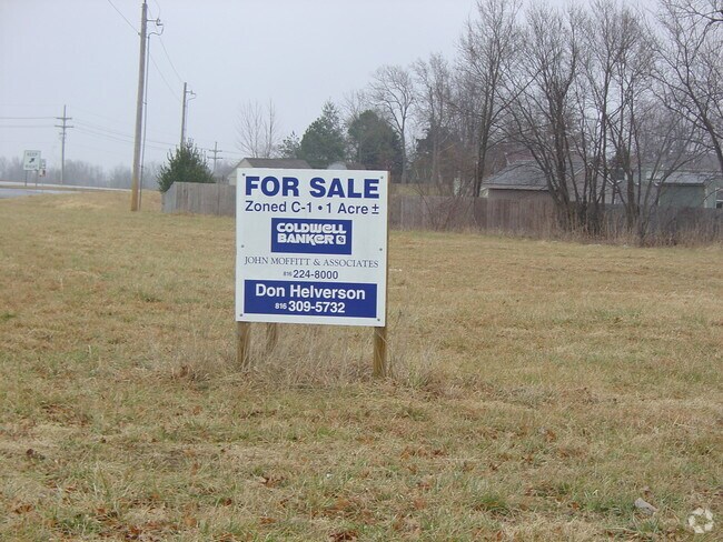
No Address Assigned By City Rd
16-240-05-20-00-0-00-000
SEC 20 TWP 50 RNG 31 BEG INTERSEC 24 HWY & DAVIS RD TH S 38 DEG E 149 THN 51 DEG E 50 TO E ROW DAVIS RD TO TR POB: TH S 38 DEG E ALG E ROW 70 TH S 32 DEG E 100.50 TH S 38 DEG E
Commercialacreage
Jackson
X
Missouri
29095C0190H
1.05 AC
2024
East Jackson County
2025
Kansas City
011406
Kansas City, MO-KS
DEMOGRAPHICS near No Address Assigned By City Rd
1 Mile
3 Mile
5 Mile
2024 Total Population
9,180
22,767
53,819
2029 Population
9,043
22,448
53,213
Pop Growth 2024-2029
(1.49%)
(1.40%)
(1.13%)
Average Age
38
37
40
2024 Total Households
3,181
8,188
21,108
HH Growth 2024-2029
(1.63%)
(1.51%)
(1.26%)
Median Household Inc
$73,728
$67,638
$61,466
Avg Household Size
2.80
2.70
2.50
2024 Avg HH Vehicles
2.00
2.00
2.00
Median Home Value
$178,025
$172,790
$174,334
Median Year Built
1976
1973
1970
Nearby Places
Map Layers
Map Styles
 Street
 Aerial
- Restaurants
- Banks
- Shops
- Fitness
- Groceries
PUBLIC TRANSPORTATION
COMMUTER RAIL
Independence Amtrak Station (Lincoln Service Missouri River Runner - Amtrak, Missouri River Runner - Amtrak)
DRIVE
WALK
Distance
Independence Amtrak Station (Lincoln Service Missouri River Runner - Amtrak, Missouri River Runner - Amtrak)
13 min
6.3 mi
AIRPORT
Kansas City International
DRIVE
WALK
Distance
Kansas City International
43 min
29.9 mi
Freight Ports
Tulsa Port Of Catoosa
DRIVE
WALK
Distance
Tulsa Port Of Catoosa
286 min
254.9 mi
SALE & LEASE HISTORY
LISTING DATE
SALE/LEASE

Dec 11, 2017
For Sale
Aug 04, 2017
For Sale
Nearby Properties
Address
Land Use
TOTAL SIZE
Lot Size
Zoning
Address
Land Use
TOTAL SIZE
Lot Size
Zoning
1 SF
1.44 AC
Address
Land Use
TOTAL SIZE
Lot Size
Zoning
Address
Land Use
TOTAL SIZE
Lot Size
Zoning
111,445 SF
8 AC
Address
Land Use
TOTAL SIZE
Lot Size
Zoning
155,098 SF
94.87 AC
Address
Land Use
TOTAL SIZE
Lot Size
Zoning
104,740 SF
7.25 AC
Address
Land Use
TOTAL SIZE
Lot Size
Zoning
158,109 SF
2.77 AC
Address
Land Use
TOTAL SIZE
Lot Size
Zoning
85,839 SF
62.42 AC
Address
Land Use
TOTAL SIZE
Lot Size
Zoning
7,948 SF
186.06 AC
Address
Land Use
TOTAL SIZE
Lot Size
Zoning
47,978 SF
10.20 AC
Address
Land Use
TOTAL SIZE
Lot Size
Zoning
4,200,000 SF
0.66 AC
Address
Land Use
TOTAL SIZE
Lot Size
Zoning
70,053 SF
2.98 AC
Address
Land Use
TOTAL SIZE
Lot Size
Zoning
15,015 SF
1.96 AC
Address
Land Use
TOTAL SIZE
Lot Size
Zoning
138,554 SF
15.62 AC
Address
Land Use
TOTAL SIZE
Lot Size
Zoning
Address
Land Use
TOTAL SIZE
Lot Size
Zoning
111,555 SF
5.54 AC
Address
Land Use
TOTAL SIZE
Lot Size
Zoning
59,939 SF
9.10 AC
Address
Land Use
TOTAL SIZE
Lot Size
Zoning
55,675 SF
11.50 AC
Address
Land Use
TOTAL SIZE
Lot Size
Zoning
45,727 SF
9.50 AC
Address
Land Use
TOTAL SIZE
Lot Size
Zoning
38,765 SF
7 AC
Address
Land Use
TOTAL SIZE
Lot Size
Zoning
118.35 AC
Address
Land Use
TOTAL SIZE
Lot Size
Zoning
60,505 SF
128.04 AC
Address
Land Use
TOTAL SIZE
Lot Size
Zoning
5,832 SF
2.37 AC
Address
Land Use
TOTAL SIZE
Lot Size
Zoning
38,783 SF
9.20 AC
Address
Land Use
TOTAL SIZE
Lot Size
Zoning
27,183 SF
6.25 AC
Address
Land Use
TOTAL SIZE
Lot Size
Zoning
17,040 SF
1.87 AC
Address
Land Use
TOTAL SIZE
Lot Size
Zoning
42,812 SF
1.70 AC
Address
Land Use
TOTAL SIZE
Lot Size
Zoning
46,250 SF
12.90 AC
Address
Land Use
TOTAL SIZE
Lot Size
Zoning
11,040 SF
154.50 AC
Address
Land Use
TOTAL SIZE
Lot Size
Zoning
32,900 SF
10 AC
Address
Land Use
TOTAL SIZE
Lot Size
Zoning
5,766 SF
2.74 AC
The World's #1 Commercial Real Estate Marketplace
Connect with us
© 2025 CoStar Group
The information above has been obtained from sources believed reliable. While we do not doubt its accuracy we have not verified it and make no guarantee, warranty or representation about it. It is your responsibility to independently confirm its accuracy and completeness. Any projections, opinions, assumptions, or estimates used are for example only and do not represent the current or future performance of the property. The value of this transaction to you depends on tax and other factors which should be evaluated by your tax, financial, and legal advisors. You and your advisors should conduct a careful, independent investigation of the property to determine to your satisfaction the suitability of the property for your needs.