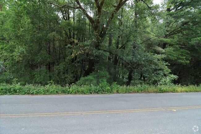
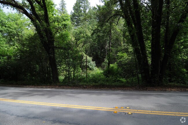
Property Record
None, Forestville, CA 95436


Save to a Folder
{{folder.Name}}
{{folder.ListingIds.length}} Properties
{{folder.ListingIds.length}} Property
Create a New Folder
Property Detail
None
Santa Rosa-Petaluma, CA
NOLAN ROAD SUB LOT 9
083-130-077
SONOMA
Vineyard
California
RRDB7FRZN
9
B and X Area of moderate flood hazard, usually the area between the limits of the 100-year and 500-year floods.
19.92 AC
2025
Sebastopol/Bodega/West
2025
North Bay/Santa Rosa
153705
NEARBY LISTINGS FOR SALE OR LEASE
-
-
View all Forestville listings for sale on LoopNet.com
DEMOGRAPHICS near None
1 mile
3 mile
5 mile
2025 Total Population
1,192
6,452
12,332
2030 Population
1,127
6,252
11,933
Pop Growth 2025-2030
(5.45%)
(3.10%)
(3.24%)
Average Age
49
49
49
2025 Total Households
502
2,816
5,261
HH Growth 2025-2030
(5.38%)
(2.91%)
(3.02%)
Median Household Inc
$123,332
$98,722
$105,215
Avg Household Size
2.30
2.20
2.30
2025 Avg HH Vehicles
2.00
2.00
2.00
Median Home Value
$850,220
$791,220
$834,058
Median Year Built
1967
1962
1965
Nearby Places
Map Layers
Map Styles
 Street
 Aerial
Layers
 Traffic
 Biking
Places
Listings with unknown addresses are not visible on the map
- Restaurants
- Banks
- Shops
- Fitness
- Groceries
PUBLIC TRANSPORTATION
AIRPORT
Charles M Schulz - Sonoma County
Drive
Walk
Distance
Charles M Schulz - Sonoma County
22 min
10.2 mi
Freight Ports
Port of Richmond
Drive
Walk
Distance
Port of Richmond
78 min
56.3 mi
Nearby Properties
Address
Land Use
TOTAL SIZE
Lot Size
Zoning
Address
Land Use
TOTAL SIZE
Lot Size
Zoning
30.04 AC
Address
Land Use
TOTAL SIZE
Lot Size
Zoning
22,517 SF
12.51 AC
DA20
Address
Land Use
TOTAL SIZE
Lot Size
Zoning
14,962 SF
20.02 AC
Address
Land Use
TOTAL SIZE
Lot Size
Zoning
360 SF
14 AC
RRD160
Address
Land Use
TOTAL SIZE
Lot Size
Zoning
26,690 SF
21.03 AC
Address
Land Use
TOTAL SIZE
Lot Size
Zoning
3,672 SF
16.30 AC
LIA40
Address
Land Use
TOTAL SIZE
Lot Size
Zoning
43.67 AC
Address
Land Use
TOTAL SIZE
Lot Size
Zoning
2,238 SF
3.50 AC
Address
Land Use
TOTAL SIZE
Lot Size
Zoning
20,296 SF
8.55 AC
LCF2
Address
Land Use
TOTAL SIZE
Lot Size
Zoning
2,883 SF
17.42 AC
DA10
Address
Land Use
TOTAL SIZE
Lot Size
Zoning
3,050 SF
6.69 AC
Address
Land Use
TOTAL SIZE
Lot Size
Zoning
4,603 SF
10.61 AC
Address
Land Use
TOTAL SIZE
Lot Size
Zoning
2,784 SF
20.31 AC
DA10
Address
Land Use
TOTAL SIZE
Lot Size
Zoning
1,731 SF
5.45 AC
RRD20
Address
Land Use
TOTAL SIZE
Lot Size
Zoning
45.26 AC
Address
Land Use
TOTAL SIZE
Lot Size
Zoning
4,555 SF
11.70 AC
Address
Land Use
TOTAL SIZE
Lot Size
Zoning
4,314 SF
167.10 AC
DA20
Address
Land Use
TOTAL SIZE
Lot Size
Zoning
8,572 SF
20.02 AC
Address
Land Use
TOTAL SIZE
Lot Size
Zoning
4,205 SF
60.87 AC
DA60
Address
Land Use
TOTAL SIZE
Lot Size
Zoning
3,280 SF
115.61 AC
LIA60
Address
Land Use
TOTAL SIZE
Lot Size
Zoning
2,387 SF
12.15 AC
DA10
Address
Land Use
TOTAL SIZE
Lot Size
Zoning
2,466 SF
70.90 AC
RRD160
Address
Land Use
TOTAL SIZE
Lot Size
Zoning
2,491 SF
25.91 AC
DA20
Address
Land Use
TOTAL SIZE
Lot Size
Zoning
3,376 SF
58.41 AC
DA20
Address
Land Use
TOTAL SIZE
Lot Size
Zoning
7,853 SF
0.47 AC
RR2
Address
Land Use
TOTAL SIZE
Lot Size
Zoning
1,664 SF
17.77 AC
DA10
Address
Land Use
TOTAL SIZE
Lot Size
Zoning
4,600 SF
22.09 AC
DA20
Address
Land Use
TOTAL SIZE
Lot Size
Zoning
180 SF
22.54 AC
Address
Land Use
TOTAL SIZE
Lot Size
Zoning
23.52 AC
DA10
Address
Land Use
TOTAL SIZE
Lot Size
Zoning
19,966 SF
2.80 AC
C1
The World's #1 Commercial Real Estate Marketplace
Connect with us
© 2026 CoStar Group
The information above has been obtained from sources believed reliable. While we do not doubt its accuracy we have not verified it and make no guarantee, warranty or representation about it. It is your responsibility to independently confirm its accuracy and completeness. Any projections, opinions, assumptions, or estimates used are for example only and do not represent the current or future performance of the property. The value of this transaction to you depends on tax and other factors which should be evaluated by your tax, financial, and legal advisors. You and your advisors should conduct a careful, independent investigation of the property to determine to your satisfaction the suitability of the property for your needs.