Property Record
Northwind Dr, Okemos, MI 48864
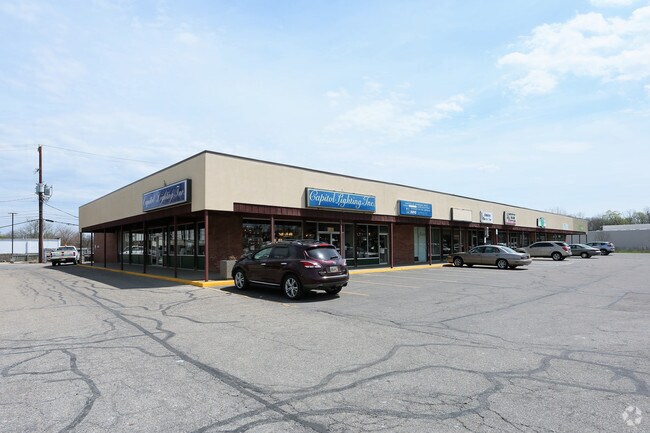


Property Detail
Northwind Dr
Lansing-East Lansing, MI
MP 6670 MP 6671 MP 6672-1 LOTS 2 & 3 & PART OF LOT 4 DESC. AS BEG. AT NW COR. OF LOT 4 & RUNNING TH S 81 DEG 50' E 117.89 FT.
02-02-20-127-003
INGHAM
Commercialacreage
Michigan
C-2
2-4
B and X Area of moderate flood hazard, usually the area between the limits of the 100-year and 500-year floods.
0.62 AC
0
East Lansing
2025
West Michigan
004302
NEARBY LISTINGS FOR SALE OR LEASE
DEMOGRAPHICS near Northwind Dr
1 mile
3 mile
5 mile
2024 Total Population
11,394
81,709
145,146
2029 Population
11,663
85,024
149,739
Pop Growth 2024-2029
+ 2.36%
+ 4.06%
+ 3.16%
Average Age
30
33
35
2024 Total Households
4,489
31,546
59,699
HH Growth 2024-2029
+ 2.99%
+ 4.43%
+ 3.36%
Median Household Inc
$37,561
$60,491
$62,268
Avg Household Size
2.10
2.20
2.20
2024 Avg HH Vehicles
2.00
2.00
2.00
Median Home Value
$250,572
$294,432
$250,896
Median Year Built
1984
1982
1978
Nearby Places
Map Layers
Map Styles
 Street
 Aerial
Transit
 Traffic
 Biking
Places
Listings with unknown addresses are not visible on the map
- Restaurants
- Banks
- Shops
- Fitness
- Groceries
PUBLIC TRANSPORTATION
COMMUTER RAIL
East Lansing Amtrak Station (Blue Water - Amtrak)
Drive
Walk
Distance
East Lansing Amtrak Station (Blue Water - Amtrak)
12 min
5.4 mi
AIRPORT
Capital Region International
Drive
Walk
Distance
Capital Region International
26 min
11.3 mi
Freight Ports
Port of Toledo
Drive
Walk
Distance
Port of Toledo
146 min
119.4 mi
Nearby Properties
Address
Land Use
TOTAL SIZE
Lot Size
Zoning
Address
Land Use
TOTAL SIZE
Lot Size
Zoning
49,959 SF
15.71 AC
RP
Address
Land Use
TOTAL SIZE
Lot Size
Zoning
98,513 SF
7.86 AC
C-2
Address
Land Use
TOTAL SIZE
Lot Size
Zoning
8,775 SF
78.38 AC
G-1 BUS
Address
Land Use
TOTAL SIZE
Lot Size
Zoning
251,183 SF
80.28 AC
Address
Land Use
TOTAL SIZE
Lot Size
Zoning
812,293 SF
62.18 AC
C-3
Address
Land Use
TOTAL SIZE
Lot Size
Zoning
149,799 SF
9.60 AC
Address
Land Use
TOTAL SIZE
Lot Size
Zoning
179,376 SF
6.03 AC
RM32
Address
Land Use
TOTAL SIZE
Lot Size
Zoning
32,946 SF
64.40 AC
RD
Address
Land Use
TOTAL SIZE
Lot Size
Zoning
51,122 SF
9.05 AC
RAA
Address
Land Use
TOTAL SIZE
Lot Size
Zoning
129,030 SF
RP
Address
Land Use
TOTAL SIZE
Lot Size
Zoning
61,198 SF
13.10 AC
C-2
Address
Land Use
TOTAL SIZE
Lot Size
Zoning
119,182 SF
19.33 AC
C-3
Address
Land Use
TOTAL SIZE
Lot Size
Zoning
35,523 SF
6.23 AC
C-2
Address
Land Use
TOTAL SIZE
Lot Size
Zoning
38,332 SF
7.44 AC
C-2
Address
Land Use
TOTAL SIZE
Lot Size
Zoning
179,376 SF
5.68 AC
Address
Land Use
TOTAL SIZE
Lot Size
Zoning
4,784 SF
24.06 AC
RC
Address
Land Use
TOTAL SIZE
Lot Size
Zoning
189,280 SF
6.03 AC
RCC
Address
Land Use
TOTAL SIZE
Lot Size
Zoning
25,308 SF
45.28 AC
RD
Address
Land Use
TOTAL SIZE
Lot Size
Zoning
15,067 SF
15.64 AC
RC
Address
Land Use
TOTAL SIZE
Lot Size
Zoning
25,430 SF
12.03 AC
RC
Address
Land Use
TOTAL SIZE
Lot Size
Zoning
78,098 SF
5.33 AC
C-3
Address
Land Use
TOTAL SIZE
Lot Size
Zoning
26,458 SF
16.65 AC
B-1
Address
Land Use
TOTAL SIZE
Lot Size
Zoning
11,374 SF
21.59 AC
RC
Address
Land Use
TOTAL SIZE
Lot Size
Zoning
119,182 SF
9.68 AC
Address
Land Use
TOTAL SIZE
Lot Size
Zoning
15,760 SF
8.49 AC
RCC
Address
Land Use
TOTAL SIZE
Lot Size
Zoning
72,020 SF
2.50 AC
C-2
Address
Land Use
TOTAL SIZE
Lot Size
Zoning
70,456 SF
9.13 AC
PO
Address
Land Use
TOTAL SIZE
Lot Size
Zoning
44,572 SF
4.23 AC
GO
Address
Land Use
TOTAL SIZE
Lot Size
Zoning
53,177 SF
9.03 AC
RA
Address
Land Use
TOTAL SIZE
Lot Size
Zoning
40,078 SF
19.38 AC
RC
The World's #1 Commercial Real Estate Marketplace
Connect with us
© 2026 CoStar Group
The information above has been obtained from sources believed reliable. While we do not doubt its accuracy we have not verified it and make no guarantee, warranty or representation about it. It is your responsibility to independently confirm its accuracy and completeness. Any projections, opinions, assumptions, or estimates used are for example only and do not represent the current or future performance of the property. The value of this transaction to you depends on tax and other factors which should be evaluated by your tax, financial, and legal advisors. You and your advisors should conduct a careful, independent investigation of the property to determine to your satisfaction the suitability of the property for your needs.