Property Record
Ns # Ns, Olathe, KS 66062

Property Detail
Ns # Ns
DF241419-2002
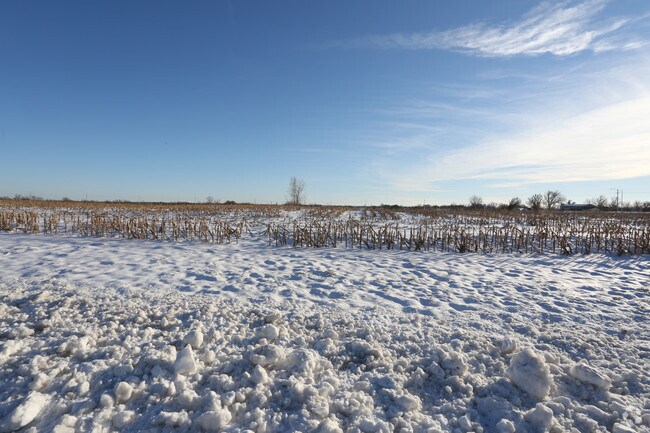
19-14-24 E 44.72 AC SW1/4 EX .894 AC IN ST & EX 17.289 AC 26.537 ACS M/L
Commercialnec
JOHNSON
CTY RUR
Kansas
B and X Area of moderate flood hazard, usually the area between the limits of the 100-year and 500-year floods.
26.16 AC
2025
South Johnson County
2025
Kansas City
053559
Kansas City, MO-KS
NEARBY LISTINGS FOR SALE OR LEASE
DEMOGRAPHICS near Ns # Ns
1 mile
3 mile
5 mile
2025 Total Population
1,520
29,642
84,853
2030 Population
1,629
30,911
87,827
Pop Growth 2025-2030
+ 7.17%
+ 4.28%
+ 3.50%
Average Age
38
38
38
2025 Total Households
508
9,810
28,297
HH Growth 2025-2030
+ 7.28%
+ 4.46%
+ 3.62%
Median Household Inc
$162,400
$131,921
$122,916
Avg Household Size
3.00
3.00
2.90
2025 Avg HH Vehicles
2.00
2.00
2.00
Median Home Value
$478,164
$390,204
$379,597
Median Year Built
2010
2003
1994
Nearby Places
Map Layers
Map Styles
 Street
 Aerial
Transit
 Traffic
 Biking
Places
Listings with unknown addresses are not visible on the map
- Restaurants
- Banks
- Shops
- Fitness
- Groceries
SALE & LEASE HISTORY
LISTING DATE
SALE/LEASE

Sep 06, 2017
For Sale
Nearby Properties
Address
Land Use
TOTAL SIZE
Lot Size
Zoning
Address
Land Use
TOTAL SIZE
Lot Size
Zoning
512,643 SF
75.55 AC
AG
Address
Land Use
TOTAL SIZE
Lot Size
Zoning
327,169 SF
141.81 AC
R-R
Address
Land Use
TOTAL SIZE
Lot Size
Zoning
720,320 SF
39.19 AC
MP-2
Address
Land Use
TOTAL SIZE
Lot Size
Zoning
508,664 SF
29.46 AC
MP-2
Address
Land Use
TOTAL SIZE
Lot Size
Zoning
499,084 SF
28.99 AC
RUR
Address
Land Use
TOTAL SIZE
Lot Size
Zoning
103,102 SF
31.90 AC
R-1
Address
Land Use
TOTAL SIZE
Lot Size
Zoning
137,955 SF
23.80 AC
R-1
Address
Land Use
TOTAL SIZE
Lot Size
Zoning
236,108 SF
12.38 AC
R-1
Address
Land Use
TOTAL SIZE
Lot Size
Zoning
102,280 SF
30.53 AC
RP-4
Address
Land Use
TOTAL SIZE
Lot Size
Zoning
70,643 SF
18.45 AC
RP-1
Address
Land Use
TOTAL SIZE
Lot Size
Zoning
75,560 SF
32.62 AC
CTY RUR
Address
Land Use
TOTAL SIZE
Lot Size
Zoning
320,891 SF
39.07 AC
M-2
Address
Land Use
TOTAL SIZE
Lot Size
Zoning
71,221 SF
17.13 AC
R-1
Address
Land Use
TOTAL SIZE
Lot Size
Zoning
244,992 SF
15.75 AC
MP-2
Address
Land Use
TOTAL SIZE
Lot Size
Zoning
71,221 SF
13.84 AC
R-1
Address
Land Use
TOTAL SIZE
Lot Size
Zoning
141,540 SF
9.23 AC
R-1
Address
Land Use
TOTAL SIZE
Lot Size
Zoning
71,221 SF
14.16 AC
Address
Land Use
TOTAL SIZE
Lot Size
Zoning
72,091 SF
11.33 AC
R-1
Address
Land Use
TOTAL SIZE
Lot Size
Zoning
69,723 SF
11.29 AC
R-1
Address
Land Use
TOTAL SIZE
Lot Size
Zoning
65,691 SF
11.51 AC
RP-1
Address
Land Use
TOTAL SIZE
Lot Size
Zoning
62,832 SF
15.43 AC
CTY RUR
Address
Land Use
TOTAL SIZE
Lot Size
Zoning
601,670 SF
37.16 AC
MP-2
Address
Land Use
TOTAL SIZE
Lot Size
Zoning
418,969 SF
48.14 AC
M-2
Address
Land Use
TOTAL SIZE
Lot Size
Zoning
24,144 SF
11.10 AC
RP-3
Address
Land Use
TOTAL SIZE
Lot Size
Zoning
446,772 SF
28.49 AC
MP-2
Address
Land Use
TOTAL SIZE
Lot Size
Zoning
436,174 SF
22.56 AC
MP-2
Address
Land Use
TOTAL SIZE
Lot Size
Zoning
47,160 SF
12.50 AC
M-2
Address
Land Use
TOTAL SIZE
Lot Size
Zoning
533,662 SF
24.67 AC
MP-2
Address
Land Use
TOTAL SIZE
Lot Size
Zoning
41,250 SF
6.01 AC
R-R
Address
Land Use
TOTAL SIZE
Lot Size
Zoning
23,219 SF
7.94 AC
CTY RUR
The World's #1 Commercial Real Estate Marketplace
Connect with us
© 2026 CoStar Group
The information above has been obtained from sources believed reliable. While we do not doubt its accuracy we have not verified it and make no guarantee, warranty or representation about it. It is your responsibility to independently confirm its accuracy and completeness. Any projections, opinions, assumptions, or estimates used are for example only and do not represent the current or future performance of the property. The value of this transaction to you depends on tax and other factors which should be evaluated by your tax, financial, and legal advisors. You and your advisors should conduct a careful, independent investigation of the property to determine to your satisfaction the suitability of the property for your needs.