Property Record
Ns # Ns, Spring Hill, KS 66083
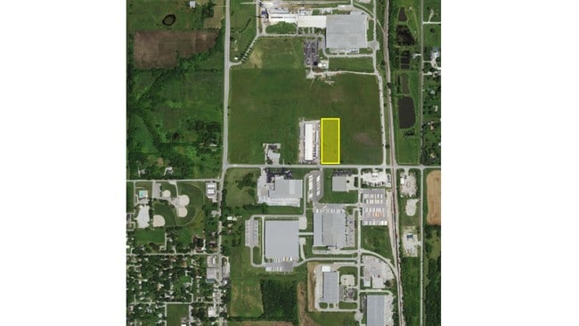

Property Detail
Ns # Ns
Kansas City, MO-KS
11-15-23 BG 442.8 W SE CR SE1/4 W 2216.18 TO E RTWY/L HWY 169 N ALG RTWY/L 2645.61 E 2169.09 TO W RTWY/L RR SWLY & SELY ALG CUR LF 1159.3& 1481.1 S 30.06 TO POB EX 9.3779 AC & 4.41 AC EX 63.6436 ACS & EX 7.44 AC 45.6384 ACS M/L
EF231511-4001
JOHNSON
Farms
Kansas
M-1
2645
B and X Area of moderate flood hazard, usually the area between the limits of the 100-year and 500-year floods.
45.84 AC
2024
South Johnson County
2025
Kansas City
053801
NEARBY LISTINGS FOR SALE OR LEASE
DEMOGRAPHICS near Ns # Ns
1 mile
3 mile
5 mile
2025 Total Population
3,186
11,231
15,764
2030 Population
3,358
11,887
16,643
Pop Growth 2025-2030
+ 5.40%
+ 5.84%
+ 5.58%
Average Age
38
38
39
2025 Total Households
1,149
3,948
5,538
HH Growth 2025-2030
+ 5.57%
+ 6.03%
+ 5.72%
Median Household Inc
$109,728
$107,408
$109,372
Avg Household Size
2.70
2.80
2.80
2025 Avg HH Vehicles
2.00
2.00
2.00
Median Home Value
$341,666
$350,722
$375,622
Median Year Built
1998
2003
2002
Nearby Places
Map Layers
Map Styles
 Street
 Aerial
Layers
 Traffic
 Biking
Places
Listings with unknown addresses are not visible on the map
- Restaurants
- Banks
- Shops
- Fitness
- Groceries
SALE & LEASE HISTORY
LISTING DATE
SALE/LEASE

Dec 29, 2017
For Sale
Nearby Properties
Address
Land Use
TOTAL SIZE
Lot Size
Zoning
Address
Land Use
TOTAL SIZE
Lot Size
Zoning
327,169 SF
141.81 AC
R-R
Address
Land Use
TOTAL SIZE
Lot Size
Zoning
102,280 SF
30.53 AC
RP-4
Address
Land Use
TOTAL SIZE
Lot Size
Zoning
70,643 SF
18.45 AC
RP-1
Address
Land Use
TOTAL SIZE
Lot Size
Zoning
71,221 SF
14.16 AC
Address
Land Use
TOTAL SIZE
Lot Size
Zoning
4,608 SF
45.43 AC
Address
Land Use
TOTAL SIZE
Lot Size
Zoning
97,479 SF
18.50 AC
R-1
Address
Land Use
TOTAL SIZE
Lot Size
Zoning
62,610 SF
35.28 AC
R-1
Address
Land Use
TOTAL SIZE
Lot Size
Zoning
483,903 SF
63.47 AC
M-1
Address
Land Use
TOTAL SIZE
Lot Size
Zoning
41,250 SF
6.01 AC
R-R
Address
Land Use
TOTAL SIZE
Lot Size
Zoning
109,026 SF
11.21 AC
M-1
Address
Land Use
TOTAL SIZE
Lot Size
Zoning
72,000 SF
13.82 AC
R-R
Address
Land Use
TOTAL SIZE
Lot Size
Zoning
24,622 SF
4.72 AC
R-1
Address
Land Use
TOTAL SIZE
Lot Size
Zoning
15,436 SF
2.60 AC
M-1
Address
Land Use
TOTAL SIZE
Lot Size
Zoning
231,750 SF
22.02 AC
M-1
Address
Land Use
TOTAL SIZE
Lot Size
Zoning
39,800 SF
4.75 AC
M-1
Address
Land Use
TOTAL SIZE
Lot Size
Zoning
204,744 SF
13.37 AC
M-1
Address
Land Use
TOTAL SIZE
Lot Size
Zoning
4,112 SF
4.55 AC
Address
Land Use
TOTAL SIZE
Lot Size
Zoning
15,876 SF
6.49 AC
R-1
Address
Land Use
TOTAL SIZE
Lot Size
Zoning
15,210 SF
2.79 AC
C-2
Address
Land Use
TOTAL SIZE
Lot Size
Zoning
168,500 SF
11.19 AC
M-1
Address
Land Use
TOTAL SIZE
Lot Size
Zoning
20.32 AC
R-R
Address
Land Use
TOTAL SIZE
Lot Size
Zoning
168,730 SF
15.32 AC
M-1
Address
Land Use
TOTAL SIZE
Lot Size
Zoning
12,112 SF
2 AC
R-1
Address
Land Use
TOTAL SIZE
Lot Size
Zoning
46,175 SF
6.24 AC
C-2
Address
Land Use
TOTAL SIZE
Lot Size
Zoning
50,525 SF
7.37 AC
Address
Land Use
TOTAL SIZE
Lot Size
Zoning
8,744 SF
1.07 AC
R-1
Address
Land Use
TOTAL SIZE
Lot Size
Zoning
47,685 SF
6.15 AC
Address
Land Use
TOTAL SIZE
Lot Size
Zoning
779 SF
5.60 AC
Address
Land Use
TOTAL SIZE
Lot Size
Zoning
12,048 SF
14 AC
M-1
Address
Land Use
TOTAL SIZE
Lot Size
Zoning
7,151 SF
0.65 AC
R-4
The World's #1 Commercial Real Estate Marketplace
Connect with us
© 2026 CoStar Group
The information above has been obtained from sources believed reliable. While we do not doubt its accuracy we have not verified it and make no guarantee, warranty or representation about it. It is your responsibility to independently confirm its accuracy and completeness. Any projections, opinions, assumptions, or estimates used are for example only and do not represent the current or future performance of the property. The value of this transaction to you depends on tax and other factors which should be evaluated by your tax, financial, and legal advisors. You and your advisors should conduct a careful, independent investigation of the property to determine to your satisfaction the suitability of the property for your needs.