Property Record
Ns Nt, Shawnee, KS 66217

Property Detail
Ns Nt
QF241218-2001
18-12-24 NW1/4 SW1/4 & SW1/4 SW1/4 LYG N OF C/L KANSAS HWY NO. 10 EX 7.9649 AC 42.174 ACS M/L SHC 602
Farms
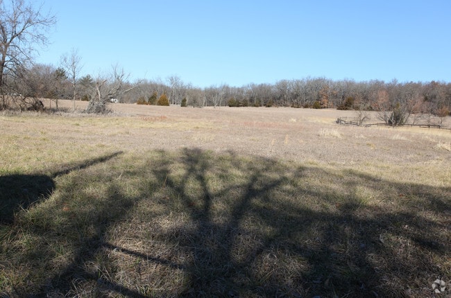
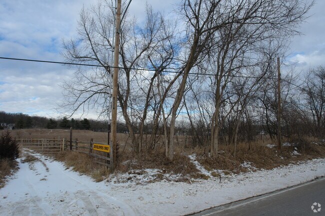
JOHNSON
AG
Kansas
B and X Area of moderate flood hazard, usually the area between the limits of the 100-year and 500-year floods.
41.20 AC
2024
Northwest Johnson County
2025
Kansas City
052308
Kansas City, MO-KS
NEARBY LISTINGS FOR SALE OR LEASE
DEMOGRAPHICS near Ns Nt
1 mile
3 mile
5 mile
2025 Total Population
1,930
40,439
125,827
2030 Population
1,975
41,589
129,881
Pop Growth 2025-2030
+ 2.33%
+ 2.84%
+ 3.22%
Average Age
44
40
40
2025 Total Households
865
15,980
50,074
HH Growth 2025-2030
+ 2.31%
+ 2.94%
+ 3.35%
Median Household Inc
$98,332
$115,897
$101,921
Avg Household Size
2.20
2.50
2.50
2025 Avg HH Vehicles
2.00
2.00
2.00
Median Home Value
$413,393
$413,301
$371,219
Median Year Built
1989
1994
1990
Nearby Places
Map Layers
Map Styles
 Street
 Aerial
Layers
 Traffic
 Biking
Places
Listings with unknown addresses are not visible on the map
- Restaurants
- Banks
- Shops
- Fitness
- Groceries
Nearby Properties
Address
Land Use
TOTAL SIZE
Lot Size
Zoning
Address
Land Use
TOTAL SIZE
Lot Size
Zoning
202,945 SF
30.29 AC
AG
Address
Land Use
TOTAL SIZE
Lot Size
Zoning
133,932 SF
3.29 AC
CC
Address
Land Use
TOTAL SIZE
Lot Size
Zoning
304,926 SF
7.87 AC
CC
Address
Land Use
TOTAL SIZE
Lot Size
Zoning
83,537 SF
27.65 AC
AG
Address
Land Use
TOTAL SIZE
Lot Size
Zoning
69,872 SF
1.91 AC
CC
Address
Land Use
TOTAL SIZE
Lot Size
Zoning
120,492 SF
10 AC
R1
Address
Land Use
TOTAL SIZE
Lot Size
Zoning
12,097 SF
56.85 AC
PI
Address
Land Use
TOTAL SIZE
Lot Size
Zoning
141,340 SF
19.92 AC
R1
Address
Land Use
TOTAL SIZE
Lot Size
Zoning
108,062 SF
14.76 AC
AG
Address
Land Use
TOTAL SIZE
Lot Size
Zoning
75,010 SF
24.78 AC
RP2
Address
Land Use
TOTAL SIZE
Lot Size
Zoning
32,186 SF
2.80 AC
CH
Address
Land Use
TOTAL SIZE
Lot Size
Zoning
49,282 SF
11.89 AC
RP1
Address
Land Use
TOTAL SIZE
Lot Size
Zoning
67,008 SF
26.85 AC
AG
Address
Land Use
TOTAL SIZE
Lot Size
Zoning
100,591 SF
33.88 AC
AG
Address
Land Use
TOTAL SIZE
Lot Size
Zoning
36,903 SF
0.55 AC
CC
Address
Land Use
TOTAL SIZE
Lot Size
Zoning
5,940 SF
77.81 AC
PI
Address
Land Use
TOTAL SIZE
Lot Size
Zoning
75,626 SF
17.48 AC
AG
Address
Land Use
TOTAL SIZE
Lot Size
Zoning
56,347 SF
0.76 AC
CC
Address
Land Use
TOTAL SIZE
Lot Size
Zoning
79,697 SF
11.36 AC
PSF
Address
Land Use
TOTAL SIZE
Lot Size
Zoning
35,848 SF
74.74 AC
R1
Address
Land Use
TOTAL SIZE
Lot Size
Zoning
186,546 SF
20.42 AC
CP2
Address
Land Use
TOTAL SIZE
Lot Size
Zoning
69,923 SF
11.99 AC
AG
Address
Land Use
TOTAL SIZE
Lot Size
Zoning
83,186 SF
28.33 AC
RP-4
Address
Land Use
TOTAL SIZE
Lot Size
Zoning
34,641 SF
14.33 AC
AG
Address
Land Use
TOTAL SIZE
Lot Size
Zoning
42,603 SF
17.67 AC
AG
Address
Land Use
TOTAL SIZE
Lot Size
Zoning
77,375 SF
9.22 AC
R-1
Address
Land Use
TOTAL SIZE
Lot Size
Zoning
203,515 SF
13.10 AC
CC
Address
Land Use
TOTAL SIZE
Lot Size
Zoning
29,365 SF
20.45 AC
RP4
Address
Land Use
TOTAL SIZE
Lot Size
Zoning
30,025 SF
148.34 AC
AG
Address
Land Use
TOTAL SIZE
Lot Size
Zoning
52,710 SF
29.55 AC
AG
The World's #1 Commercial Real Estate Marketplace
Connect with us
© 2026 CoStar Group
The information above has been obtained from sources believed reliable. While we do not doubt its accuracy we have not verified it and make no guarantee, warranty or representation about it. It is your responsibility to independently confirm its accuracy and completeness. Any projections, opinions, assumptions, or estimates used are for example only and do not represent the current or future performance of the property. The value of this transaction to you depends on tax and other factors which should be evaluated by your tax, financial, and legal advisors. You and your advisors should conduct a careful, independent investigation of the property to determine to your satisfaction the suitability of the property for your needs.