Property Record
Nw 15Th Ter, Cape Coral, FL 33993

NEARBY LISTINGS FOR SALE OR LEASE
Property Detail
Nw 15Th Ter
Cape Coral-Fort Myers, FL
Cape Coral
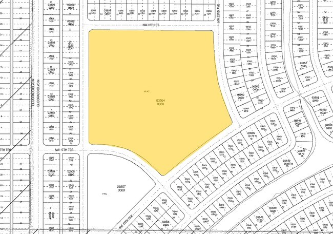
33-43-23-C4-03904.0000
CAPE CORAL UNIT 53 BLK.3904 PB 19 PG 66 + 70 BLOCK 3904
Publicschool
Lee
AE
Florida
12071C0242G
20.46 AC
2024
Cape Coral
2025
Southwest Florida
010111
DEMOGRAPHICS near Nw 15Th Ter
1 Mile
3 Mile
5 Mile
2024 Total Population
5,495
37,963
85,838
2029 Population
6,610
46,000
102,952
Pop Growth 2024-2029
+ 20.29%
+ 21.17%
+ 19.94%
Average Age
38
39
40
2024 Total Households
1,847
12,675
29,797
HH Growth 2024-2029
+ 19.87%
+ 20.80%
+ 19.46%
Median Household Inc
$67,976
$72,154
$71,531
Avg Household Size
2.90
2.90
2.80
2024 Avg HH Vehicles
2.00
2.00
2.00
Median Home Value
$265,080
$272,454
$269,137
Median Year Built
2006
2007
2005
Nearby Places
Map Layers
Map Styles
 Street
 Aerial
- Restaurants
- Banks
- Shops
- Fitness
- Groceries
PUBLIC TRANSPORTATION
AIRPORT
Punta Gorda
DRIVE
WALK
Distance
Punta Gorda
31 min
19.2 mi
Southwest Florida International
DRIVE
WALK
Distance
Southwest Florida International
45 min
26.1 mi
Nearby Properties
Address
Land Use
TOTAL SIZE
Lot Size
Zoning
Address
Land Use
TOTAL SIZE
Lot Size
Zoning
507,243 SF
115.38 AC
A
Address
Land Use
TOTAL SIZE
Lot Size
Zoning
25.99 AC
RML
Address
Land Use
TOTAL SIZE
Lot Size
Zoning
670.48 AC
AG-2
Address
Land Use
TOTAL SIZE
Lot Size
Zoning
27.77 AC
RML
Address
Land Use
TOTAL SIZE
Lot Size
Zoning
71,898 SF
98.60 AC
C1-D
Address
Land Use
TOTAL SIZE
Lot Size
Zoning
64,461 SF
27.05 AC
RD-D
Address
Land Use
TOTAL SIZE
Lot Size
Zoning
255.79 AC
AG-2
Address
Land Use
TOTAL SIZE
Lot Size
Zoning
228.33 AC
R1A
Address
Land Use
TOTAL SIZE
Lot Size
Zoning
78,740 SF
4.51 AC
C-1
Address
Land Use
TOTAL SIZE
Lot Size
Zoning
48,402 SF
6.20 AC
Address
Land Use
TOTAL SIZE
Lot Size
Zoning
16.86 AC
RD
Address
Land Use
TOTAL SIZE
Lot Size
Zoning
142.97 AC
AG-2
Address
Land Use
TOTAL SIZE
Lot Size
Zoning
113.70 AC
AG-2
Address
Land Use
TOTAL SIZE
Lot Size
Zoning
30,610 SF
9.19 AC
RD-D
Address
Land Use
TOTAL SIZE
Lot Size
Zoning
8,068 SF
1.10 AC
C-1
Address
Land Use
TOTAL SIZE
Lot Size
Zoning
6.73 AC
C-1
Address
Land Use
TOTAL SIZE
Lot Size
Zoning
3.34 AC
NC
Address
Land Use
TOTAL SIZE
Lot Size
Zoning
83.89 AC
RD
Address
Land Use
TOTAL SIZE
Lot Size
Zoning
6,187 SF
1.13 AC
C1
Address
Land Use
TOTAL SIZE
Lot Size
Zoning
8,898 SF
2.95 AC
NC
Address
Land Use
TOTAL SIZE
Lot Size
Zoning
23,747 SF
178.18 AC
Address
Land Use
TOTAL SIZE
Lot Size
Zoning
157.25 AC
AG-2
Address
Land Use
TOTAL SIZE
Lot Size
Zoning
9,274 SF
1.20 AC
C1
Address
Land Use
TOTAL SIZE
Lot Size
Zoning
114.94 AC
NC
Address
Land Use
TOTAL SIZE
Lot Size
Zoning
15.57 AC
NC
Address
Land Use
TOTAL SIZE
Lot Size
Zoning
20.30 AC
RD-D
Address
Land Use
TOTAL SIZE
Lot Size
Zoning
19.05 AC
R1
Address
Land Use
TOTAL SIZE
Lot Size
Zoning
20.24 AC
AG-2
Address
Land Use
TOTAL SIZE
Lot Size
Zoning
20 AC
RD
Address
Land Use
TOTAL SIZE
Lot Size
Zoning
24 AC
INST
The World's #1 Commercial Real Estate Marketplace
Connect with us
© 2026 CoStar Group
The information above has been obtained from sources believed reliable. While we do not doubt its accuracy we have not verified it and make no guarantee, warranty or representation about it. It is your responsibility to independently confirm its accuracy and completeness. Any projections, opinions, assumptions, or estimates used are for example only and do not represent the current or future performance of the property. The value of this transaction to you depends on tax and other factors which should be evaluated by your tax, financial, and legal advisors. You and your advisors should conduct a careful, independent investigation of the property to determine to your satisfaction the suitability of the property for your needs.