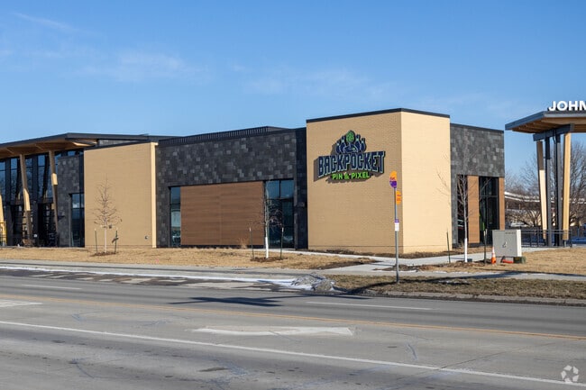
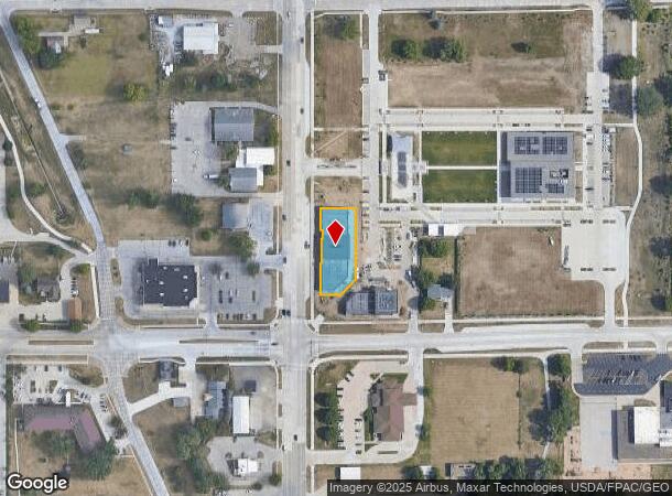
Property Record
6205 Merle Hay Rd, Johnston, IA 50131
Current Lease Availabilities
NEARBY LISTINGS FOR SALE OR LEASE
Property Detail
6205 Merle Hay Rd
Des Moines
Johnston Town Center
Des Moines-West Des Moines, IA
LOT 6 -EX PARCEL 2021-164 BK 18812 PG 506- & PARCELS 2021-163 & 2021-165 BK 18812 PG 506 OUTLOT Z JOHNSTON TOWN CENTER
241/00747-875-018
Polk
Regionalshoppingcenterormallwithanchorstore
Iowa
0
6
2025
0.47 AC
011406
Western Suburbs
13,329 SF
DEMOGRAPHICS near 6205 Merle Hay Rd
1 Mile
3 Mile
5 Mile
2024 Total Population
8,226
38,262
135,232
2029 Population
8,672
39,484
140,429
Pop Growth 2024-2029
+ 5.42%
+ 3.19%
+ 3.84%
Average Age
39
39
38
2024 Total Households
3,593
14,988
53,896
HH Growth 2024-2029
+ 5.73%
+ 3.45%
+ 4.00%
Median Household Inc
$75,340
$87,073
$82,059
Avg Household Size
2.20
2.50
2.40
2024 Avg HH Vehicles
2.00
2.00
2.00
Median Home Value
$266,147
$258,282
$240,582
Median Year Built
1999
1990
1981
Nearby Places
- Restaurants
- Banks
- Shops
- Fitness
- Groceries
PUBLIC TRANSPORTATION
AIRPORT
Des Moines International
DRIVE
WALK
Distance
Des Moines International
24 min
12.0 mi
Freight Ports
Port Milwaukee
DRIVE
WALK
Distance
Port Milwaukee
417 min
375.6 mi
Nearby Properties
Address
Land Use
TOTAL SIZE
Lot Size
Zoning
Address
Land Use
TOTAL SIZE
Lot Size
Zoning
486,792 SF
38.70 AC
PC
Address
Land Use
TOTAL SIZE
Lot Size
Zoning
627,104 SF
40.09 AC
Address
Land Use
TOTAL SIZE
Lot Size
Zoning
197,658 SF
15.91 AC
Address
Land Use
TOTAL SIZE
Lot Size
Zoning
184,658 SF
14.61 AC
Address
Land Use
TOTAL SIZE
Lot Size
Zoning
133,256 SF
15.93 AC
Address
Land Use
TOTAL SIZE
Lot Size
Zoning
166,160 SF
11.88 AC
Address
Land Use
TOTAL SIZE
Lot Size
Zoning
287,228 SF
27.32 AC
A-R
Address
Land Use
TOTAL SIZE
Lot Size
Zoning
307,734 SF
23.59 AC
R-3
Address
Land Use
TOTAL SIZE
Lot Size
Zoning
71,938 SF
8.23 AC
C-O
Address
Land Use
TOTAL SIZE
Lot Size
Zoning
101,592 SF
7.79 AC
PUD
Address
Land Use
TOTAL SIZE
Lot Size
Zoning
386,236 SF
9.62 AC
C-4
Address
Land Use
TOTAL SIZE
Lot Size
Zoning
141,377 SF
3.16 AC
Address
Land Use
TOTAL SIZE
Lot Size
Zoning
363,736 SF
25.79 AC
M-1
Address
Land Use
TOTAL SIZE
Lot Size
Zoning
188,453 SF
14.20 AC
R-3
Address
Land Use
TOTAL SIZE
Lot Size
Zoning
146,025 SF
9.59 AC
PUD
Address
Land Use
TOTAL SIZE
Lot Size
Zoning
91,985 SF
13.11 AC
PUD
Address
Land Use
TOTAL SIZE
Lot Size
Zoning
223,876 SF
15.01 AC
Address
Land Use
TOTAL SIZE
Lot Size
Zoning
143,831 SF
16.12 AC
PUD
Address
Land Use
TOTAL SIZE
Lot Size
Zoning
95,039 SF
4.52 AC
PUD
Address
Land Use
TOTAL SIZE
Lot Size
Zoning
115,000 SF
3.69 AC
Address
Land Use
TOTAL SIZE
Lot Size
Zoning
56,478 SF
5.86 AC
Address
Land Use
TOTAL SIZE
Lot Size
Zoning
158,256 SF
8.87 AC
R-3
Address
Land Use
TOTAL SIZE
Lot Size
Zoning
130,686 SF
1.23 AC
Address
Land Use
TOTAL SIZE
Lot Size
Zoning
130,136 SF
6.77 AC
PARKVIEW P
Address
Land Use
TOTAL SIZE
Lot Size
Zoning
203,062 SF
17.82 AC
C-2
Address
Land Use
TOTAL SIZE
Lot Size
Zoning
92,392 SF
12.40 AC
C-2
Address
Land Use
TOTAL SIZE
Lot Size
Zoning
59,590 SF
6.05 AC
Address
Land Use
TOTAL SIZE
Lot Size
Zoning
140,163 SF
5.87 AC
PUD
Address
Land Use
TOTAL SIZE
Lot Size
Zoning
50,564 SF
13.14 AC
R-1 (60)
Address
Land Use
TOTAL SIZE
Lot Size
Zoning
114,048 SF
8.64 AC
PUD
The World's #1 Commercial Real Estate Marketplace
Connect with us
© 2025 CoStar Group
The information above has been obtained from sources believed reliable. While we do not doubt its accuracy we have not verified it and make no guarantee, warranty or representation about it. It is your responsibility to independently confirm its accuracy and completeness. Any projections, opinions, assumptions, or estimates used are for example only and do not represent the current or future performance of the property. The value of this transaction to you depends on tax and other factors which should be evaluated by your tax, financial, and legal advisors. You and your advisors should conduct a careful, independent investigation of the property to determine to your satisfaction the suitability of the property for your needs.