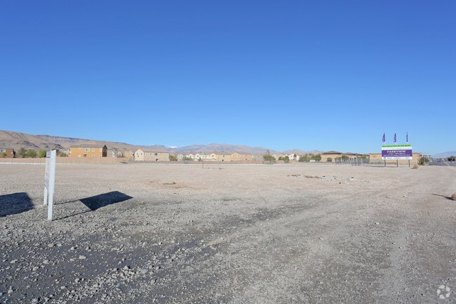
Property Record
8880 W Sunset Rd, Las Vegas, NV 89148


NEARBY LISTINGS FOR SALE OR LEASE
-
-
-
Patrick Lane and Santa Margarita Street @ Rainbow and Patrick
Las Vegas, NV 89118
$2,570,911
2.27 AC Lots
Land
-
-
-
-
-
View all Las Vegas listings for sale on LoopNet.com
Property Detail
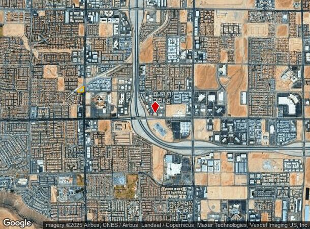
8880 W Sunset Rd
Las Vegas-Henderson-North Las Vegas, NV
Judgment And Final Order Of Condemnation
163-31-702-017
PT NE4 SE4 SEC 31 21 60
Commercialnec
Clark
X
Nevada
32003C2535F
1.09 AC
2025
Southwest Las Vegas
2025
Las Vegas
005870
DEMOGRAPHICS near 8880 W Sunset Rd
1 Mile
3 Mile
5 Mile
2024 Total Population
27,016
127,108
331,072
2029 Population
29,220
137,789
357,865
Pop Growth 2024-2029
+ 8.16%
+ 8.40%
+ 8.09%
Average Age
37
39
39
2024 Total Households
10,544
50,133
126,874
HH Growth 2024-2029
+ 8.20%
+ 8.38%
+ 7.99%
Median Household Inc
$84,731
$78,288
$73,681
Avg Household Size
2.60
2.50
2.60
2024 Avg HH Vehicles
2.00
2.00
2.00
Median Home Value
$392,520
$417,404
$410,620
Median Year Built
2008
2006
2002
Nearby Places
Map Layers
Map Styles
 Street
 Aerial
- Restaurants
- Banks
- Shops
- Fitness
- Groceries
PUBLIC TRANSPORTATION
AIRPORT
Harry Reid International
DRIVE
WALK
Distance
Harry Reid International
16 min
10.5 mi
Boulder City Municipal
DRIVE
WALK
Distance
Boulder City Municipal
41 min
30.1 mi
SALE & LEASE HISTORY
LISTING DATE
SALE/LEASE

Jan 20, 2017
For Sale
Nearby Properties
Address
Land Use
TOTAL SIZE
Lot Size
Zoning
Address
Land Use
TOTAL SIZE
Lot Size
Zoning
552,417 SF
49.39 AC
H1
Address
Land Use
TOTAL SIZE
Lot Size
Zoning
412,086 SF
33.58 AC
CP
Address
Land Use
TOTAL SIZE
Lot Size
Zoning
190,129 SF
36.24 AC
C1
Address
Land Use
TOTAL SIZE
Lot Size
Zoning
29.59 AC
CP
Address
Land Use
TOTAL SIZE
Lot Size
Zoning
174,108 SF
52.16 AC
RU
Address
Land Use
TOTAL SIZE
Lot Size
Zoning
760,651 SF
41.25 AC
Address
Land Use
TOTAL SIZE
Lot Size
Zoning
9,279 SF
24.36 AC
Address
Land Use
TOTAL SIZE
Lot Size
Zoning
349,295 SF
25.97 AC
Address
Land Use
TOTAL SIZE
Lot Size
Zoning
Address
Land Use
TOTAL SIZE
Lot Size
Zoning
7,736 SF
16.26 AC
RE
Address
Land Use
TOTAL SIZE
Lot Size
Zoning
8,754 SF
17.14 AC
C2
Address
Land Use
TOTAL SIZE
Lot Size
Zoning
504,632 SF
6.25 AC
Address
Land Use
TOTAL SIZE
Lot Size
Zoning
6,142 SF
13.96 AC
C2
Address
Land Use
TOTAL SIZE
Lot Size
Zoning
151,243 SF
22.93 AC
Address
Land Use
TOTAL SIZE
Lot Size
Zoning
401,023 SF
17.61 AC
R-3
Address
Land Use
TOTAL SIZE
Lot Size
Zoning
35.55 AC
PF
Address
Land Use
TOTAL SIZE
Lot Size
Zoning
18.62 AC
PF
Address
Land Use
TOTAL SIZE
Lot Size
Zoning
374,101 SF
31.11 AC
Address
Land Use
TOTAL SIZE
Lot Size
Zoning
396,742 SF
17.10 AC
Address
Land Use
TOTAL SIZE
Lot Size
Zoning
1,961 SF
4.34 AC
Address
Land Use
TOTAL SIZE
Lot Size
Zoning
9.34 AC
Address
Land Use
TOTAL SIZE
Lot Size
Zoning
5,374 SF
12.36 AC
Address
Land Use
TOTAL SIZE
Lot Size
Zoning
220,718 SF
3.99 AC
C2
Address
Land Use
TOTAL SIZE
Lot Size
Zoning
43,264 SF
3.56 AC
Address
Land Use
TOTAL SIZE
Lot Size
Zoning
322,127 SF
9.32 AC
Address
Land Use
TOTAL SIZE
Lot Size
Zoning
7,302 SF
9.21 AC
Address
Land Use
TOTAL SIZE
Lot Size
Zoning
478,844 SF
35.21 AC
MD
Address
Land Use
TOTAL SIZE
Lot Size
Zoning
4,382 SF
13.65 AC
C2
Address
Land Use
TOTAL SIZE
Lot Size
Zoning
370,870 SF
28.56 AC
MD
Address
Land Use
TOTAL SIZE
Lot Size
Zoning
107.39 AC
RE
The World's #1 Commercial Real Estate Marketplace
Connect with us
© 2026 CoStar Group
The information above has been obtained from sources believed reliable. While we do not doubt its accuracy we have not verified it and make no guarantee, warranty or representation about it. It is your responsibility to independently confirm its accuracy and completeness. Any projections, opinions, assumptions, or estimates used are for example only and do not represent the current or future performance of the property. The value of this transaction to you depends on tax and other factors which should be evaluated by your tax, financial, and legal advisors. You and your advisors should conduct a careful, independent investigation of the property to determine to your satisfaction the suitability of the property for your needs.