Property Record
Nw Highway 231, Laceys Spring, AL 35754

NEARBY LISTINGS FOR SALE OR LEASE
-
-
View all Laceys Spring listings for sale on LoopNet.com
Property Detail
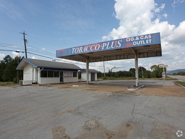
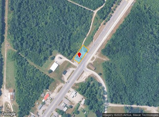
Nw Highway 231
06-07-36-0-000-007.001
COM AT NE COR OF SEC 36, T5S, R1W TH SO 675', TH SW 354', TH NW 20' TO TPOB TH SW 235', TH NW 85' 65'S, TH NE 265', TH SE 85'
Autorepair
Morgan
X
Alabama
01089C0455G
0.32 AC
2025
Alabama North Area
2024
Other Market Areas
005704
Decatur, AL
448 SF
DEMOGRAPHICS near Nw Highway 231
1 Mile
3 Mile
5 Mile
2024 Total Population
417
7,446
24,953
2029 Population
422
8,020
27,176
Pop Growth 2024-2029
+ 1.20%
+ 7.71%
+ 8.91%
Average Age
41
41
42
2024 Total Households
167
2,930
10,224
HH Growth 2024-2029
+ 1.20%
+ 7.92%
+ 9.26%
Median Household Inc
$61,667
$84,716
$89,910
Avg Household Size
2.50
2.50
2.40
2024 Avg HH Vehicles
3.00
2.00
2.00
Median Home Value
$215,000
$262,533
$246,534
Median Year Built
1989
1997
1988
Nearby Places
Map Layers
Map Styles
 Street
 Aerial
- Restaurants
- Banks
- Shops
- Fitness
- Groceries
PUBLIC TRANSPORTATION
AIRPORT
Huntsville International-Carl T Jones Field
DRIVE
WALK
Distance
Huntsville International-Carl T Jones Field
38 min
25.4 mi
Nearby Properties
Address
Land Use
TOTAL SIZE
Lot Size
Zoning
Address
Land Use
TOTAL SIZE
Lot Size
Zoning
83,720 SF
109 AC
Address
Land Use
TOTAL SIZE
Lot Size
Zoning
84,320 SF
7.73 AC
Address
Land Use
TOTAL SIZE
Lot Size
Zoning
8,190 SF
18.58 AC
Address
Land Use
TOTAL SIZE
Lot Size
Zoning
24,800 SF
4.90 AC
Address
Land Use
TOTAL SIZE
Lot Size
Zoning
4,210 SF
71.20 AC
Address
Land Use
TOTAL SIZE
Lot Size
Zoning
Address
Land Use
TOTAL SIZE
Lot Size
Zoning
Address
Land Use
TOTAL SIZE
Lot Size
Zoning
2,480 SF
14.70 AC
Address
Land Use
TOTAL SIZE
Lot Size
Zoning
7,500 SF
7.50 AC
Address
Land Use
TOTAL SIZE
Lot Size
Zoning
19.28 AC
Address
Land Use
TOTAL SIZE
Lot Size
Zoning
Address
Land Use
TOTAL SIZE
Lot Size
Zoning
54,909 SF
10.40 AC
Address
Land Use
TOTAL SIZE
Lot Size
Zoning
7,250 SF
11 AC
Address
Land Use
TOTAL SIZE
Lot Size
Zoning
8,500 SF
9.50 AC
Address
Land Use
TOTAL SIZE
Lot Size
Zoning
9,000 SF
2.40 AC
Address
Land Use
TOTAL SIZE
Lot Size
Zoning
23,501 SF
2.80 AC
Address
Land Use
TOTAL SIZE
Lot Size
Zoning
1,120 SF
160 AC
Address
Land Use
TOTAL SIZE
Lot Size
Zoning
25,000 SF
1.90 AC
Address
Land Use
TOTAL SIZE
Lot Size
Zoning
22,400 SF
37 AC
Address
Land Use
TOTAL SIZE
Lot Size
Zoning
3,616 SF
1.04 AC
Address
Land Use
TOTAL SIZE
Lot Size
Zoning
9,228 SF
1.25 AC
Address
Land Use
TOTAL SIZE
Lot Size
Zoning
3,484 SF
39.63 AC
Address
Land Use
TOTAL SIZE
Lot Size
Zoning
12,020 SF
1.03 AC
Address
Land Use
TOTAL SIZE
Lot Size
Zoning
11,209 SF
2 AC
Address
Land Use
TOTAL SIZE
Lot Size
Zoning
4.60 AC
Address
Land Use
TOTAL SIZE
Lot Size
Zoning
9.10 AC
Address
Land Use
TOTAL SIZE
Lot Size
Zoning
5,774 SF
0.86 AC
Address
Land Use
TOTAL SIZE
Lot Size
Zoning
6,174 SF
0.86 AC
Address
Land Use
TOTAL SIZE
Lot Size
Zoning
5,000 SF
16 AC
Address
Land Use
TOTAL SIZE
Lot Size
Zoning
2,027 SF
0.99 AC
The World's #1 Commercial Real Estate Marketplace
Connect with us
© 2025 CoStar Group
The information above has been obtained from sources believed reliable. While we do not doubt its accuracy we have not verified it and make no guarantee, warranty or representation about it. It is your responsibility to independently confirm its accuracy and completeness. Any projections, opinions, assumptions, or estimates used are for example only and do not represent the current or future performance of the property. The value of this transaction to you depends on tax and other factors which should be evaluated by your tax, financial, and legal advisors. You and your advisors should conduct a careful, independent investigation of the property to determine to your satisfaction the suitability of the property for your needs.