Property Record
Nw State Ave, Chehalis, WA 98532
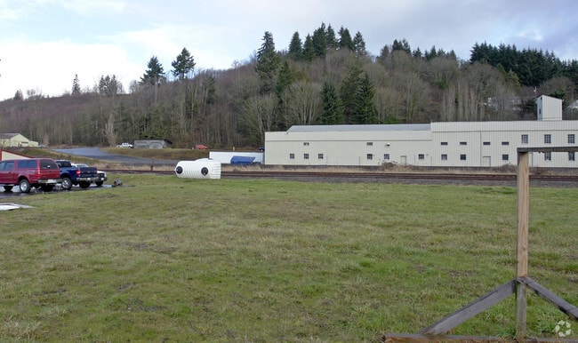

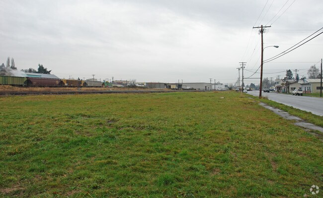
Property Detail
Nw State Ave
Centralia, WA
SECTION 30 TOWNSHIP 14N RANGE 02W PT NE4 SE4 BEING LOT B OF BOUNDARY LINE ADJUSTMENT AFN 3186779
004272-001-002
LEWIS
Residentialacreage
Washington
ILCG
b
2024
0.59 AC
2024
Washington State Area
971000
Other Market Areas
NEARBY LISTINGS FOR SALE OR LEASE
DEMOGRAPHICS near Nw State Ave
1 mile
3 mile
5 mile
2025 Total Population
3,667
15,159
36,685
2030 Population
3,785
15,727
38,022
Pop Growth 2025-2030
+ 3.22%
+ 3.75%
+ 3.64%
Average Age
39
39
40
2025 Total Households
1,499
5,781
14,033
HH Growth 2025-2030
+ 3.14%
+ 3.72%
+ 3.61%
Median Household Inc
$69,658
$74,613
$69,249
Avg Household Size
2.40
2.50
2.50
2025 Avg HH Vehicles
2.00
2.00
2.00
Median Home Value
$387,165
$383,430
$375,298
Median Year Built
1957
1974
1976
Nearby Places
Map Layers
Map Styles
 Street
 Aerial
Layers
 Traffic
 Biking
Places
Listings with unknown addresses are not visible on the map
- Restaurants
- Banks
- Shops
- Fitness
- Groceries
PUBLIC TRANSPORTATION
COMMUTER RAIL
Drive
Walk
Distance
9 min
4.1 mi
Freight Ports
Port of Long View, WA
Drive
Walk
Distance
Port of Long View, WA
56 min
43.0 mi
Nearby Properties
Address
Land Use
TOTAL SIZE
Lot Size
Zoning
Address
Land Use
TOTAL SIZE
Lot Size
Zoning
83,945 SF
3.12 AC
ILCG
Address
Land Use
TOTAL SIZE
Lot Size
Zoning
215,594 SF
42.22 AC
RUGA
Address
Land Use
TOTAL SIZE
Lot Size
Zoning
15,000 SF
66.30 AC
EPFI
Address
Land Use
TOTAL SIZE
Lot Size
Zoning
62,057 SF
2.08 AC
EPFG
Address
Land Use
TOTAL SIZE
Lot Size
Zoning
1,714 SF
220.30 AC
EPFA
Address
Land Use
TOTAL SIZE
Lot Size
Zoning
222,077 SF
Address
Land Use
TOTAL SIZE
Lot Size
Zoning
3,012 SF
11.23 AC
R4
Address
Land Use
TOTAL SIZE
Lot Size
Zoning
82,667 SF
Address
Land Use
TOTAL SIZE
Lot Size
Zoning
7,168 SF
3.95 AC
OSPF
Address
Land Use
TOTAL SIZE
Lot Size
Zoning
43,477 SF
8.64 AC
CG
Address
Land Use
TOTAL SIZE
Lot Size
Zoning
2.14 AC
C1
Address
Land Use
TOTAL SIZE
Lot Size
Zoning
53,794 SF
7.50 AC
EPFS
Address
Land Use
TOTAL SIZE
Lot Size
Zoning
3,742 SF
21.83 AC
EPFU
Address
Land Use
TOTAL SIZE
Lot Size
Zoning
34,150 SF
7.20 AC
CG
Address
Land Use
TOTAL SIZE
Lot Size
Zoning
2,741 SF
20.47 AC
EPFS
Address
Land Use
TOTAL SIZE
Lot Size
Zoning
4,361 SF
5.41 AC
R2
Address
Land Use
TOTAL SIZE
Lot Size
Zoning
94,044 SF
Address
Land Use
TOTAL SIZE
Lot Size
Zoning
2,750 SF
2 AC
CG
Address
Land Use
TOTAL SIZE
Lot Size
Zoning
13.11 AC
Address
Land Use
TOTAL SIZE
Lot Size
Zoning
83,043 SF
6.76 AC
CG
Address
Land Use
TOTAL SIZE
Lot Size
Zoning
30,308 SF
45.31 AC
OSPF
Address
Land Use
TOTAL SIZE
Lot Size
Zoning
31,418 SF
1.75 AC
CF
Address
Land Use
TOTAL SIZE
Lot Size
Zoning
4.32 AC
RUGA
Address
Land Use
TOTAL SIZE
Lot Size
Zoning
138,421 SF
12.16 AC
CG
Address
Land Use
TOTAL SIZE
Lot Size
Zoning
56,121 SF
4.05 AC
ILCG
Address
Land Use
TOTAL SIZE
Lot Size
Zoning
Address
Land Use
TOTAL SIZE
Lot Size
Zoning
22,974 SF
8.73 AC
CF
Address
Land Use
TOTAL SIZE
Lot Size
Zoning
304,473 SF
27.22 AC
CG
Address
Land Use
TOTAL SIZE
Lot Size
Zoning
1,056 SF
12.90 AC
EPFS
Address
Land Use
TOTAL SIZE
Lot Size
Zoning
23,490 SF
10.75 AC
RDD5
The World's #1 Commercial Real Estate Marketplace
Connect with us
© 2026 CoStar Group
The information above has been obtained from sources believed reliable. While we do not doubt its accuracy we have not verified it and make no guarantee, warranty or representation about it. It is your responsibility to independently confirm its accuracy and completeness. Any projections, opinions, assumptions, or estimates used are for example only and do not represent the current or future performance of the property. The value of this transaction to you depends on tax and other factors which should be evaluated by your tax, financial, and legal advisors. You and your advisors should conduct a careful, independent investigation of the property to determine to your satisfaction the suitability of the property for your needs.