Property Record
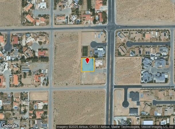
4335 N Fort Apache Rd, Las Vegas, NV 89129

NEARBY LISTINGS FOR SALE OR LEASE
Property Detail
4335 N Fort Apache Rd
Las Vegas-Henderson-Paradise, NV
Parcel Map File 67 Page 81
138-06-703-002
PARCEL MAP FILE 67 PAGE 81 LOT 1
Vacantlandnec
Clark
X
Nevada
32003C2135F
1
2025
0.46 AC
2025
Northwest Las Vegas
003240
Las Vegas
DEMOGRAPHICS near 4335 N Fort Apache Rd
1 Mile
3 Mile
5 Mile
2024 Total Population
8,908
97,716
309,886
2029 Population
9,599
104,926
333,570
Pop Growth 2024-2029
+ 7.76%
+ 7.38%
+ 7.64%
Average Age
41
45
41
2024 Total Households
2,974
39,111
119,439
HH Growth 2024-2029
+ 7.67%
+ 7.35%
+ 7.62%
Median Household Inc
$114,016
$83,678
$76,809
Avg Household Size
2.90
2.50
2.50
2024 Avg HH Vehicles
2.00
2.00
2.00
Median Home Value
$528,826
$413,087
$388,277
Median Year Built
1997
1996
1996
Nearby Places
Map Layers
Map Styles
 Street
 Aerial
- Restaurants
- Banks
- Shops
- Fitness
- Groceries
PUBLIC TRANSPORTATION
AIRPORT
Harry Reid International
DRIVE
WALK
Distance
Harry Reid International
31 min
19.0 mi
Freight Ports
Port of Long Beach
DRIVE
WALK
Distance
Port of Long Beach
332 min
294.5 mi
SALE & LEASE HISTORY
LISTING DATE
SALE/LEASE

Jun 21, 2017
For Sale
Nearby Properties
Address
Land Use
TOTAL SIZE
Lot Size
Zoning
Address
Land Use
TOTAL SIZE
Lot Size
Zoning
161.14 AC
CV
Address
Land Use
TOTAL SIZE
Lot Size
Zoning
25 AC
RE
Address
Land Use
TOTAL SIZE
Lot Size
Zoning
9,840 SF
19.89 AC
PD
Address
Land Use
TOTAL SIZE
Lot Size
Zoning
263,881 SF
7.49 AC
R-4
Address
Land Use
TOTAL SIZE
Lot Size
Zoning
380 AC
RU
Address
Land Use
TOTAL SIZE
Lot Size
Zoning
21.12 AC
RE
Address
Land Use
TOTAL SIZE
Lot Size
Zoning
43,952 SF
7.96 AC
Address
Land Use
TOTAL SIZE
Lot Size
Zoning
80.99 AC
RE
Address
Land Use
TOTAL SIZE
Lot Size
Zoning
178,800 SF
16.79 AC
TC
Address
Land Use
TOTAL SIZE
Lot Size
Zoning
132,309 SF
12.45 AC
L:T-C
Address
Land Use
TOTAL SIZE
Lot Size
Zoning
3,618 SF
10 AC
L:R-3
Address
Land Use
TOTAL SIZE
Lot Size
Zoning
3,620 SF
12.96 AC
PD
Address
Land Use
TOTAL SIZE
Lot Size
Zoning
7,103 SF
14.27 AC
L:R-3
Address
Land Use
TOTAL SIZE
Lot Size
Zoning
105,205 SF
18.86 AC
TC
Address
Land Use
TOTAL SIZE
Lot Size
Zoning
196,873 SF
5.25 AC
C2
Address
Land Use
TOTAL SIZE
Lot Size
Zoning
18.02 AC
PF
Address
Land Use
TOTAL SIZE
Lot Size
Zoning
117,088 SF
5.49 AC
Address
Land Use
TOTAL SIZE
Lot Size
Zoning
9,789 SF
2.10 AC
R3
Address
Land Use
TOTAL SIZE
Lot Size
Zoning
2,224 SF
8.66 AC
TC
Address
Land Use
TOTAL SIZE
Lot Size
Zoning
18.70 AC
PC
Address
Land Use
TOTAL SIZE
Lot Size
Zoning
14.99 AC
PF
Address
Land Use
TOTAL SIZE
Lot Size
Zoning
136,533 SF
13.34 AC
TC
Address
Land Use
TOTAL SIZE
Lot Size
Zoning
55,385 SF
4 AC
Address
Land Use
TOTAL SIZE
Lot Size
Zoning
115,701 SF
10.94 AC
C1
Address
Land Use
TOTAL SIZE
Lot Size
Zoning
4,207 SF
3.51 AC
TC
Address
Land Use
TOTAL SIZE
Lot Size
Zoning
28.97 AC
TC
Address
Land Use
TOTAL SIZE
Lot Size
Zoning
225,292 SF
17.40 AC
TC
Address
Land Use
TOTAL SIZE
Lot Size
Zoning
97,232 SF
7.86 AC
TC
Address
Land Use
TOTAL SIZE
Lot Size
Zoning
16.02 AC
RE
The World's #1 Commercial Real Estate Marketplace
Connect with us
© 2025 CoStar Group
The information above has been obtained from sources believed reliable. While we do not doubt its accuracy we have not verified it and make no guarantee, warranty or representation about it. It is your responsibility to independently confirm its accuracy and completeness. Any projections, opinions, assumptions, or estimates used are for example only and do not represent the current or future performance of the property. The value of this transaction to you depends on tax and other factors which should be evaluated by your tax, financial, and legal advisors. You and your advisors should conduct a careful, independent investigation of the property to determine to your satisfaction the suitability of the property for your needs.