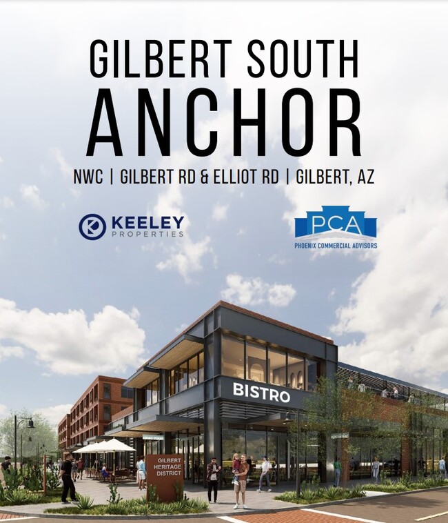
Property Record
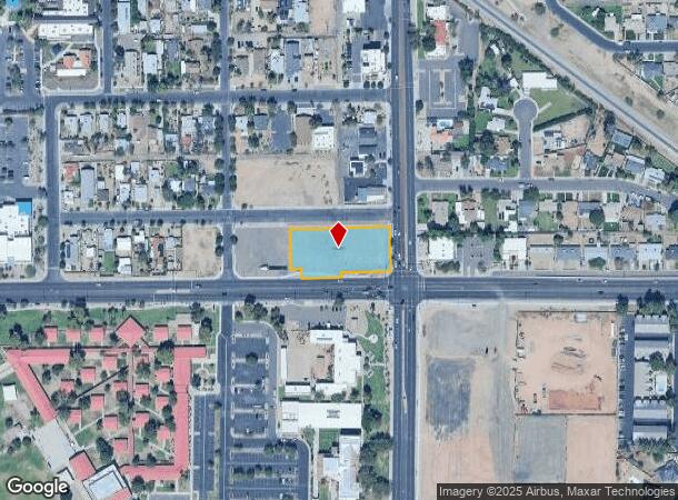
40 W Elliot Rd, Gilbert, AZ 85233

Current Lease Availabilities
NEARBY LISTINGS FOR SALE OR LEASE
Property Detail
40 W Elliot Rd
Phoenix-Mesa-Scottsdale, AZ
Lacy Tract Blk 9
302-18-055
LACY TRACT BLK 9 MCR 8-15
Municipalproperty
Maricopa
X
Arizona
04013C2731M
7
0
0.91 AC
2025
Gilbert
422309
Phoenix
17,012 SF
DEMOGRAPHICS near 40 W Elliot Rd
1 Mile
3 Mile
5 Mile
2024 Total Population
15,207
119,852
392,774
2029 Population
16,162
127,327
420,189
Pop Growth 2024-2029
+ 6.28%
+ 6.24%
+ 6.98%
Average Age
37
38
37
2024 Total Households
5,632
42,670
141,215
HH Growth 2024-2029
+ 6.23%
+ 6.18%
+ 7.14%
Median Household Inc
$88,895
$99,104
$81,365
Avg Household Size
2.60
2.80
2.70
2024 Avg HH Vehicles
2.00
2.00
2.00
Median Home Value
$421,645
$419,524
$376,492
Median Year Built
1991
1992
1990
Nearby Places
- Restaurants
- Banks
- Shops
- Fitness
- Groceries
PUBLIC TRANSPORTATION
AIRPORT
Phoenix-Mesa Gateway
DRIVE
WALK
Distance
Phoenix-Mesa Gateway
18 min
9.9 mi
Phoenix Sky Harbor International
DRIVE
WALK
Distance
Phoenix Sky Harbor International
28 min
18.8 mi
Freight Ports
Port of San Diego
DRIVE
WALK
Distance
Port of San Diego
410 min
371.7 mi
Nearby Properties
Address
Land Use
TOTAL SIZE
Lot Size
Zoning
Address
Land Use
TOTAL SIZE
Lot Size
Zoning
7.90 AC
Address
Land Use
TOTAL SIZE
Lot Size
Zoning
184,558 SF
6.18 AC
Address
Land Use
TOTAL SIZE
Lot Size
Zoning
127,962 SF
18.60 AC
I-1
Address
Land Use
TOTAL SIZE
Lot Size
Zoning
5.92 AC
I-1
Address
Land Use
TOTAL SIZE
Lot Size
Zoning
4.96 AC
Address
Land Use
TOTAL SIZE
Lot Size
Zoning
30,075 SF
6.86 AC
I-1
Address
Land Use
TOTAL SIZE
Lot Size
Zoning
301,190 SF
77.17 AC
PF
Address
Land Use
TOTAL SIZE
Lot Size
Zoning
9.25 AC
I-1
Address
Land Use
TOTAL SIZE
Lot Size
Zoning
62,328 SF
2.65 AC
Address
Land Use
TOTAL SIZE
Lot Size
Zoning
281,301 SF
19.13 AC
I-1
Address
Land Use
TOTAL SIZE
Lot Size
Zoning
290,450 SF
38.47 AC
PF
Address
Land Use
TOTAL SIZE
Lot Size
Zoning
112,628 SF
17.37 AC
I-1
Address
Land Use
TOTAL SIZE
Lot Size
Zoning
309,031 SF
18.55 AC
Address
Land Use
TOTAL SIZE
Lot Size
Zoning
16.57 AC
PF
Address
Land Use
TOTAL SIZE
Lot Size
Zoning
572,119 SF
22.45 AC
PF
Address
Land Use
TOTAL SIZE
Lot Size
Zoning
372,953 SF
14.36 AC
C-C
Address
Land Use
TOTAL SIZE
Lot Size
Zoning
344,641 SF
21.43 AC
I-1
Address
Land Use
TOTAL SIZE
Lot Size
Zoning
16,133 SF
1.79 AC
PF
Address
Land Use
TOTAL SIZE
Lot Size
Zoning
267,868 SF
13.18 AC
R-CH
Address
Land Use
TOTAL SIZE
Lot Size
Zoning
348,151 SF
20.69 AC
LI
Address
Land Use
TOTAL SIZE
Lot Size
Zoning
357,691 SF
19.87 AC
PAD
Address
Land Use
TOTAL SIZE
Lot Size
Zoning
7,418 SF
2.37 AC
C-G
Address
Land Use
TOTAL SIZE
Lot Size
Zoning
1.17 AC
Address
Land Use
TOTAL SIZE
Lot Size
Zoning
237,329 SF
9.76 AC
C-N
Address
Land Use
TOTAL SIZE
Lot Size
Zoning
253,276 SF
18.33 AC
PAD
Address
Land Use
TOTAL SIZE
Lot Size
Zoning
115,920 SF
18.19 AC
Address
Land Use
TOTAL SIZE
Lot Size
Zoning
154,816 SF
35.89 AC
I-1
Address
Land Use
TOTAL SIZE
Lot Size
Zoning
1.62 AC
Address
Land Use
TOTAL SIZE
Lot Size
Zoning
367,012 SF
19.91 AC
M-H
Address
Land Use
TOTAL SIZE
Lot Size
Zoning
100,580 SF
22.70 AC
C-G
The World's #1 Commercial Real Estate Marketplace
Connect with us
© 2025 CoStar Group
The information above has been obtained from sources believed reliable. While we do not doubt its accuracy we have not verified it and make no guarantee, warranty or representation about it. It is your responsibility to independently confirm its accuracy and completeness. Any projections, opinions, assumptions, or estimates used are for example only and do not represent the current or future performance of the property. The value of this transaction to you depends on tax and other factors which should be evaluated by your tax, financial, and legal advisors. You and your advisors should conduct a careful, independent investigation of the property to determine to your satisfaction the suitability of the property for your needs.