No Photo
Property Record
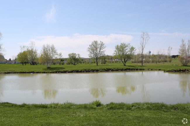
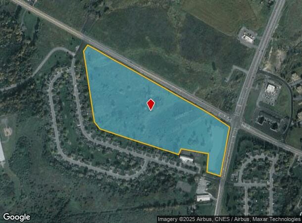
Nys Rte 342, Calcium, NY 13616

NEARBY LISTINGS FOR SALE OR LEASE
Property Detail
Nys Rte 342
224089-075-000-0001-002-430
Jefferson
Commercialacreage
New York
X
2.430
3603410065E
24.72 AC
2025
Jefferson County
2024
Syracuse
060500
Watertown-Fort Drum, NY
DEMOGRAPHICS near Nys Rte 342
1 Mile
3 Mile
5 Mile
2024 Total Population
3,070
17,109
37,256
2029 Population
2,983
16,404
36,243
Pop Growth 2024-2029
(2.83%)
(4.12%)
(2.72%)
Average Age
26
27
31
2024 Total Households
1,254
5,244
12,784
HH Growth 2024-2029
(3.03%)
(5.07%)
(3.29%)
Median Household Inc
$53,427
$56,836
$54,799
Avg Household Size
2.40
2.50
2.50
2024 Avg HH Vehicles
2.00
2.00
2.00
Median Home Value
$199,264
$202,457
$150,644
Median Year Built
1993
1995
1985
Nearby Places
Map Layers
Map Styles
 Street
 Aerial
- Restaurants
- Banks
- Shops
- Fitness
- Groceries
Nearby Properties
Address
Land Use
TOTAL SIZE
Lot Size
Zoning
Address
Land Use
TOTAL SIZE
Lot Size
Zoning
10,848 SF
89.80 AC
B
Address
Land Use
TOTAL SIZE
Lot Size
Zoning
1,060.13 AC
AR
Address
Land Use
TOTAL SIZE
Lot Size
Zoning
3,852 SF
60.50 AC
PD
Address
Land Use
TOTAL SIZE
Lot Size
Zoning
10,944 SF
82.39 AC
PD
Address
Land Use
TOTAL SIZE
Lot Size
Zoning
77,688 SF
53.15 AC
AR
Address
Land Use
TOTAL SIZE
Lot Size
Zoning
203,818 SF
23.37 AC
B
Address
Land Use
TOTAL SIZE
Lot Size
Zoning
99,356 SF
14.96 AC
R
Address
Land Use
TOTAL SIZE
Lot Size
Zoning
1,747 SF
15.68 AC
PD
Address
Land Use
TOTAL SIZE
Lot Size
Zoning
6,752 SF
21.30 AC
PD
Address
Land Use
TOTAL SIZE
Lot Size
Zoning
35,900 SF
5.43 AC
B-
Address
Land Use
TOTAL SIZE
Lot Size
Zoning
Address
Land Use
TOTAL SIZE
Lot Size
Zoning
1,500 SF
25.60 AC
AR
Address
Land Use
TOTAL SIZE
Lot Size
Zoning
40.70 AC
AR
Address
Land Use
TOTAL SIZE
Lot Size
Zoning
3.01 AC
R
Address
Land Use
TOTAL SIZE
Lot Size
Zoning
10,310 SF
12.53 AC
PD
Address
Land Use
TOTAL SIZE
Lot Size
Zoning
0.01 AC
B
Address
Land Use
TOTAL SIZE
Lot Size
Zoning
58,212 SF
4.15 AC
B-
Address
Land Use
TOTAL SIZE
Lot Size
Zoning
3,820 SF
8.26 AC
B
Address
Land Use
TOTAL SIZE
Lot Size
Zoning
Address
Land Use
TOTAL SIZE
Lot Size
Zoning
25,000 SF
2.21 AC
B
Address
Land Use
TOTAL SIZE
Lot Size
Zoning
27,030 SF
1.52 AC
R
Address
Land Use
TOTAL SIZE
Lot Size
Zoning
2.06 AC
AR
Address
Land Use
TOTAL SIZE
Lot Size
Zoning
5,895 SF
1.87 AC
B
Address
Land Use
TOTAL SIZE
Lot Size
Zoning
0.91 AC
AR
Address
Land Use
TOTAL SIZE
Lot Size
Zoning
10,500 SF
3.56 AC
B
Address
Land Use
TOTAL SIZE
Lot Size
Zoning
41,900 SF
7.70 AC
B-
Address
Land Use
TOTAL SIZE
Lot Size
Zoning
Address
Land Use
TOTAL SIZE
Lot Size
Zoning
42,628 SF
2.23 AC
B
Address
Land Use
TOTAL SIZE
Lot Size
Zoning
8,714 SF
195.76 AC
99
Address
Land Use
TOTAL SIZE
Lot Size
Zoning
6,360 SF
1.97 AC
B-
The World's #1 Commercial Real Estate Marketplace
Connect with us
© 2026 CoStar Group
The information above has been obtained from sources believed reliable. While we do not doubt its accuracy we have not verified it and make no guarantee, warranty or representation about it. It is your responsibility to independently confirm its accuracy and completeness. Any projections, opinions, assumptions, or estimates used are for example only and do not represent the current or future performance of the property. The value of this transaction to you depends on tax and other factors which should be evaluated by your tax, financial, and legal advisors. You and your advisors should conduct a careful, independent investigation of the property to determine to your satisfaction the suitability of the property for your needs.