Property Record
Oak Grove Rd, Harvard, IL 60033
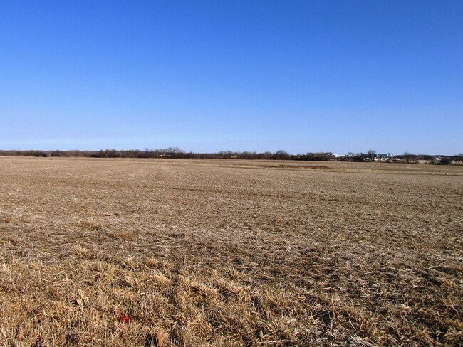


Property Detail
Oak Grove Rd
Chicago-Naperville-Elgin, IL-IN
DOC 2022R0016482 N1/2 SW1/4 /EX PC 10FT X 38.70FT/ LYING SELY OF CEN HWY
01-23-300-015
MCHENRY
Farms
Illinois
B and X Area of moderate flood hazard, usually the area between the limits of the 100-year and 500-year floods.
64.07 AC
2024
Far Northwest
2024
Chicago
870302
NEARBY LISTINGS FOR SALE OR LEASE
-
-
View all Harvard listings for sale on LoopNet.com
DEMOGRAPHICS near Oak Grove Rd
1 mile
3 mile
5 mile
2025 Total Population
371
10,698
12,902
2030 Population
389
10,944
13,133
Pop Growth 2025-2030
+ 4.85%
+ 2.30%
+ 1.79%
Average Age
36
37
38
2025 Total Households
130
3,648
4,477
HH Growth 2025-2030
+ 5.38%
+ 2.36%
+ 1.79%
Median Household Inc
$70,077
$70,416
$72,754
Avg Household Size
2.80
2.90
2.80
2025 Avg HH Vehicles
2.00
2.00
2.00
Median Home Value
$182,856
$176,219
$191,705
Median Year Built
1995
1981
1981
Nearby Places
Map Layers
Map Styles
 Street
 Aerial
Layers
 Traffic
 Biking
Places
Listings with unknown addresses are not visible on the map
- Restaurants
- Banks
- Shops
- Fitness
- Groceries
PUBLIC TRANSPORTATION
COMMUTER RAIL
Harvard Station (Union Pacific Northwest Line - Northeast Illinois Regional Commuter Railroad (Metra))
Drive
Walk
Distance
Harvard Station (Union Pacific Northwest Line - Northeast Illinois Regional Commuter Railroad (Metra))
10 min
4.3 mi
AIRPORT
Chicago/Rockford International
Drive
Walk
Distance
Chicago/Rockford International
65 min
42.6 mi
Freight Ports
Port Milwaukee
Drive
Walk
Distance
Port Milwaukee
83 min
62.3 mi
SALE & LEASE HISTORY
LISTING DATE
SALE/LEASE

Apr 15, 2020
For Sale
Nearby Properties
Address
Land Use
TOTAL SIZE
Lot Size
Zoning
Address
Land Use
TOTAL SIZE
Lot Size
Zoning
23.89 AC
Address
Land Use
TOTAL SIZE
Lot Size
Zoning
290.30 AC
Address
Land Use
TOTAL SIZE
Lot Size
Zoning
457,340 SF
19.04 AC
Address
Land Use
TOTAL SIZE
Lot Size
Zoning
8.38 AC
Address
Land Use
TOTAL SIZE
Lot Size
Zoning
4.34 AC
Address
Land Use
TOTAL SIZE
Lot Size
Zoning
6.51 AC
Address
Land Use
TOTAL SIZE
Lot Size
Zoning
346,000 SF
11.50 AC
Address
Land Use
TOTAL SIZE
Lot Size
Zoning
17.16 AC
Address
Land Use
TOTAL SIZE
Lot Size
Zoning
209,100 SF
8.04 AC
Address
Land Use
TOTAL SIZE
Lot Size
Zoning
292,500 SF
17.66 AC
Address
Land Use
TOTAL SIZE
Lot Size
Zoning
Address
Land Use
TOTAL SIZE
Lot Size
Zoning
3.44 AC
Address
Land Use
TOTAL SIZE
Lot Size
Zoning
3.16 AC
Address
Land Use
TOTAL SIZE
Lot Size
Zoning
3.74 AC
Address
Land Use
TOTAL SIZE
Lot Size
Zoning
7,232 SF
2.15 AC
Address
Land Use
TOTAL SIZE
Lot Size
Zoning
Address
Land Use
TOTAL SIZE
Lot Size
Zoning
2.23 AC
Address
Land Use
TOTAL SIZE
Lot Size
Zoning
1.31 AC
Address
Land Use
TOTAL SIZE
Lot Size
Zoning
13,619 SF
1.66 AC
Address
Land Use
TOTAL SIZE
Lot Size
Zoning
15,750 SF
1.60 AC
Address
Land Use
TOTAL SIZE
Lot Size
Zoning
0.98 AC
Address
Land Use
TOTAL SIZE
Lot Size
Zoning
0.49 AC
Address
Land Use
TOTAL SIZE
Lot Size
Zoning
20,434 SF
0.65 AC
Address
Land Use
TOTAL SIZE
Lot Size
Zoning
Address
Land Use
TOTAL SIZE
Lot Size
Zoning
5.05 AC
Address
Land Use
TOTAL SIZE
Lot Size
Zoning
1.41 AC
Address
Land Use
TOTAL SIZE
Lot Size
Zoning
0.57 AC
Address
Land Use
TOTAL SIZE
Lot Size
Zoning
3,677 SF
1.21 AC
Address
Land Use
TOTAL SIZE
Lot Size
Zoning
19.66 AC
The World's #1 Commercial Real Estate Marketplace
Connect with us
© 2026 CoStar Group
The information above has been obtained from sources believed reliable. While we do not doubt its accuracy we have not verified it and make no guarantee, warranty or representation about it. It is your responsibility to independently confirm its accuracy and completeness. Any projections, opinions, assumptions, or estimates used are for example only and do not represent the current or future performance of the property. The value of this transaction to you depends on tax and other factors which should be evaluated by your tax, financial, and legal advisors. You and your advisors should conduct a careful, independent investigation of the property to determine to your satisfaction the suitability of the property for your needs.