Property Record
Oak Harbor Blvd, , LA

Property Detail
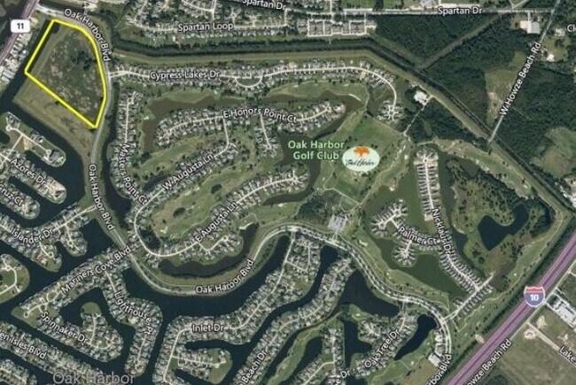
Oak Harbor Blvd
Slidell-Mandeville-Covington, LA
26.6743 ACS M/L SEC 44 9 14 OAK HARBOR MULTI-FAMILY SITE COMMUNITY SERVICE PARCEL INST NO 937062 INST NO 1814364 INST NO 1944
123579
ST TAMMANY
Residentialacreage
Louisiana
2025
26.67 AC
2025
Slidell
040900
New Orleans/Metairie/Kenner
NEARBY LISTINGS FOR SALE OR LEASE
DEMOGRAPHICS near Oak Harbor Blvd
1 mile
3 mile
5 mile
2024 Total Population
6,471
34,745
67,337
2029 Population
6,659
36,208
69,650
Pop Growth 2024-2029
+ 2.91%
+ 4.21%
+ 3.43%
Average Age
41
40
40
2024 Total Households
2,605
14,269
26,399
HH Growth 2024-2029
+ 2.96%
+ 4.17%
+ 3.46%
Median Household Inc
$68,956
$63,411
$71,793
Avg Household Size
2.40
2.40
2.50
2024 Avg HH Vehicles
2.00
2.00
2.00
Median Home Value
$284,409
$249,545
$234,652
Median Year Built
1997
1995
1989
Nearby Places
Map Layers
Map Styles
 Street
 Aerial
Transit
 Traffic
 Biking
Places
Listings with unknown addresses are not visible on the map
- Restaurants
- Banks
- Shops
- Fitness
- Groceries
PUBLIC TRANSPORTATION
COMMUTER RAIL
Slidell Amtrak Station (Crescent - Amtrak)
Drive
Walk
Distance
Slidell Amtrak Station (Crescent - Amtrak)
5 min
3.0 mi
Freight Ports
Port of New Orleans
Drive
Walk
Distance
Port of New Orleans
46 min
31.8 mi
SALE & LEASE HISTORY
LISTING DATE
SALE/LEASE

Sep 24, 2016
For Sale
Mar 25, 2025
For Sale
Mar 02, 2021
For Sale
Nearby Properties
Address
Land Use
TOTAL SIZE
Lot Size
Zoning
Address
Land Use
TOTAL SIZE
Lot Size
Zoning
318,479 SF
34.24 AC
Address
Land Use
TOTAL SIZE
Lot Size
Zoning
141,360 SF
30.70 AC
Address
Land Use
TOTAL SIZE
Lot Size
Zoning
151,281 SF
19.39 AC
Address
Land Use
TOTAL SIZE
Lot Size
Zoning
85,000 SF
12.23 AC
Address
Land Use
TOTAL SIZE
Lot Size
Zoning
125,000 SF
10.84 AC
Address
Land Use
TOTAL SIZE
Lot Size
Zoning
122,475 SF
12.88 AC
Address
Land Use
TOTAL SIZE
Lot Size
Zoning
127,681 SF
3 AC
Address
Land Use
TOTAL SIZE
Lot Size
Zoning
106,115 SF
4.29 AC
Address
Land Use
TOTAL SIZE
Lot Size
Zoning
107,853 SF
8.97 AC
Address
Land Use
TOTAL SIZE
Lot Size
Zoning
105,733 SF
6.70 AC
Address
Land Use
TOTAL SIZE
Lot Size
Zoning
103,645 SF
20 AC
Address
Land Use
TOTAL SIZE
Lot Size
Zoning
107,626 SF
0.50 AC
Address
Land Use
TOTAL SIZE
Lot Size
Zoning
55,000 SF
1.88 AC
Address
Land Use
TOTAL SIZE
Lot Size
Zoning
52,640 SF
2.53 AC
Address
Land Use
TOTAL SIZE
Lot Size
Zoning
80,737 SF
8.06 AC
Address
Land Use
TOTAL SIZE
Lot Size
Zoning
73,519 SF
6.97 AC
Address
Land Use
TOTAL SIZE
Lot Size
Zoning
97,950 SF
4.73 AC
Address
Land Use
TOTAL SIZE
Lot Size
Zoning
41,117 SF
5.63 AC
Address
Land Use
TOTAL SIZE
Lot Size
Zoning
61,783 SF
9.21 AC
Address
Land Use
TOTAL SIZE
Lot Size
Zoning
32,964 SF
1 AC
Address
Land Use
TOTAL SIZE
Lot Size
Zoning
50,122 SF
25 AC
Address
Land Use
TOTAL SIZE
Lot Size
Zoning
24.66 AC
Address
Land Use
TOTAL SIZE
Lot Size
Zoning
50,846 SF
6.47 AC
Address
Land Use
TOTAL SIZE
Lot Size
Zoning
32,896 SF
3 AC
Address
Land Use
TOTAL SIZE
Lot Size
Zoning
41,305 SF
2.36 AC
Address
Land Use
TOTAL SIZE
Lot Size
Zoning
40,105 SF
2.96 AC
Address
Land Use
TOTAL SIZE
Lot Size
Zoning
35,158 SF
2.43 AC
Address
Land Use
TOTAL SIZE
Lot Size
Zoning
32,392 SF
7 AC
Address
Land Use
TOTAL SIZE
Lot Size
Zoning
42,747 SF
9.47 AC
Address
Land Use
TOTAL SIZE
Lot Size
Zoning
27,000 SF
10 AC
The World's #1 Commercial Real Estate Marketplace
Connect with us
© 2026 CoStar Group
The information above has been obtained from sources believed reliable. While we do not doubt its accuracy we have not verified it and make no guarantee, warranty or representation about it. It is your responsibility to independently confirm its accuracy and completeness. Any projections, opinions, assumptions, or estimates used are for example only and do not represent the current or future performance of the property. The value of this transaction to you depends on tax and other factors which should be evaluated by your tax, financial, and legal advisors. You and your advisors should conduct a careful, independent investigation of the property to determine to your satisfaction the suitability of the property for your needs.