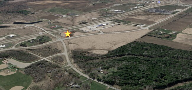
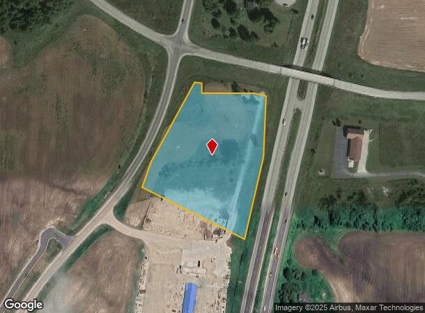
Property Record
Oak Orchard Rd, Abrams, WI 54101

NEARBY LISTINGS FOR SALE OR LEASE
-
-
View all Abrams listings for sale on LoopNet.com
Property Detail
Oak Orchard Rd
Green Bay, WI
PRT NENE & SENE K/A LOT 1 CSM V29-P7
002-40-34-003-11-D
Oconto
Commercialacreage
Wisconsin
X
1
55083C0743D
4.56 AC
2024
Oconto County
2024
Green Bay
101100
DEMOGRAPHICS near Oak Orchard Rd
1 mile
3 mile
5 mile
2024 Total Population
401
1,912
4,584
2029 Population
417
1,987
4,738
Pop Growth 2024-2029
+ 3.99%
+ 3.92%
+ 3.36%
Average Age
43
43
43
2024 Total Households
162
774
1,821
HH Growth 2024-2029
+ 3.70%
+ 3.62%
+ 3.13%
Median Household Inc
$82,500
$84,943
$87,896
Avg Household Size
2.40
2.40
2.50
2024 Avg HH Vehicles
3.00
3.00
3.00
Median Home Value
$236,274
$234,016
$235,409
Median Year Built
1984
1985
1987
Nearby Places
Map Layers
Map Styles
 Street
 Aerial
Transit
 Traffic
 Biking
Places
Listings with unknown addresses are not visible on the map
- Restaurants
- Banks
- Shops
- Fitness
- Groceries
PUBLIC TRANSPORTATION
AIRPORT
Green Bay/Austin Straubel International
Drive
Walk
Distance
Green Bay/Austin Straubel International
30 min
23.6 mi
Freight Ports
Port Milwaukee
Drive
Walk
Distance
Port Milwaukee
156 min
137.3 mi
SALE & LEASE HISTORY
LISTING DATE
SALE/LEASE

Sep 22, 2017
For Sale
Nearby Properties
Address
Land Use
TOTAL SIZE
Lot Size
Zoning
Address
Land Use
TOTAL SIZE
Lot Size
Zoning
9.96 AC
RC
Address
Land Use
TOTAL SIZE
Lot Size
Zoning
4.34 AC
GC
Address
Land Use
TOTAL SIZE
Lot Size
Zoning
3.30 AC
GC
Address
Land Use
TOTAL SIZE
Lot Size
Zoning
10.01 AC
GC
Address
Land Use
TOTAL SIZE
Lot Size
Zoning
51.99 AC
AG
Address
Land Use
TOTAL SIZE
Lot Size
Zoning
13.83 AC
Address
Land Use
TOTAL SIZE
Lot Size
Zoning
10.70 AC
I
Address
Land Use
TOTAL SIZE
Lot Size
Zoning
37.36 AC
AG
Address
Land Use
TOTAL SIZE
Lot Size
Zoning
18.85 AC
AG
Address
Land Use
TOTAL SIZE
Lot Size
Zoning
6.03 AC
F
Address
Land Use
TOTAL SIZE
Lot Size
Zoning
27.74 AC
F
Address
Land Use
TOTAL SIZE
Lot Size
Zoning
6.10 AC
AG
Address
Land Use
TOTAL SIZE
Lot Size
Zoning
32.75 AC
AG
Address
Land Use
TOTAL SIZE
Lot Size
Zoning
22.85 AC
F
Address
Land Use
TOTAL SIZE
Lot Size
Zoning
37.42 AC
F
Address
Land Use
TOTAL SIZE
Lot Size
Zoning
23.88 AC
AG
Address
Land Use
TOTAL SIZE
Lot Size
Zoning
Address
Land Use
TOTAL SIZE
Lot Size
Zoning
19.94 AC
F
Address
Land Use
TOTAL SIZE
Lot Size
Zoning
13.73 AC
I
Address
Land Use
TOTAL SIZE
Lot Size
Zoning
Address
Land Use
TOTAL SIZE
Lot Size
Zoning
2 AC
F
Address
Land Use
TOTAL SIZE
Lot Size
Zoning
10.01 AC
F
Address
Land Use
TOTAL SIZE
Lot Size
Zoning
26.41 AC
AG
Address
Land Use
TOTAL SIZE
Lot Size
Zoning
2.16 AC
R1
Address
Land Use
TOTAL SIZE
Lot Size
Zoning
28.78 AC
GC
Address
Land Use
TOTAL SIZE
Lot Size
Zoning
4.86 AC
RR
Address
Land Use
TOTAL SIZE
Lot Size
Zoning
4.70 AC
GC
Address
Land Use
TOTAL SIZE
Lot Size
Zoning
20 AC
RR
Address
Land Use
TOTAL SIZE
Lot Size
Zoning
3.14 AC
F
Address
Land Use
TOTAL SIZE
Lot Size
Zoning
1.84 AC
R1
The World's #1 Commercial Real Estate Marketplace
Connect with us
© 2026 CoStar Group
The information above has been obtained from sources believed reliable. While we do not doubt its accuracy we have not verified it and make no guarantee, warranty or representation about it. It is your responsibility to independently confirm its accuracy and completeness. Any projections, opinions, assumptions, or estimates used are for example only and do not represent the current or future performance of the property. The value of this transaction to you depends on tax and other factors which should be evaluated by your tax, financial, and legal advisors. You and your advisors should conduct a careful, independent investigation of the property to determine to your satisfaction the suitability of the property for your needs.