Property Record
Ohanlon Davis Rd, Whitesboro, TX 76273

Property Detail
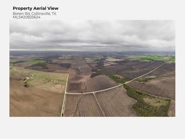
Ohanlon Davis Rd
Sherman-Denison, TX
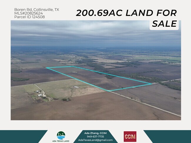
G-0492 HARWOOD C H A-G0492, ACRES 150.0
124576
GRAYSON
Farms
Texas
B and X Area of moderate flood hazard, usually the area between the limits of the 100-year and 500-year floods.
150 AC
2024
Whitesboro
2025
Other Market Areas
001104
NEARBY LISTINGS FOR SALE OR LEASE
DEMOGRAPHICS near Ohanlon Davis Rd
1 mile
3 mile
5 mile
2025 Total Population
21
572
1,923
2030 Population
22
612
2,058
Pop Growth 2025-2030
+ 4.76%
+ 6.99%
+ 7.02%
Average Age
42
41
42
2025 Total Households
7
206
703
HH Growth 2025-2030
+ 14.29%
+ 6.80%
+ 7.11%
Median Household Inc
$158,333
$118,518
$113,157
Avg Household Size
2.70
2.70
2.70
2025 Avg HH Vehicles
3.00
3.00
3.00
Median Home Value
$499,999
$415,854
$386,892
Median Year Built
2002
2003
2001
Nearby Places
Map Layers
Map Styles
 Street
 Aerial
Transit
 Traffic
 Biking
Places
Listings with unknown addresses are not visible on the map
- Restaurants
- Banks
- Shops
- Fitness
- Groceries
SALE & LEASE HISTORY
LISTING DATE
SALE/LEASE

Mar 06, 2025
For Sale
Nearby Properties
Address
Land Use
TOTAL SIZE
Lot Size
Zoning
Address
Land Use
TOTAL SIZE
Lot Size
Zoning
217.44 AC
Address
Land Use
TOTAL SIZE
Lot Size
Zoning
16,077 SF
19.80 AC
Address
Land Use
TOTAL SIZE
Lot Size
Zoning
5,304 SF
7.50 AC
Address
Land Use
TOTAL SIZE
Lot Size
Zoning
12,716 SF
12.18 AC
Address
Land Use
TOTAL SIZE
Lot Size
Zoning
2,295 SF
32.36 AC
Address
Land Use
TOTAL SIZE
Lot Size
Zoning
3,433 SF
23 AC
Address
Land Use
TOTAL SIZE
Lot Size
Zoning
2,700 SF
13.56 AC
Address
Land Use
TOTAL SIZE
Lot Size
Zoning
3,080 SF
176.68 AC
Address
Land Use
TOTAL SIZE
Lot Size
Zoning
2,040 SF
11.96 AC
Address
Land Use
TOTAL SIZE
Lot Size
Zoning
2,362 SF
19.99 AC
Address
Land Use
TOTAL SIZE
Lot Size
Zoning
2,200 SF
13.50 AC
Address
Land Use
TOTAL SIZE
Lot Size
Zoning
2,321 SF
4 AC
Address
Land Use
TOTAL SIZE
Lot Size
Zoning
2,800 SF
5 AC
Address
Land Use
TOTAL SIZE
Lot Size
Zoning
2,698 SF
14.91 AC
Address
Land Use
TOTAL SIZE
Lot Size
Zoning
2,580 SF
24.60 AC
Address
Land Use
TOTAL SIZE
Lot Size
Zoning
1,632 SF
12.05 AC
Address
Land Use
TOTAL SIZE
Lot Size
Zoning
2,885 SF
20 AC
Address
Land Use
TOTAL SIZE
Lot Size
Zoning
2,072 SF
7.39 AC
Address
Land Use
TOTAL SIZE
Lot Size
Zoning
1,638 SF
16.01 AC
Address
Land Use
TOTAL SIZE
Lot Size
Zoning
1,740 SF
1,222.79 AC
Address
Land Use
TOTAL SIZE
Lot Size
Zoning
5.35 AC
Address
Land Use
TOTAL SIZE
Lot Size
Zoning
1,148 SF
12.60 AC
Address
Land Use
TOTAL SIZE
Lot Size
Zoning
Address
Land Use
TOTAL SIZE
Lot Size
Zoning
Address
Land Use
TOTAL SIZE
Lot Size
Zoning
Address
Land Use
TOTAL SIZE
Lot Size
Zoning
Address
Land Use
TOTAL SIZE
Lot Size
Zoning
Address
Land Use
TOTAL SIZE
Lot Size
Zoning
Address
Land Use
TOTAL SIZE
Lot Size
Zoning
Address
Land Use
TOTAL SIZE
Lot Size
Zoning
The World's #1 Commercial Real Estate Marketplace
Connect with us
© 2026 CoStar Group
The information above has been obtained from sources believed reliable. While we do not doubt its accuracy we have not verified it and make no guarantee, warranty or representation about it. It is your responsibility to independently confirm its accuracy and completeness. Any projections, opinions, assumptions, or estimates used are for example only and do not represent the current or future performance of the property. The value of this transaction to you depends on tax and other factors which should be evaluated by your tax, financial, and legal advisors. You and your advisors should conduct a careful, independent investigation of the property to determine to your satisfaction the suitability of the property for your needs.