Property Record
Old Atlanta Hwy, Covington, GA 30014
NEARBY LISTINGS FOR SALE OR LEASE
Property Detail
Old Atlanta Hwy
Atlanta-Sandy Springs-Roswell, GA
R5 Misc Land - Area 4
0042000000003000
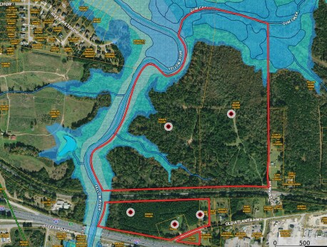
69.73AC OLD ATLANTA HWY
Privatepreserveopenspacevacantlandforestlandconservation
Newton
AE
Georgia
13217C0106D
99.17 AC
2025
Newton County
2025
Atlanta
100302
DEMOGRAPHICS near Old Atlanta Hwy
1 Mile
3 Mile
5 Mile
2024 Total Population
849
25,180
76,241
2029 Population
927
27,936
83,818
Pop Growth 2024-2029
+ 9.19%
+ 10.95%
+ 9.94%
Average Age
39
38
38
2024 Total Households
347
8,807
27,216
HH Growth 2024-2029
+ 8.93%
+ 11.31%
+ 10.25%
Median Household Inc
$69,807
$72,910
$71,595
Avg Household Size
2.40
2.70
2.70
2024 Avg HH Vehicles
2.00
2.00
2.00
Median Home Value
$83,333
$187,031
$185,907
Median Year Built
1990
1996
1996
Nearby Places
Map Layers
Map Styles
 Street
 Aerial
- Restaurants
- Banks
- Shops
- Fitness
- Groceries
PUBLIC TRANSPORTATION
AIRPORT
Hartsfield - Jackson Atlanta International
DRIVE
WALK
Distance
Hartsfield - Jackson Atlanta International
49 min
36.3 mi
Freight Ports
Georgia Ports - Savannah
DRIVE
WALK
Distance
Georgia Ports - Savannah
271 min
232.4 mi
SALE & LEASE HISTORY
LISTING DATE
SALE/LEASE

Nov 06, 2023
For Sale
Jul 14, 2021
For Sale
Nearby Properties
Address
Land Use
TOTAL SIZE
Lot Size
Zoning
Address
Land Use
TOTAL SIZE
Lot Size
Zoning
4,734 SF
35.19 AC
RMF
Address
Land Use
TOTAL SIZE
Lot Size
Zoning
306,886 SF
118.50 AC
R2
Address
Land Use
TOTAL SIZE
Lot Size
Zoning
882,960 SF
0.01 AC
Address
Land Use
TOTAL SIZE
Lot Size
Zoning
14,624 SF
26.09 AC
C1
Address
Land Use
TOTAL SIZE
Lot Size
Zoning
372,762 SF
32.27 AC
A1
Address
Land Use
TOTAL SIZE
Lot Size
Zoning
92,162 SF
11.21 AC
R2
Address
Land Use
TOTAL SIZE
Lot Size
Zoning
5,160 SF
45.17 AC
C1
Address
Land Use
TOTAL SIZE
Lot Size
Zoning
882,960 SF
114.02 AC
M1
Address
Land Use
TOTAL SIZE
Lot Size
Zoning
34,384 SF
3.32 AC
Address
Land Use
TOTAL SIZE
Lot Size
Zoning
222,056 SF
13.35 AC
Address
Land Use
TOTAL SIZE
Lot Size
Zoning
3,888 SF
7.17 AC
C1
Address
Land Use
TOTAL SIZE
Lot Size
Zoning
65,520 SF
35 AC
E6
Address
Land Use
TOTAL SIZE
Lot Size
Zoning
65,008 SF
23.81 AC
R2
Address
Land Use
TOTAL SIZE
Lot Size
Zoning
4,768 SF
263.26 AC
C1
Address
Land Use
TOTAL SIZE
Lot Size
Zoning
6,936 SF
8.88 AC
C1
Address
Land Use
TOTAL SIZE
Lot Size
Zoning
99,686 SF
11.50 AC
C1
Address
Land Use
TOTAL SIZE
Lot Size
Zoning
38,120 SF
155.15 AC
E1
Address
Land Use
TOTAL SIZE
Lot Size
Zoning
367,374 SF
39.48 AC
M1
Address
Land Use
TOTAL SIZE
Lot Size
Zoning
54,712 SF
54.54 AC
E6
Address
Land Use
TOTAL SIZE
Lot Size
Zoning
101,010 SF
59.60 AC
E6
Address
Land Use
TOTAL SIZE
Lot Size
Zoning
115,806 SF
29.25 AC
I1
Address
Land Use
TOTAL SIZE
Lot Size
Zoning
5,226 SF
8.13 AC
C1
Address
Land Use
TOTAL SIZE
Lot Size
Zoning
39,567 SF
36.38 AC
I1
Address
Land Use
TOTAL SIZE
Lot Size
Zoning
40,138 SF
13.59 AC
R1
Address
Land Use
TOTAL SIZE
Lot Size
Zoning
48,204 SF
0.77 AC
R1
Address
Land Use
TOTAL SIZE
Lot Size
Zoning
85,560 SF
10.26 AC
C1
Address
Land Use
TOTAL SIZE
Lot Size
Zoning
73,624 SF
15.25 AC
C1
Address
Land Use
TOTAL SIZE
Lot Size
Zoning
24,788 SF
2 AC
C1
Address
Land Use
TOTAL SIZE
Lot Size
Zoning
17,556 SF
3.32 AC
I1
Address
Land Use
TOTAL SIZE
Lot Size
Zoning
51,230 SF
7.46 AC
C1
The World's #1 Commercial Real Estate Marketplace
Connect with us
© 2025 CoStar Group
The information above has been obtained from sources believed reliable. While we do not doubt its accuracy we have not verified it and make no guarantee, warranty or representation about it. It is your responsibility to independently confirm its accuracy and completeness. Any projections, opinions, assumptions, or estimates used are for example only and do not represent the current or future performance of the property. The value of this transaction to you depends on tax and other factors which should be evaluated by your tax, financial, and legal advisors. You and your advisors should conduct a careful, independent investigation of the property to determine to your satisfaction the suitability of the property for your needs.