Property Record
Old Clyattville Rd, Valdosta, GA 31601


NEARBY LISTINGS FOR SALE OR LEASE
Property Detail
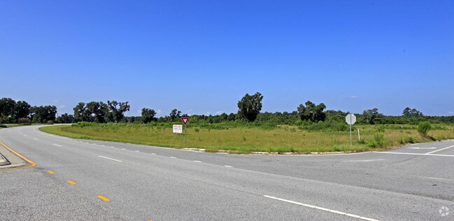
Old Clyattville Rd
Valdosta, GA
South Acreage
0127B-001
I-75 & NEW EXIT NO 13A LANDLOT: 65 LANDDIST: 11
Agriculturalland
Lowndes
AE
Georgia
13185C0220E
296.26 AC
2024
Valdosta/Lake Park
2024
Other Market Areas
011402
DEMOGRAPHICS near Old Clyattville Rd
1 Mile
3 Mile
5 Mile
2024 Total Population
13
6,276
36,547
2029 Population
14
6,593
38,198
Pop Growth 2024-2029
+ 7.69%
+ 5.05%
+ 4.52%
Average Age
35
37
35
2024 Total Households
4
2,177
13,787
HH Growth 2024-2029
+ 25.00%
+ 5.51%
+ 4.79%
Median Household Inc
$5,000
$26,210
$25,787
Avg Household Size
2.00
2.50
2.40
2024 Avg HH Vehicles
2.00
2.00
2.00
Median Home Value
$50,000
$120,336
$132,667
Median Year Built
1989
1988
1983
Nearby Places
Map Layers
Map Styles
 Street
 Aerial
- Restaurants
- Banks
- Shops
- Fitness
- Groceries
PUBLIC TRANSPORTATION
AIRPORT
Valdosta Regional
DRIVE
WALK
Distance
Valdosta Regional
5 min
2.7 mi
Freight Ports
Jacksonville Port
DRIVE
WALK
Distance
Jacksonville Port
137 min
121.4 mi
SALE & LEASE HISTORY
LISTING DATE
SALE/LEASE

Sep 24, 2016
For Sale
Nearby Properties
Address
Land Use
TOTAL SIZE
Lot Size
Zoning
Address
Land Use
TOTAL SIZE
Lot Size
Zoning
1,200 SF
73.36 AC
M-2
Address
Land Use
TOTAL SIZE
Lot Size
Zoning
414,158 SF
40 AC
M-1
Address
Land Use
TOTAL SIZE
Lot Size
Zoning
150,802 SF
11.97 AC
M-1
Address
Land Use
TOTAL SIZE
Lot Size
Zoning
210,000 SF
81.43 AC
M-2
Address
Land Use
TOTAL SIZE
Lot Size
Zoning
2,496 SF
63.73 AC
M-2
Address
Land Use
TOTAL SIZE
Lot Size
Zoning
101,774 SF
3.55 AC
C-H
Address
Land Use
TOTAL SIZE
Lot Size
Zoning
120,400 SF
9.12 AC
M-1
Address
Land Use
TOTAL SIZE
Lot Size
Zoning
143,560 SF
M-1
Address
Land Use
TOTAL SIZE
Lot Size
Zoning
114,460 SF
M-1
Address
Land Use
TOTAL SIZE
Lot Size
Zoning
72,832 SF
114.10 AC
M-1
Address
Land Use
TOTAL SIZE
Lot Size
Zoning
55,180 SF
2.46 AC
M-2
Address
Land Use
TOTAL SIZE
Lot Size
Zoning
108,800 SF
15 AC
M-2
Address
Land Use
TOTAL SIZE
Lot Size
Zoning
56,879 SF
63 AC
CON
Address
Land Use
TOTAL SIZE
Lot Size
Zoning
52,220 SF
181.31 AC
M-2
Address
Land Use
TOTAL SIZE
Lot Size
Zoning
21,558 SF
30.25 AC
M-2
Address
Land Use
TOTAL SIZE
Lot Size
Zoning
576 SF
6,986.68 AC
E-A
Address
Land Use
TOTAL SIZE
Lot Size
Zoning
54,000 SF
9.15 AC
M-2
Address
Land Use
TOTAL SIZE
Lot Size
Zoning
74,638 SF
4.72 AC
M-1
Address
Land Use
TOTAL SIZE
Lot Size
Zoning
35,520 SF
16.58 AC
M-2
Address
Land Use
TOTAL SIZE
Lot Size
Zoning
57,902 SF
5.25 AC
C-H
Address
Land Use
TOTAL SIZE
Lot Size
Zoning
36,000 SF
6.58 AC
M-2
Address
Land Use
TOTAL SIZE
Lot Size
Zoning
48.57 AC
R-1
Address
Land Use
TOTAL SIZE
Lot Size
Zoning
152,725 SF
10.27 AC
M-2
Address
Land Use
TOTAL SIZE
Lot Size
Zoning
26,004 SF
12.82 AC
M-2
Address
Land Use
TOTAL SIZE
Lot Size
Zoning
271,019 SF
30 AC
M-2
Address
Land Use
TOTAL SIZE
Lot Size
Zoning
109,920 SF
4.63 AC
M-2
Address
Land Use
TOTAL SIZE
Lot Size
Zoning
14,012 SF
11.89 AC
C-H
Address
Land Use
TOTAL SIZE
Lot Size
Zoning
4,000 SF
4.87 AC
C-H
The World's #1 Commercial Real Estate Marketplace
Connect with us
© 2026 CoStar Group
The information above has been obtained from sources believed reliable. While we do not doubt its accuracy we have not verified it and make no guarantee, warranty or representation about it. It is your responsibility to independently confirm its accuracy and completeness. Any projections, opinions, assumptions, or estimates used are for example only and do not represent the current or future performance of the property. The value of this transaction to you depends on tax and other factors which should be evaluated by your tax, financial, and legal advisors. You and your advisors should conduct a careful, independent investigation of the property to determine to your satisfaction the suitability of the property for your needs.