Property Record
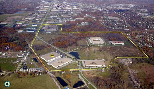
Old Cochran Rd, Solon, OH 44139


Property Detail
Old Cochran Rd
Cleveland-Elyria, OH
RES 39.413 AC OL 18/ 23/24 2013 SR
991-22-003
CUYAHOGA
Industrialacreage
Ohio
IG
18,23
2025
39.41 AC
2025
Southeast
184106
Cleveland
2,007 SF
NEARBY LISTINGS FOR SALE OR LEASE
DEMOGRAPHICS near Old Cochran Rd
1 mile
3 mile
5 mile
2025 Total Population
2,496
39,400
97,738
2030 Population
2,520
39,153
97,066
Pop Growth 2025-2030
+ 0.96%
(0.63%)
(0.69%)
Average Age
42
43
43
2025 Total Households
895
15,498
40,030
HH Growth 2025-2030
+ 0.89%
(0.65%)
(0.72%)
Median Household Inc
$117,934
$98,224
$91,142
Avg Household Size
2.70
2.50
2.40
2025 Avg HH Vehicles
2.00
2.00
2.00
Median Home Value
$331,399
$308,923
$301,242
Median Year Built
1985
1981
1977
Nearby Places
Map Layers
Map Styles
 Street
 Aerial
Transit
 Traffic
 Biking
Places
Listings with unknown addresses are not visible on the map
- Restaurants
- Banks
- Shops
- Fitness
- Groceries
PUBLIC TRANSPORTATION
COMMUTER RAIL
Canal Exploration Center (National Park Scenic Railway - Cuyahoga Valley Scenic Railroad)
Drive
Walk
Distance
Canal Exploration Center (National Park Scenic Railway - Cuyahoga Valley Scenic Railroad)
19 min
8.7 mi
AIRPORT
Cleveland-Hopkins International
Drive
Walk
Distance
Cleveland-Hopkins International
40 min
24.2 mi
Freight Ports
Port of Toledo
Drive
Walk
Distance
Port of Toledo
154 min
125.1 mi
Nearby Properties
Address
Land Use
TOTAL SIZE
Lot Size
Zoning
Address
Land Use
TOTAL SIZE
Lot Size
Zoning
130,621 SF
67.21 AC
I-2
Address
Land Use
TOTAL SIZE
Lot Size
Zoning
49.31 AC
Address
Land Use
TOTAL SIZE
Lot Size
Zoning
433,283 SF
29.89 AC
Address
Land Use
TOTAL SIZE
Lot Size
Zoning
202,010 SF
90.68 AC
I-2
Address
Land Use
TOTAL SIZE
Lot Size
Zoning
197,000 SF
42.41 AC
I-2
Address
Land Use
TOTAL SIZE
Lot Size
Zoning
246,138 SF
67.82 AC
R-1-C
Address
Land Use
TOTAL SIZE
Lot Size
Zoning
344,806 SF
35.19 AC
R-1-A
Address
Land Use
TOTAL SIZE
Lot Size
Zoning
184,512 SF
5.22 AC
C-1
Address
Land Use
TOTAL SIZE
Lot Size
Zoning
475,568 SF
38.17 AC
IG
Address
Land Use
TOTAL SIZE
Lot Size
Zoning
433,283 SF
40.49 AC
Address
Land Use
TOTAL SIZE
Lot Size
Zoning
458,000 SF
35.06 AC
IG
Address
Land Use
TOTAL SIZE
Lot Size
Zoning
243,040 SF
9.36 AC
R-3-B
Address
Land Use
TOTAL SIZE
Lot Size
Zoning
96,632 SF
13.87 AC
R-3
Address
Land Use
TOTAL SIZE
Lot Size
Zoning
30,386 SF
4.63 AC
R-3
Address
Land Use
TOTAL SIZE
Lot Size
Zoning
49,264 SF
13.36 AC
C-3
Address
Land Use
TOTAL SIZE
Lot Size
Zoning
36,686 SF
5.78 AC
R-3
Address
Land Use
TOTAL SIZE
Lot Size
Zoning
29,560 SF
4.46 AC
R-3
Address
Land Use
TOTAL SIZE
Lot Size
Zoning
302,022 SF
19.04 AC
I-2
Address
Land Use
TOTAL SIZE
Lot Size
Zoning
342,068 SF
29.02 AC
Address
Land Use
TOTAL SIZE
Lot Size
Zoning
594,909 SF
39.82 AC
I-2
Address
Land Use
TOTAL SIZE
Lot Size
Zoning
262,950 SF
26.24 AC
IG
Address
Land Use
TOTAL SIZE
Lot Size
Zoning
20.49 AC
R-1-C
Address
Land Use
TOTAL SIZE
Lot Size
Zoning
37.51 AC
I-2
Address
Land Use
TOTAL SIZE
Lot Size
Zoning
351,911 SF
39.85 AC
I-2
Address
Land Use
TOTAL SIZE
Lot Size
Zoning
247,000 SF
18.44 AC
IG
Address
Land Use
TOTAL SIZE
Lot Size
Zoning
90,287 SF
66.28 AC
G-2
Address
Land Use
TOTAL SIZE
Lot Size
Zoning
14.67 AC
I-2
Address
Land Use
TOTAL SIZE
Lot Size
Zoning
401,401 SF
25.14 AC
IG
Address
Land Use
TOTAL SIZE
Lot Size
Zoning
66,157 SF
13.08 AC
Address
Land Use
TOTAL SIZE
Lot Size
Zoning
197,930 SF
14.80 AC
I-2
The World's #1 Commercial Real Estate Marketplace
Connect with us
© 2026 CoStar Group
The information above has been obtained from sources believed reliable. While we do not doubt its accuracy we have not verified it and make no guarantee, warranty or representation about it. It is your responsibility to independently confirm its accuracy and completeness. Any projections, opinions, assumptions, or estimates used are for example only and do not represent the current or future performance of the property. The value of this transaction to you depends on tax and other factors which should be evaluated by your tax, financial, and legal advisors. You and your advisors should conduct a careful, independent investigation of the property to determine to your satisfaction the suitability of the property for your needs.