Property Record
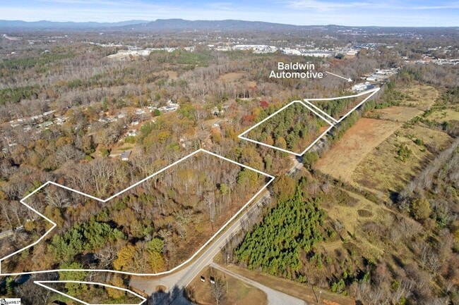
800 Old Easley Hwy, Greenville, SC 29611

NEARBY LISTINGS FOR SALE OR LEASE
Property Detail
800 Old Easley Hwy
Greenville-Anderson-Greer, SC
MAP 0238.01; 4
0238.01-04-015.00
Greenville
Residentialacreage
South Carolina
X
015.00
45045C0377E
6.85 AC
2025
West Side Greenville
2024
Greenville/Spartanburg
003705
DEMOGRAPHICS near 800 Old Easley Hwy
1 Mile
3 Mile
5 Mile
2024 Total Population
1,752
47,071
121,386
2029 Population
1,938
52,095
134,089
Pop Growth 2024-2029
+ 10.62%
+ 10.67%
+ 10.46%
Average Age
38
38
39
2024 Total Households
640
17,939
49,712
HH Growth 2024-2029
+ 10.78%
+ 10.75%
+ 10.74%
Median Household Inc
$43,720
$40,278
$50,207
Avg Household Size
2.70
2.50
2.30
2024 Avg HH Vehicles
2.00
2.00
2.00
Median Home Value
$147,345
$132,476
$204,603
Median Year Built
1978
1977
1982
Nearby Places
Map Layers
Map Styles
 Street
 Aerial
- Restaurants
- Banks
- Shops
- Fitness
- Groceries
PUBLIC TRANSPORTATION
COMMUTER RAIL
Greenville Amtrak Station (Crescent - Amtrak)
DRIVE
WALK
Distance
Greenville Amtrak Station (Crescent - Amtrak)
8 min
3.8 mi
AIRPORT
Greenville Spartanburg International
DRIVE
WALK
Distance
Greenville Spartanburg International
30 min
18.1 mi
Freight Ports
North Charleston Terminal
DRIVE
WALK
Distance
North Charleston Terminal
237 min
208.8 mi
SALE & LEASE HISTORY
LISTING DATE
SALE/LEASE

Feb 20, 2025
For Sale
Nearby Properties
Address
Land Use
TOTAL SIZE
Lot Size
Zoning
Address
Land Use
TOTAL SIZE
Lot Size
Zoning
20.04 AC
RM
Address
Land Use
TOTAL SIZE
Lot Size
Zoning
5.60 AC
RM
Address
Land Use
TOTAL SIZE
Lot Size
Zoning
4.70 AC
RM
Address
Land Use
TOTAL SIZE
Lot Size
Zoning
10.10 AC
RM
Address
Land Use
TOTAL SIZE
Lot Size
Zoning
954 SF
7.83 AC
S1
Address
Land Use
TOTAL SIZE
Lot Size
Zoning
27.38 AC
R75
Address
Land Use
TOTAL SIZE
Lot Size
Zoning
2.14 AC
RM
Address
Land Use
TOTAL SIZE
Lot Size
Zoning
50.95 AC
R75
Address
Land Use
TOTAL SIZE
Lot Size
Zoning
8.29 AC
I1
Address
Land Use
TOTAL SIZE
Lot Size
Zoning
4.97 AC
RM20
Address
Land Use
TOTAL SIZE
Lot Size
Zoning
15.60 AC
I1
Address
Land Use
TOTAL SIZE
Lot Size
Zoning
1.08 AC
C3
Address
Land Use
TOTAL SIZE
Lot Size
Zoning
1.83 AC
RM
Address
Land Use
TOTAL SIZE
Lot Size
Zoning
7.83 AC
RM2
Address
Land Use
TOTAL SIZE
Lot Size
Zoning
5.06 AC
PD
Address
Land Use
TOTAL SIZE
Lot Size
Zoning
18.22 AC
RM
Address
Land Use
TOTAL SIZE
Lot Size
Zoning
16.81 AC
I1
Address
Land Use
TOTAL SIZE
Lot Size
Zoning
3.20 AC
S1
Address
Land Use
TOTAL SIZE
Lot Size
Zoning
8.74 AC
S1
Address
Land Use
TOTAL SIZE
Lot Size
Zoning
15.46 AC
Address
Land Use
TOTAL SIZE
Lot Size
Zoning
1.25 AC
C2
Address
Land Use
TOTAL SIZE
Lot Size
Zoning
5.05 AC
C2
Address
Land Use
TOTAL SIZE
Lot Size
Zoning
8.82 AC
RM2
Address
Land Use
TOTAL SIZE
Lot Size
Zoning
1.43 AC
C1N
Address
Land Use
TOTAL SIZE
Lot Size
Zoning
1,346 SF
4.51 AC
R75
Address
Land Use
TOTAL SIZE
Lot Size
Zoning
0.47 AC
PD
Address
Land Use
TOTAL SIZE
Lot Size
Zoning
3.48 AC
RM1
Address
Land Use
TOTAL SIZE
Lot Size
Zoning
3.80 AC
S1
Address
Land Use
TOTAL SIZE
Lot Size
Zoning
1,410 SF
10.17 AC
R10
Address
Land Use
TOTAL SIZE
Lot Size
Zoning
2.13 AC
RM1
The World's #1 Commercial Real Estate Marketplace
Connect with us
© 2026 CoStar Group
The information above has been obtained from sources believed reliable. While we do not doubt its accuracy we have not verified it and make no guarantee, warranty or representation about it. It is your responsibility to independently confirm its accuracy and completeness. Any projections, opinions, assumptions, or estimates used are for example only and do not represent the current or future performance of the property. The value of this transaction to you depends on tax and other factors which should be evaluated by your tax, financial, and legal advisors. You and your advisors should conduct a careful, independent investigation of the property to determine to your satisfaction the suitability of the property for your needs.