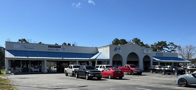
Property Record
Old Folkstone Rd, Sneads Ferry, NC 28460

Save to a Folder
{{folder.Name}}
{{folder.ListingIds.length}} Properties
{{folder.ListingIds.length}} Property
Create a New Folder
Property Detail
Old Folkstone Rd
027577
SR 1518
Residentialacreage
ONSLOW
HB
North Carolina
B and X Area of moderate flood hazard, usually the area between the limits of the 100-year and 500-year floods.
16.66 AC
2025
Coastal Carolina
2025
Other Market Areas
000405
Jacksonville, NC
NEARBY LISTINGS FOR SALE OR LEASE
-
-
View all Sneads Ferry listings for lease on LoopNet.com
DEMOGRAPHICS near Old Folkstone Rd
1 mile
3 mile
5 mile
2025 Total Population
2,522
11,769
21,430
2030 Population
2,729
12,781
23,507
Pop Growth 2025-2030
+ 8.21%
+ 8.60%
+ 9.69%
Average Age
36
37
39
2025 Total Households
995
4,896
9,200
HH Growth 2025-2030
+ 8.24%
+ 8.86%
+ 10.21%
Median Household Inc
$109,645
$101,627
$101,211
Avg Household Size
2.50
2.40
2.30
2025 Avg HH Vehicles
2.00
2.00
2.00
Median Home Value
$343,128
$357,781
$387,036
Median Year Built
2010
2007
2004
Nearby Places
Map Layers
Map Styles
 Street
 Aerial
Layers
 Traffic
 Biking
Places
Listings with unknown addresses are not visible on the map
- Restaurants
- Banks
- Shops
- Fitness
- Groceries
PUBLIC TRANSPORTATION
AIRPORT
Albert J Ellis
Drive
Walk
Distance
Albert J Ellis
50 min
30.4 mi
Freight Ports
Port of Wilmington
Drive
Walk
Distance
Port of Wilmington
69 min
41.6 mi
SALE & LEASE HISTORY
LISTING DATE
SALE/LEASE

Mar 07, 2024
For Lease
Nearby Properties
Address
Land Use
TOTAL SIZE
Lot Size
Zoning
Address
Land Use
TOTAL SIZE
Lot Size
Zoning
40,608 SF
40 AC
R-8M
Address
Land Use
TOTAL SIZE
Lot Size
Zoning
22,746 SF
27.30 AC
HB
Address
Land Use
TOTAL SIZE
Lot Size
Zoning
4,604 SF
12.21 AC
HB
Address
Land Use
TOTAL SIZE
Lot Size
Zoning
94,174 SF
23.14 AC
HB
Address
Land Use
TOTAL SIZE
Lot Size
Zoning
19,856 SF
1.67 AC
HB
Address
Land Use
TOTAL SIZE
Lot Size
Zoning
30,651 SF
9.28 AC
HB
Address
Land Use
TOTAL SIZE
Lot Size
Zoning
34,908 SF
4.28 AC
HB
Address
Land Use
TOTAL SIZE
Lot Size
Zoning
30,897 SF
9.31 AC
HB
Address
Land Use
TOTAL SIZE
Lot Size
Zoning
27,372 SF
13.34 AC
HB
Address
Land Use
TOTAL SIZE
Lot Size
Zoning
3,080 SF
415.47 AC
RA
Address
Land Use
TOTAL SIZE
Lot Size
Zoning
36,706 SF
6.17 AC
HB
Address
Land Use
TOTAL SIZE
Lot Size
Zoning
480 SF
12.50 AC
HB
Address
Land Use
TOTAL SIZE
Lot Size
Zoning
52,544 SF
3.71 AC
HB
Address
Land Use
TOTAL SIZE
Lot Size
Zoning
6,845 SF
6.03 AC
HB
Address
Land Use
TOTAL SIZE
Lot Size
Zoning
11,705 SF
96.50 AC
HB
Address
Land Use
TOTAL SIZE
Lot Size
Zoning
232.88 AC
R-15
Address
Land Use
TOTAL SIZE
Lot Size
Zoning
12,296 SF
1.96 AC
HB
Address
Land Use
TOTAL SIZE
Lot Size
Zoning
1,688 SF
8.01 AC
R-5
Address
Land Use
TOTAL SIZE
Lot Size
Zoning
32,400 SF
3.46 AC
HB
Address
Land Use
TOTAL SIZE
Lot Size
Zoning
35,568 SF
6.03 AC
HB
Address
Land Use
TOTAL SIZE
Lot Size
Zoning
11,928 SF
2.53 AC
HB
Address
Land Use
TOTAL SIZE
Lot Size
Zoning
1,595 SF
2.66 AC
R-20
Address
Land Use
TOTAL SIZE
Lot Size
Zoning
5,000 SF
7.39 AC
HB
Address
Land Use
TOTAL SIZE
Lot Size
Zoning
3,902 SF
0.27 AC
R-5
Address
Land Use
TOTAL SIZE
Lot Size
Zoning
15,400 SF
2.50 AC
HB
Address
Land Use
TOTAL SIZE
Lot Size
Zoning
640 SF
3.69 AC
HB
Address
Land Use
TOTAL SIZE
Lot Size
Zoning
10,729 SF
1.91 AC
HB
Address
Land Use
TOTAL SIZE
Lot Size
Zoning
14,000 SF
3.06 AC
HB
Address
Land Use
TOTAL SIZE
Lot Size
Zoning
10,588 SF
2.10 AC
HB
Address
Land Use
TOTAL SIZE
Lot Size
Zoning
5,042 SF
0.54 AC
R-20
The World's #1 Commercial Real Estate Marketplace
Connect with us
© 2026 CoStar Group
The information above has been obtained from sources believed reliable. While we do not doubt its accuracy we have not verified it and make no guarantee, warranty or representation about it. It is your responsibility to independently confirm its accuracy and completeness. Any projections, opinions, assumptions, or estimates used are for example only and do not represent the current or future performance of the property. The value of this transaction to you depends on tax and other factors which should be evaluated by your tax, financial, and legal advisors. You and your advisors should conduct a careful, independent investigation of the property to determine to your satisfaction the suitability of the property for your needs.