Property Record
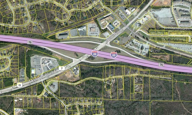
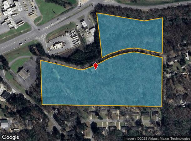
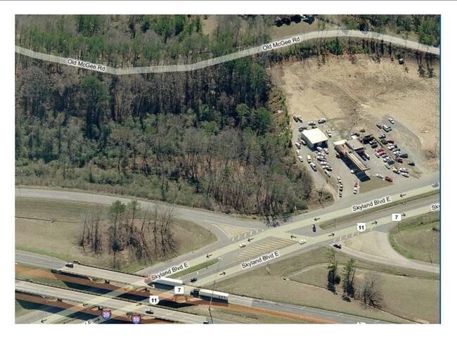
Old Mcgee Rd, Tuscaloosa, AL 35405
NEARBY LISTINGS FOR SALE OR LEASE
Property Detail
Old Mcgee Rd
30-08-33-4-001-003.000
BEG 75(S) SW OF INT E LN S33 & S ROW I-59 TH S 930(S); W 1265 (S); N 505(S); E'LY 680(S); N 465(S); SE 490(S); NE 195(S) TO POB IN NE1/4-SE1/4 S33 T21S R9W L&E ROAD ROW
Vacantlandnec
Tuscaloosa
X
Alabama
01125C0536G
19 AC
2025
Tuscaloosa
2024
Birmingham
012503
Tuscaloosa, AL
1,868 SF
DEMOGRAPHICS near Old Mcgee Rd
1 Mile
3 Mile
5 Mile
2024 Total Population
4,003
34,169
88,702
2029 Population
4,516
38,946
100,805
Pop Growth 2024-2029
+ 12.82%
+ 13.98%
+ 13.64%
Average Age
42
38
35
2024 Total Households
1,615
14,854
35,929
HH Growth 2024-2029
+ 12.01%
+ 13.48%
+ 14.31%
Median Household Inc
$68,926
$56,657
$43,328
Avg Household Size
2.30
2.20
2.20
2024 Avg HH Vehicles
2.00
2.00
2.00
Median Home Value
$204,354
$183,389
$179,167
Median Year Built
1991
1990
1992
Nearby Places
- Restaurants
- Banks
- Shops
- Fitness
- Groceries
PUBLIC TRANSPORTATION
COMMUTER RAIL
Tuscaloosa Amtrak Station (Crescent - Amtrak)
DRIVE
WALK
Distance
Tuscaloosa Amtrak Station (Crescent - Amtrak)
10 min
7.2 mi
Freight Ports
Port of Mobile
DRIVE
WALK
Distance
Port of Mobile
242 min
202.7 mi
SALE & LEASE HISTORY
LISTING DATE
SALE/LEASE

Sep 29, 2020
For Sale
Nearby Properties
Address
Land Use
TOTAL SIZE
Lot Size
Zoning
Address
Land Use
TOTAL SIZE
Lot Size
Zoning
8,760 SF
23 AC
R4
Address
Land Use
TOTAL SIZE
Lot Size
Zoning
9,616 SF
30.17 AC
R4
Address
Land Use
TOTAL SIZE
Lot Size
Zoning
9,328 SF
19 AC
RMF1
Address
Land Use
TOTAL SIZE
Lot Size
Zoning
1,088 SF
17 AC
R4
Address
Land Use
TOTAL SIZE
Lot Size
Zoning
5,568 SF
50 AC
Address
Land Use
TOTAL SIZE
Lot Size
Zoning
25,155 SF
6 AC
R4
Address
Land Use
TOTAL SIZE
Lot Size
Zoning
15,912 SF
22 AC
Address
Land Use
TOTAL SIZE
Lot Size
Zoning
32,616 SF
11 AC
Address
Land Use
TOTAL SIZE
Lot Size
Zoning
9,796 SF
14 AC
RMF1
Address
Land Use
TOTAL SIZE
Lot Size
Zoning
16,536 SF
15.96 AC
R4
Address
Land Use
TOTAL SIZE
Lot Size
Zoning
2,442 SF
10.85 AC
R4
Address
Land Use
TOTAL SIZE
Lot Size
Zoning
13,110 SF
7.33 AC
RMF1
Address
Land Use
TOTAL SIZE
Lot Size
Zoning
8,454 SF
5.30 AC
BH
Address
Land Use
TOTAL SIZE
Lot Size
Zoning
20,535 SF
5.50 AC
R4
Address
Land Use
TOTAL SIZE
Lot Size
Zoning
174,624 SF
9.90 AC
BN
Address
Land Use
TOTAL SIZE
Lot Size
Zoning
6,992 SF
13 AC
RMF1
Address
Land Use
TOTAL SIZE
Lot Size
Zoning
8,000 SF
8.30 AC
R4
Address
Land Use
TOTAL SIZE
Lot Size
Zoning
206,739 SF
22.69 AC
BN
Address
Land Use
TOTAL SIZE
Lot Size
Zoning
56,211 SF
2.05 AC
BH
Address
Land Use
TOTAL SIZE
Lot Size
Zoning
22,672 SF
13 AC
R4
Address
Land Use
TOTAL SIZE
Lot Size
Zoning
66,949 SF
3.60 AC
BH
Address
Land Use
TOTAL SIZE
Lot Size
Zoning
42,408 SF
5.50 AC
R4
Address
Land Use
TOTAL SIZE
Lot Size
Zoning
55,862 SF
11 AC
BH
Address
Land Use
TOTAL SIZE
Lot Size
Zoning
59,082 SF
4.13 AC
R1
Address
Land Use
TOTAL SIZE
Lot Size
Zoning
25,200 SF
35.03 AC
BN
Address
Land Use
TOTAL SIZE
Lot Size
Zoning
59,344 SF
13.73 AC
BH
Address
Land Use
TOTAL SIZE
Lot Size
Zoning
106,272 SF
12 AC
BN
Address
Land Use
TOTAL SIZE
Lot Size
Zoning
58,099 SF
1.77 AC
BH
Address
Land Use
TOTAL SIZE
Lot Size
Zoning
41,250 SF
2.22 AC
BH
Address
Land Use
TOTAL SIZE
Lot Size
Zoning
39,797 SF
1.96 AC
The World's #1 Commercial Real Estate Marketplace
Connect with us
© 2025 CoStar Group
The information above has been obtained from sources believed reliable. While we do not doubt its accuracy we have not verified it and make no guarantee, warranty or representation about it. It is your responsibility to independently confirm its accuracy and completeness. Any projections, opinions, assumptions, or estimates used are for example only and do not represent the current or future performance of the property. The value of this transaction to you depends on tax and other factors which should be evaluated by your tax, financial, and legal advisors. You and your advisors should conduct a careful, independent investigation of the property to determine to your satisfaction the suitability of the property for your needs.