Property Record
Bethsaida Rd, South Fulton, GA 30349
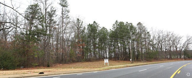

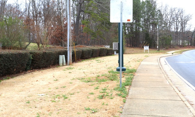

This Property Is For Sale
NEARBY LISTINGS FOR SALE OR LEASE
Property Detail
Bethsaida Rd
13-0164-LL-022-0
Fulton
Commercialacreage
Georgia
X
11.66 AC
13121C0490F
North Clayton/Airport
2024
Atlanta
2025
Atlanta-Sandy Springs-Roswell, GA
010529
DEMOGRAPHICS near Bethsaida Rd
1 Mile
3 Mile
5 Mile
2024 Total Population
6,988
53,937
153,473
2029 Population
7,205
55,105
156,265
Pop Growth 2024-2029
+ 3.11%
+ 2.17%
+ 1.82%
Average Age
37
39
37
2024 Total Households
2,308
19,262
57,632
HH Growth 2024-2029
+ 3.29%
+ 2.24%
+ 1.79%
Median Household Inc
$66,322
$62,943
$53,044
Avg Household Size
2.90
2.70
2.60
2024 Avg HH Vehicles
2.00
2.00
2.00
Median Home Value
$214,545
$183,699
$173,428
Median Year Built
1998
1989
1987
Nearby Places
- Restaurants
- Banks
- Shops
- Fitness
- Groceries
PUBLIC TRANSPORTATION
AIRPORT
Hartsfield - Jackson Atlanta International
DRIVE
WALK
Distance
Hartsfield - Jackson Atlanta International
20 min
10.6 mi
Freight Ports
Georgia Ports - Savannah
DRIVE
WALK
Distance
Georgia Ports - Savannah
275 min
242.6 mi
Nearby Properties
Address
Land Use
TOTAL SIZE
Lot Size
Zoning
Address
Land Use
TOTAL SIZE
Lot Size
Zoning
1,026,040 SF
72.52 AC
M1
Address
Land Use
TOTAL SIZE
Lot Size
Zoning
948,900 SF
16.24 AC
RM
Address
Land Use
TOTAL SIZE
Lot Size
Zoning
85,347 SF
49.56 AC
AG1
Address
Land Use
TOTAL SIZE
Lot Size
Zoning
3,904,656 SF
30.58 AC
RM
Address
Land Use
TOTAL SIZE
Lot Size
Zoning
278 SF
18.53 AC
PUD
Address
Land Use
TOTAL SIZE
Lot Size
Zoning
358,011 SF
60.44 AC
AG1
Address
Land Use
TOTAL SIZE
Lot Size
Zoning
1,053,234 SF
14.47 AC
RM
Address
Land Use
TOTAL SIZE
Lot Size
Zoning
147,540 SF
47.10 AC
C RP
Address
Land Use
TOTAL SIZE
Lot Size
Zoning
369,000 SF
43.81 AC
AC
Address
Land Use
TOTAL SIZE
Lot Size
Zoning
257,723 SF
28.76 AC
C1
Address
Land Use
TOTAL SIZE
Lot Size
Zoning
137,872 SF
14.23 AC
Address
Land Use
TOTAL SIZE
Lot Size
Zoning
93,568 SF
15.84 AC
R4C
Address
Land Use
TOTAL SIZE
Lot Size
Zoning
95,422 SF
17.28 AC
Address
Land Use
TOTAL SIZE
Lot Size
Zoning
86,781 SF
16 AC
RS110
Address
Land Use
TOTAL SIZE
Lot Size
Zoning
138,852 SF
6.72 AC
C CH
Address
Land Use
TOTAL SIZE
Lot Size
Zoning
132,252 SF
14.33 AC
C1C
Address
Land Use
TOTAL SIZE
Lot Size
Zoning
116,848 SF
8.51 AC
Address
Land Use
TOTAL SIZE
Lot Size
Zoning
97,408 SF
16.01 AC
C1
Address
Land Use
TOTAL SIZE
Lot Size
Zoning
72.57 AC
RM
Address
Land Use
TOTAL SIZE
Lot Size
Zoning
91,767 SF
19.83 AC
R4
Address
Land Use
TOTAL SIZE
Lot Size
Zoning
73,138 SF
5.40 AC
SUBA
Address
Land Use
TOTAL SIZE
Lot Size
Zoning
100,000 SF
8.96 AC
AG1
Address
Land Use
TOTAL SIZE
Lot Size
Zoning
84,645 SF
8.24 AC
C1
Address
Land Use
TOTAL SIZE
Lot Size
Zoning
67,595 SF
14.80 AC
RS180
Address
Land Use
TOTAL SIZE
Lot Size
Zoning
42,615 SF
9.27 AC
RS110
Address
Land Use
TOTAL SIZE
Lot Size
Zoning
117,381 SF
5.97 AC
C1
Address
Land Use
TOTAL SIZE
Lot Size
Zoning
448,625 SF
6.91 AC
A
Address
Land Use
TOTAL SIZE
Lot Size
Zoning
134,136 SF
9.19 AC
Address
Land Use
TOTAL SIZE
Lot Size
Zoning
40,703 SF
7.44 AC
RM
Address
Land Use
TOTAL SIZE
Lot Size
Zoning
31,620 SF
4.99 AC
R4C
The World's #1 Commercial Real Estate Marketplace
Connect with us
© 2025 CoStar Group
The information above has been obtained from sources believed reliable. While we do not doubt its accuracy we have not verified it and make no guarantee, warranty or representation about it. It is your responsibility to independently confirm its accuracy and completeness. Any projections, opinions, assumptions, or estimates used are for example only and do not represent the current or future performance of the property. The value of this transaction to you depends on tax and other factors which should be evaluated by your tax, financial, and legal advisors. You and your advisors should conduct a careful, independent investigation of the property to determine to your satisfaction the suitability of the property for your needs.