Property Record
Olive Ave, Morgan Hill, CA 95037

Property Detail
Olive Ave
779-05-043
SANTA CLARA
Residentialacreage
California
RR5AC
13-15
AE The base floodplain where base flood elevations are provided. AE Zones are now used on new format FIRMs instead of A1-A30 Zones.
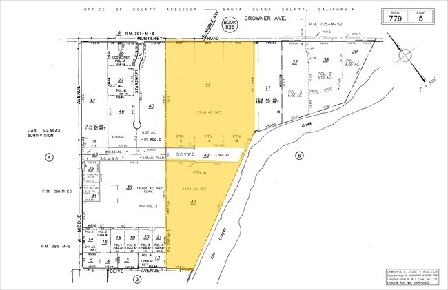
16.12 AC
2024
Morgan Hill
2025
South Bay/San Jose
512312
San Jose-Sunnyvale-Santa Clara, CA
NEARBY LISTINGS FOR SALE OR LEASE
-
-
-
-
-
-
-
No Photo
-
View all Morgan Hill listings for sale on LoopNet.com
DEMOGRAPHICS near Olive Ave
1 mile
3 mile
5 mile
2025 Total Population
3,681
35,458
64,659
2030 Population
3,692
35,995
65,712
Pop Growth 2025-2030
+ 0.30%
+ 1.51%
+ 1.63%
Average Age
46
41
41
2025 Total Households
1,315
11,668
20,741
HH Growth 2025-2030
+ 0.46%
+ 1.56%
+ 1.65%
Median Household Inc
$146,278
$148,429
$163,409
Avg Household Size
2.70
2.90
3.00
2025 Avg HH Vehicles
2.00
2.00
2.00
Median Home Value
$946,540
$1,065,791
$1,077,593
Median Year Built
1978
1983
1986
Nearby Places
Map Layers
Map Styles
 Street
 Aerial
Transit
 Traffic
 Biking
Places
Listings with unknown addresses are not visible on the map
- Restaurants
- Banks
- Shops
- Fitness
- Groceries
PUBLIC TRANSPORTATION
COMMUTER RAIL
San Martin Caltrain Station Southbound (South Santa Clara County Connector - Caltrain (Caltrain))
Drive
Walk
Distance
San Martin Caltrain Station Southbound (South Santa Clara County Connector - Caltrain (Caltrain))
4 min
2.0 mi
San Martin Caltrain Station Northbound (South Santa Clara County Connector - Caltrain (Caltrain))
Drive
Walk
Distance
San Martin Caltrain Station Northbound (South Santa Clara County Connector - Caltrain (Caltrain))
4 min
2.2 mi
AIRPORT
Norman Y Mineta San Jose International
Drive
Walk
Distance
Norman Y Mineta San Jose International
38 min
28.9 mi
Freight Ports
Port of Redwood City
Drive
Walk
Distance
Port of Redwood City
59 min
47.0 mi
Nearby Properties
Address
Land Use
TOTAL SIZE
Lot Size
Zoning
Address
Land Use
TOTAL SIZE
Lot Size
Zoning
223,897 SF
8.25 AC
A-20A
Address
Land Use
TOTAL SIZE
Lot Size
Zoning
133,738 SF
5.66 AC
APD
Address
Land Use
TOTAL SIZE
Lot Size
Zoning
6,748 SF
26.12 AC
PUD
Address
Land Use
TOTAL SIZE
Lot Size
Zoning
23.56 AC
R1
Address
Land Use
TOTAL SIZE
Lot Size
Zoning
128,450 SF
1.65 AC
CC
Address
Land Use
TOTAL SIZE
Lot Size
Zoning
112,738 SF
4.05 AC
R3
Address
Land Use
TOTAL SIZE
Lot Size
Zoning
91,712 SF
4.03 AC
R3
Address
Land Use
TOTAL SIZE
Lot Size
Zoning
60,890 SF
1.73 AC
R3
Address
Land Use
TOTAL SIZE
Lot Size
Zoning
137,553 SF
8.09 AC
R3
Address
Land Use
TOTAL SIZE
Lot Size
Zoning
9.24 AC
PUD
Address
Land Use
TOTAL SIZE
Lot Size
Zoning
58,035 SF
2.60 AC
PUDHC
Address
Land Use
TOTAL SIZE
Lot Size
Zoning
2.25 AC
MH
Address
Land Use
TOTAL SIZE
Lot Size
Zoning
44,909 SF
0.50 AC
PUD
Address
Land Use
TOTAL SIZE
Lot Size
Zoning
2.79 AC
R3
Address
Land Use
TOTAL SIZE
Lot Size
Zoning
100 SF
11.86 AC
PUD
Address
Land Use
TOTAL SIZE
Lot Size
Zoning
400 SF
3.67 AC
ML
Address
Land Use
TOTAL SIZE
Lot Size
Zoning
60,679 SF
4.52 AC
CG
Address
Land Use
TOTAL SIZE
Lot Size
Zoning
20,140.41 AC
SJ
Address
Land Use
TOTAL SIZE
Lot Size
Zoning
98,151 SF
4.55 AC
M
Address
Land Use
TOTAL SIZE
Lot Size
Zoning
74,982 SF
4.79 AC
R3
Address
Land Use
TOTAL SIZE
Lot Size
Zoning
32,500 SF
1.39 AC
PUD
Address
Land Use
TOTAL SIZE
Lot Size
Zoning
53,997 SF
4.98 AC
C1
Address
Land Use
TOTAL SIZE
Lot Size
Zoning
47,098 SF
2.30 AC
R3
Address
Land Use
TOTAL SIZE
Lot Size
Zoning
2.69 AC
MH
Address
Land Use
TOTAL SIZE
Lot Size
Zoning
3.98 AC
APD
Address
Land Use
TOTAL SIZE
Lot Size
Zoning
39,166 SF
15.10 AC
HS
Address
Land Use
TOTAL SIZE
Lot Size
Zoning
28,662 SF
2.63 AC
R3
Address
Land Use
TOTAL SIZE
Lot Size
Zoning
69,615 SF
2.93 AC
MH
Address
Land Use
TOTAL SIZE
Lot Size
Zoning
50,086 SF
2.02 AC
HC
The World's #1 Commercial Real Estate Marketplace
Connect with us
© 2026 CoStar Group
The information above has been obtained from sources believed reliable. While we do not doubt its accuracy we have not verified it and make no guarantee, warranty or representation about it. It is your responsibility to independently confirm its accuracy and completeness. Any projections, opinions, assumptions, or estimates used are for example only and do not represent the current or future performance of the property. The value of this transaction to you depends on tax and other factors which should be evaluated by your tax, financial, and legal advisors. You and your advisors should conduct a careful, independent investigation of the property to determine to your satisfaction the suitability of the property for your needs.