Property Record
Ooo Unassigned, Oronoco, MN 55960


Property Detail
Ooo Unassigned
Rochester, MN
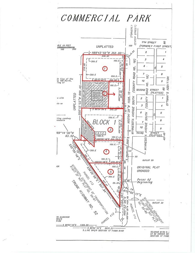
SECT-17 TWP-108 RANGE-014 ORONOCO COMMERCIAL PARK LOT-003 BLOCK-001 LOT 3 BLK 1
84.17.32.077791
OLMSTED
Commercialacreage
Minnesota
B and X Area of moderate flood hazard, usually the area between the limits of the 100-year and 500-year floods.
3
2025
2.07 AC
2024
Rochester
001902
Other Market Areas
NEARBY LISTINGS FOR SALE OR LEASE
-
-
View all Oronoco listings for sale on LoopNet.com
DEMOGRAPHICS near Ooo Unassigned
1 mile
3 mile
5 mile
2025 Total Population
1,630
3,172
12,946
2030 Population
1,635
3,211
13,269
Pop Growth 2025-2030
+ 0.31%
+ 1.23%
+ 2.49%
Average Age
38
39
38
2025 Total Households
536
1,080
4,497
HH Growth 2025-2030
+ 0.19%
+ 1.30%
+ 2.45%
Median Household Inc
$133,750
$124,012
$123,397
Avg Household Size
3.00
2.90
2.80
2025 Avg HH Vehicles
3.00
2.00
2.00
Median Home Value
$534,585
$548,581
$450,648
Median Year Built
1993
1989
2001
Nearby Places
Map Layers
Map Styles
 Street
 Aerial
Layers
 Traffic
 Biking
Places
Listings with unknown addresses are not visible on the map
- Restaurants
- Banks
- Shops
- Fitness
- Groceries
PUBLIC TRANSPORTATION
AIRPORT
Rochester International
Drive
Walk
Distance
Rochester International
27 min
19.4 mi
SALE & LEASE HISTORY
LISTING DATE
SALE/LEASE

Sep 24, 2016
For Sale
Nearby Properties
Address
Land Use
TOTAL SIZE
Lot Size
Zoning
Address
Land Use
TOTAL SIZE
Lot Size
Zoning
77,297 SF
18.92 AC
Address
Land Use
TOTAL SIZE
Lot Size
Zoning
32,432 SF
16.45 AC
Address
Land Use
TOTAL SIZE
Lot Size
Zoning
48.22 AC
Address
Land Use
TOTAL SIZE
Lot Size
Zoning
17,280 SF
11.97 AC
Address
Land Use
TOTAL SIZE
Lot Size
Zoning
10,400 SF
9.99 AC
Address
Land Use
TOTAL SIZE
Lot Size
Zoning
2,872 SF
20 AC
Address
Land Use
TOTAL SIZE
Lot Size
Zoning
20,880 SF
3.25 AC
Address
Land Use
TOTAL SIZE
Lot Size
Zoning
40,632 SF
35.71 AC
Address
Land Use
TOTAL SIZE
Lot Size
Zoning
2,789 SF
160 AC
Address
Land Use
TOTAL SIZE
Lot Size
Zoning
12,000 SF
3.81 AC
Address
Land Use
TOTAL SIZE
Lot Size
Zoning
1,312 SF
16.40 AC
Address
Land Use
TOTAL SIZE
Lot Size
Zoning
15,680 SF
3.34 AC
Address
Land Use
TOTAL SIZE
Lot Size
Zoning
1,656 SF
160 AC
Address
Land Use
TOTAL SIZE
Lot Size
Zoning
96 SF
133.10 AC
Address
Land Use
TOTAL SIZE
Lot Size
Zoning
1,642 SF
155 AC
Address
Land Use
TOTAL SIZE
Lot Size
Zoning
38,668 SF
5.71 AC
Address
Land Use
TOTAL SIZE
Lot Size
Zoning
17,408 SF
0.58 AC
Address
Land Use
TOTAL SIZE
Lot Size
Zoning
8,912 SF
5 AC
Address
Land Use
TOTAL SIZE
Lot Size
Zoning
4,100 SF
2.06 AC
Address
Land Use
TOTAL SIZE
Lot Size
Zoning
1,052 SF
11 AC
Address
Land Use
TOTAL SIZE
Lot Size
Zoning
11,640 SF
8.60 AC
Address
Land Use
TOTAL SIZE
Lot Size
Zoning
12.44 AC
Address
Land Use
TOTAL SIZE
Lot Size
Zoning
13,254 SF
1 AC
Address
Land Use
TOTAL SIZE
Lot Size
Zoning
8,369 SF
8.01 AC
Address
Land Use
TOTAL SIZE
Lot Size
Zoning
Address
Land Use
TOTAL SIZE
Lot Size
Zoning
Address
Land Use
TOTAL SIZE
Lot Size
Zoning
2,384 SF
91.20 AC
Address
Land Use
TOTAL SIZE
Lot Size
Zoning
3,600 SF
1.29 AC
Address
Land Use
TOTAL SIZE
Lot Size
Zoning
1,600 SF
3.56 AC
The World's #1 Commercial Real Estate Marketplace
Connect with us
© 2026 CoStar Group
The information above has been obtained from sources believed reliable. While we do not doubt its accuracy we have not verified it and make no guarantee, warranty or representation about it. It is your responsibility to independently confirm its accuracy and completeness. Any projections, opinions, assumptions, or estimates used are for example only and do not represent the current or future performance of the property. The value of this transaction to you depends on tax and other factors which should be evaluated by your tax, financial, and legal advisors. You and your advisors should conduct a careful, independent investigation of the property to determine to your satisfaction the suitability of the property for your needs.