Property Record
Open, Riverhead, NY 11901

Property Detail
Open
Nassau County-Suffolk County, NY
96 INCORPORATED FILED MA40
0900-119-00-02-00-004-025
SUFFOLK
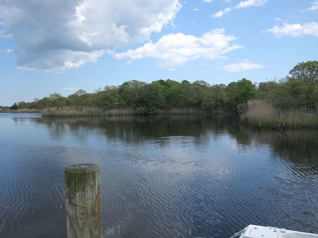
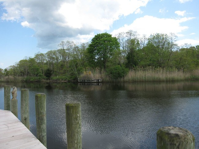
Wildliferefuge
New York
R40
4
AE The base floodplain where base flood elevations are provided. AE Zones are now used on new format FIRMs instead of A1-A30 Zones.
5.32 AC
0
Eastern Suffolk
2025
Long Island (New York)
190405
NEARBY LISTINGS FOR SALE OR LEASE
DEMOGRAPHICS near Open
1 mile
3 mile
5 mile
2025 Total Population
6,021
23,395
33,713
2030 Population
6,076
23,559
33,925
Pop Growth 2025-2030
+ 0.91%
+ 0.70%
+ 0.63%
Average Age
38
40
42
2025 Total Households
1,980
7,876
12,128
HH Growth 2025-2030
+ 0.76%
+ 0.44%
+ 0.26%
Median Household Inc
$46,209
$84,853
$83,319
Avg Household Size
2.90
2.80
2.60
2025 Avg HH Vehicles
2.00
2.00
2.00
Median Home Value
$417,766
$468,841
$491,706
Median Year Built
1979
1977
1982
Nearby Places
Map Layers
Map Styles
 Street
 Aerial
Layers
 Traffic
 Biking
Places
Listings with unknown addresses are not visible on the map
- Restaurants
- Banks
- Shops
- Fitness
- Groceries
PUBLIC TRANSPORTATION
COMMUTER RAIL
Riverhead Station (Greenport Branch - Long Island Rail Road)
Drive
Walk
Distance
Riverhead Station (Greenport Branch - Long Island Rail Road)
6 min
2.5 mi
Westhampton Station (Montauk Branch - Long Island Rail Road)
Drive
Walk
Distance
Westhampton Station (Montauk Branch - Long Island Rail Road)
12 min
7.8 mi
AIRPORT
Long Island MacArthur
Drive
Walk
Distance
Long Island MacArthur
47 min
29.8 mi
Freight Ports
Port of New Haven
Drive
Walk
Distance
Port of New Haven
153 min
62.2 mi
Nearby Properties
Address
Land Use
TOTAL SIZE
Lot Size
Zoning
Address
Land Use
TOTAL SIZE
Lot Size
Zoning
233,668 SF
82.70 AC
CR200
Address
Land Use
TOTAL SIZE
Lot Size
Zoning
450,000 SF
8.50 AC
3
Address
Land Use
TOTAL SIZE
Lot Size
Zoning
252,053 SF
31.60 AC
3
Address
Land Use
TOTAL SIZE
Lot Size
Zoning
49,680 SF
1.30 AC
8
Address
Land Use
TOTAL SIZE
Lot Size
Zoning
176,704 SF
34.70 AC
3
Address
Land Use
TOTAL SIZE
Lot Size
Zoning
51.70 AC
R15
Address
Land Use
TOTAL SIZE
Lot Size
Zoning
18,880 SF
213 AC
CR200
Address
Land Use
TOTAL SIZE
Lot Size
Zoning
8,100 SF
4.31 AC
LI40
Address
Land Use
TOTAL SIZE
Lot Size
Zoning
222 AC
H2O
Address
Land Use
TOTAL SIZE
Lot Size
Zoning
197.50 AC
Address
Land Use
TOTAL SIZE
Lot Size
Zoning
17 AC
CR200
Address
Land Use
TOTAL SIZE
Lot Size
Zoning
151,290 SF
6.17 AC
08
Address
Land Use
TOTAL SIZE
Lot Size
Zoning
81.70 AC
R60
Address
Land Use
TOTAL SIZE
Lot Size
Zoning
36,883 SF
14.80 AC
R15
Address
Land Use
TOTAL SIZE
Lot Size
Zoning
23,743 SF
5.80 AC
MTL
Address
Land Use
TOTAL SIZE
Lot Size
Zoning
485.30 AC
CR60
Address
Land Use
TOTAL SIZE
Lot Size
Zoning
16,699 SF
24.81 AC
03
Address
Land Use
TOTAL SIZE
Lot Size
Zoning
29.72 AC
R20
Address
Land Use
TOTAL SIZE
Lot Size
Zoning
68.90 AC
H2O
Address
Land Use
TOTAL SIZE
Lot Size
Zoning
31,462 SF
5.74 AC
LI200
Address
Land Use
TOTAL SIZE
Lot Size
Zoning
403.50 AC
CR200
Address
Land Use
TOTAL SIZE
Lot Size
Zoning
108,572 SF
17.30 AC
04
Address
Land Use
TOTAL SIZE
Lot Size
Zoning
108,504 SF
31.20 AC
SC
Address
Land Use
TOTAL SIZE
Lot Size
Zoning
3,468 SF
17.70 AC
CR60
Address
Land Use
TOTAL SIZE
Lot Size
Zoning
13,773 SF
11.65 AC
03
Address
Land Use
TOTAL SIZE
Lot Size
Zoning
36.60 AC
RC
Address
Land Use
TOTAL SIZE
Lot Size
Zoning
4,410 SF
1 AC
OD
Address
Land Use
TOTAL SIZE
Lot Size
Zoning
113,634 SF
27.49 AC
04
Address
Land Use
TOTAL SIZE
Lot Size
Zoning
3,362 SF
3 AC
RWB
Address
Land Use
TOTAL SIZE
Lot Size
Zoning
28.97 AC
R40
The World's #1 Commercial Real Estate Marketplace
Connect with us
© 2026 CoStar Group
The information above has been obtained from sources believed reliable. While we do not doubt its accuracy we have not verified it and make no guarantee, warranty or representation about it. It is your responsibility to independently confirm its accuracy and completeness. Any projections, opinions, assumptions, or estimates used are for example only and do not represent the current or future performance of the property. The value of this transaction to you depends on tax and other factors which should be evaluated by your tax, financial, and legal advisors. You and your advisors should conduct a careful, independent investigation of the property to determine to your satisfaction the suitability of the property for your needs.