Property Record
Orchard Ave, La Mesa, CA 91942


Save to a Folder
{{folder.Name}}
{{folder.ListingIds.length}} Properties
{{folder.ListingIds.length}} Property
Create a New Folder
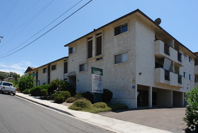
Property Detail
Orchard Ave
San Diego-Chula Vista-Carlsbad, CA
BLK 1 LOT 6 TR 001102
494-150-06
SAN DIEGO
Residentialacreage
California
R1
6
B and X Area of moderate flood hazard, usually the area between the limits of the 100-year and 500-year floods.
0.15 AC
2025
La Mesa
2026
San Diego
014803
NEARBY LISTINGS FOR SALE OR LEASE
DEMOGRAPHICS near Orchard Ave
1 mile
3 mile
5 mile
2025 Total Population
24,258
172,668
464,810
2030 Population
24,458
172,983
465,201
Pop Growth 2025-2030
+ 0.82%
+ 0.18%
+ 0.08%
Average Age
40
39
39
2025 Total Households
10,303
63,492
160,618
HH Growth 2025-2030
+ 0.77%
+ 0.10%
(0.01%)
Median Household Inc
$85,326
$94,520
$90,115
Avg Household Size
2.30
2.60
2.70
2025 Avg HH Vehicles
2.00
2.00
2.00
Median Home Value
$769,938
$783,849
$761,847
Median Year Built
1971
1968
1971
Nearby Places
Map Layers
Map Styles
 Street
 Aerial
Layers
 Traffic
 Biking
Places
Listings with unknown addresses are not visible on the map
- Restaurants
- Banks
- Shops
- Fitness
- Groceries
PUBLIC TRANSPORTATION
AIRPORT
San Diego International
Drive
Walk
Distance
San Diego International
18 min
12.4 mi
Freight Ports
Port of San Diego
Drive
Walk
Distance
Port of San Diego
18 min
10.7 mi
Nearby Properties
Address
Land Use
TOTAL SIZE
Lot Size
Zoning
Address
Land Use
TOTAL SIZE
Lot Size
Zoning
9,999 SF
30.38 AC
RB
Address
Land Use
TOTAL SIZE
Lot Size
Zoning
8.23 AC
CUPD-CU-2-
Address
Land Use
TOTAL SIZE
Lot Size
Zoning
62.04 AC
C
Address
Land Use
TOTAL SIZE
Lot Size
Zoning
9,999 SF
6.79 AC
C
Address
Land Use
TOTAL SIZE
Lot Size
Zoning
9,999 SF
5.02 AC
RM-4-10
Address
Land Use
TOTAL SIZE
Lot Size
Zoning
9,999 SF
4.77 AC
C
Address
Land Use
TOTAL SIZE
Lot Size
Zoning
9,999 SF
8.65 AC
R3
Address
Land Use
TOTAL SIZE
Lot Size
Zoning
135,165 SF
12.24 AC
CC-5-3
Address
Land Use
TOTAL SIZE
Lot Size
Zoning
9,999 SF
4.73 AC
RM-4-10
Address
Land Use
TOTAL SIZE
Lot Size
Zoning
2,500 SF
7.05 AC
R3
Address
Land Use
TOTAL SIZE
Lot Size
Zoning
9,999 SF
1.54 AC
RM-3-9
Address
Land Use
TOTAL SIZE
Lot Size
Zoning
2.82 AC
R3
Address
Land Use
TOTAL SIZE
Lot Size
Zoning
9,999 SF
4.10 AC
RB
Address
Land Use
TOTAL SIZE
Lot Size
Zoning
9,999 SF
11.28 AC
C
Address
Land Use
TOTAL SIZE
Lot Size
Zoning
9,999 SF
5.47 AC
R3
Address
Land Use
TOTAL SIZE
Lot Size
Zoning
9,999 SF
6.14 AC
R3
Address
Land Use
TOTAL SIZE
Lot Size
Zoning
9,999 SF
13.48 AC
CC-1-3
Address
Land Use
TOTAL SIZE
Lot Size
Zoning
9,999 SF
C
Address
Land Use
TOTAL SIZE
Lot Size
Zoning
9,999 SF
6.31 AC
CC-1-3
Address
Land Use
TOTAL SIZE
Lot Size
Zoning
480 SF
0.18 AC
RM-3-9
Address
Land Use
TOTAL SIZE
Lot Size
Zoning
2,988 SF
6.12 AC
RB
Address
Land Use
TOTAL SIZE
Lot Size
Zoning
4,900 SF
3.54 AC
R3
Address
Land Use
TOTAL SIZE
Lot Size
Zoning
9,999 SF
5.17 AC
R3
Address
Land Use
TOTAL SIZE
Lot Size
Zoning
9,332 SF
1.14 AC
C
Address
Land Use
TOTAL SIZE
Lot Size
Zoning
9,999 SF
6.72 AC
RM-3-7
Address
Land Use
TOTAL SIZE
Lot Size
Zoning
3,198 SF
5 AC
RM-2200
Address
Land Use
TOTAL SIZE
Lot Size
Zoning
9,999 SF
17.63 AC
RM-1-3
Address
Land Use
TOTAL SIZE
Lot Size
Zoning
3,964 SF
5.25 AC
R3
Address
Land Use
TOTAL SIZE
Lot Size
Zoning
7,270 SF
3.40 AC
RM-3-7
Address
Land Use
TOTAL SIZE
Lot Size
Zoning
8,902 SF
3.86 AC
RM-3-9
The World's #1 Commercial Real Estate Marketplace
Connect with us
© 2026 CoStar Group
The information above has been obtained from sources believed reliable. While we do not doubt its accuracy we have not verified it and make no guarantee, warranty or representation about it. It is your responsibility to independently confirm its accuracy and completeness. Any projections, opinions, assumptions, or estimates used are for example only and do not represent the current or future performance of the property. The value of this transaction to you depends on tax and other factors which should be evaluated by your tax, financial, and legal advisors. You and your advisors should conduct a careful, independent investigation of the property to determine to your satisfaction the suitability of the property for your needs.