Property Record
Orcutt Rd, Rural San Luis Obispo, CA 93401

NEARBY LISTINGS FOR SALE OR LEASE
-
-
View all Rural San Luis Obispo listings for sale on LoopNet.com
Property Detail
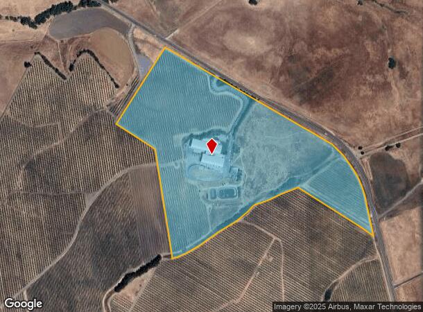
Orcutt Rd
044-051-035
PM 53/59 PTN PAR 1
Winery
San Luis Obispo
X
California
06079C1355G
48.60 AC
2024
Outlying SLO County
2025
San Luis Obispo/Paso Robles
011103
San Luis Obispo-Paso Robles-Arroyo Grande, CA
41,976 SF
DEMOGRAPHICS near Orcutt Rd
1 Mile
3 Mile
5 Mile
2024 Total Population
61
12,292
43,353
2029 Population
62
12,313
43,459
Pop Growth 2024-2029
+ 1.64%
+ 0.17%
+ 0.24%
Average Age
41
42
37
2024 Total Households
19
4,927
16,740
HH Growth 2024-2029
+ 5.26%
(0.04%)
0.00%
Median Household Inc
$137,500
$104,728
$78,011
Avg Household Size
2.50
2.40
2.30
2024 Avg HH Vehicles
2.00
2.00
2.00
Median Home Value
$1,050,000
$925,047
$833,412
Median Year Built
1995
1985
1978
Nearby Places
Map Layers
Map Styles
 Street
 Aerial
- Restaurants
- Banks
- Shops
- Fitness
- Groceries
PUBLIC TRANSPORTATION
COMMUTER RAIL
San Luis Obispo (Coast Starlight - Amtrak, Pacific Surfliner - Amtrak)
DRIVE
WALK
Distance
San Luis Obispo (Coast Starlight - Amtrak, Pacific Surfliner - Amtrak)
10 min
4.5 mi
AIRPORT
San Luis County Regional
DRIVE
WALK
Distance
San Luis County Regional
12 min
4.7 mi
Freight Ports
The Port of Hueneme
DRIVE
WALK
Distance
The Port of Hueneme
171 min
129.2 mi
Nearby Properties
Address
Land Use
TOTAL SIZE
Lot Size
Zoning
Address
Land Use
TOTAL SIZE
Lot Size
Zoning
92,330 SF
3.69 AC
R4
Address
Land Use
TOTAL SIZE
Lot Size
Zoning
Address
Land Use
TOTAL SIZE
Lot Size
Zoning
69,091 SF
20.41 AC
AG
Address
Land Use
TOTAL SIZE
Lot Size
Zoning
91,389 SF
4.65 AC
R4
Address
Land Use
TOTAL SIZE
Lot Size
Zoning
201,280 SF
8.66 AC
M
Address
Land Use
TOTAL SIZE
Lot Size
Zoning
85,863 SF
7.70 AC
R3
Address
Land Use
TOTAL SIZE
Lot Size
Zoning
66,022 SF
3.26 AC
R4
Address
Land Use
TOTAL SIZE
Lot Size
Zoning
59,358 SF
2 AC
M
Address
Land Use
TOTAL SIZE
Lot Size
Zoning
37,842 SF
1.36 AC
CS
Address
Land Use
TOTAL SIZE
Lot Size
Zoning
67,560 SF
10.07 AC
CC
Address
Land Use
TOTAL SIZE
Lot Size
Zoning
39,802 SF
5.04 AC
BP
Address
Land Use
TOTAL SIZE
Lot Size
Zoning
46,390 SF
5.26 AC
CS
Address
Land Use
TOTAL SIZE
Lot Size
Zoning
114,262 SF
5.70 AC
IND
Address
Land Use
TOTAL SIZE
Lot Size
Zoning
66,008 SF
10.75 AC
IND
Address
Land Use
TOTAL SIZE
Lot Size
Zoning
46,106 SF
2.23 AC
CN
Address
Land Use
TOTAL SIZE
Lot Size
Zoning
33,130 SF
3.23 AC
BP
Address
Land Use
TOTAL SIZE
Lot Size
Zoning
36,668 SF
129.30 AC
REC
Address
Land Use
TOTAL SIZE
Lot Size
Zoning
141,309 SF
9.98 AC
RS
Address
Land Use
TOTAL SIZE
Lot Size
Zoning
43,580 SF
1.65 AC
M
Address
Land Use
TOTAL SIZE
Lot Size
Zoning
52,467 SF
2.36 AC
CS
Address
Land Use
TOTAL SIZE
Lot Size
Zoning
331,196 SF
5.01 AC
CS
Address
Land Use
TOTAL SIZE
Lot Size
Zoning
60,852 SF
1.81 AC
Address
Land Use
TOTAL SIZE
Lot Size
Zoning
23,907 SF
1.65 AC
CS
Address
Land Use
TOTAL SIZE
Lot Size
Zoning
108,940 SF
7.10 AC
M
Address
Land Use
TOTAL SIZE
Lot Size
Zoning
2.15 AC
R3
Address
Land Use
TOTAL SIZE
Lot Size
Zoning
50,283 SF
3.81 AC
CS
Address
Land Use
TOTAL SIZE
Lot Size
Zoning
24,500 SF
0.85 AC
O
Address
Land Use
TOTAL SIZE
Lot Size
Zoning
66,835 SF
6.22 AC
CS
Address
Land Use
TOTAL SIZE
Lot Size
Zoning
60,604 SF
3.96 AC
M
The World's #1 Commercial Real Estate Marketplace
Connect with us
© 2026 CoStar Group
The information above has been obtained from sources believed reliable. While we do not doubt its accuracy we have not verified it and make no guarantee, warranty or representation about it. It is your responsibility to independently confirm its accuracy and completeness. Any projections, opinions, assumptions, or estimates used are for example only and do not represent the current or future performance of the property. The value of this transaction to you depends on tax and other factors which should be evaluated by your tax, financial, and legal advisors. You and your advisors should conduct a careful, independent investigation of the property to determine to your satisfaction the suitability of the property for your needs.