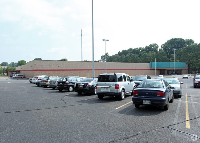
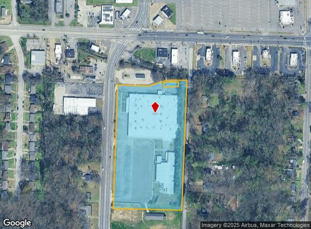
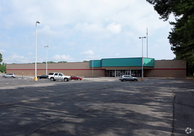
Property Record
Overton Crossing St, Memphis, TN 38127
NEARBY LISTINGS FOR SALE OR LEASE
Property Detail
Overton Crossing St
07-2054-0-0054
Memphis Business Academy Ph 2
Publicschool
PART OF LOTS 21-32
X
Shelby
47157C0280F
Tennessee
0
6.90 AC
2025
North
010121
Memphis
111,016 SF
Memphis, TN-MS-AR
DEMOGRAPHICS near Overton Crossing St
1 Mile
3 Mile
5 Mile
2024 Total Population
10,816
48,415
138,038
2029 Population
10,814
48,549
138,452
Pop Growth 2024-2029
(0.02%)
+ 0.28%
+ 0.30%
Average Age
35
36
36
2024 Total Households
3,746
17,608
52,737
HH Growth 2024-2029
(0.11%)
+ 0.20%
+ 0.22%
Median Household Inc
$37,855
$35,912
$39,211
Avg Household Size
2.80
2.70
2.50
2024 Avg HH Vehicles
2.00
2.00
2.00
Median Home Value
$69,848
$71,366
$92,777
Median Year Built
1964
1965
1966
Nearby Places
Map Layers
Map Styles
 Street
 Aerial
- Restaurants
- Banks
- Shops
- Fitness
- Groceries
PUBLIC TRANSPORTATION
COMMUTER RAIL
Central Station (Riverfront Loop - Memphis Area Transit Authority Trolley (MataTrolley))
DRIVE
WALK
Distance
Central Station (Riverfront Loop - Memphis Area Transit Authority Trolley (MataTrolley))
14 min
8.5 mi
AIRPORT
Memphis International
DRIVE
WALK
Distance
Memphis International
22 min
14.3 mi
Freight Ports
Port of Shreveport
DRIVE
WALK
Distance
Port of Shreveport
406 min
374.7 mi
Nearby Properties
Address
Land Use
TOTAL SIZE
Lot Size
Zoning
Address
Land Use
TOTAL SIZE
Lot Size
Zoning
1,709,372 SF
28.70 AC
EMP
Address
Land Use
TOTAL SIZE
Lot Size
Zoning
1,146,617 SF
62.32 AC
EMP
Address
Land Use
TOTAL SIZE
Lot Size
Zoning
917,056 SF
65.53 AC
EMP
Address
Land Use
TOTAL SIZE
Lot Size
Zoning
31,305 SF
17.89 AC
RU-3
Address
Land Use
TOTAL SIZE
Lot Size
Zoning
90,574 SF
40.74 AC
EMP
Address
Land Use
TOTAL SIZE
Lot Size
Zoning
201,722 SF
64.13 AC
EMP
Address
Land Use
TOTAL SIZE
Lot Size
Zoning
92,798 SF
12.66 AC
RU-3
Address
Land Use
TOTAL SIZE
Lot Size
Zoning
56,620 SF
25.08 AC
R-6
Address
Land Use
TOTAL SIZE
Lot Size
Zoning
32,116 SF
7.61 AC
R-6
Address
Land Use
TOTAL SIZE
Lot Size
Zoning
19,013 SF
3.51 AC
RU-3
Address
Land Use
TOTAL SIZE
Lot Size
Zoning
18,492 SF
8.35 AC
R-6
Address
Land Use
TOTAL SIZE
Lot Size
Zoning
27,930 SF
12.14 AC
RU-3
Address
Land Use
TOTAL SIZE
Lot Size
Zoning
53,176 SF
12.57 AC
RU-3
Address
Land Use
TOTAL SIZE
Lot Size
Zoning
47,756 SF
9.94 AC
RU-3
Address
Land Use
TOTAL SIZE
Lot Size
Zoning
35,890 SF
10.53 AC
RU-3
Address
Land Use
TOTAL SIZE
Lot Size
Zoning
10.26 AC
R-10
Address
Land Use
TOTAL SIZE
Lot Size
Zoning
39,628 SF
8.81 AC
RU-3
Address
Land Use
TOTAL SIZE
Lot Size
Zoning
22,925 SF
13.53 AC
RU-3
Address
Land Use
TOTAL SIZE
Lot Size
Zoning
48,194 SF
5.49 AC
R-6
Address
Land Use
TOTAL SIZE
Lot Size
Zoning
51,253 SF
17.50 AC
RU-3
Address
Land Use
TOTAL SIZE
Lot Size
Zoning
37,092 SF
4.30 AC
RU-3
Address
Land Use
TOTAL SIZE
Lot Size
Zoning
236,244 SF
11.24 AC
EMP
Address
Land Use
TOTAL SIZE
Lot Size
Zoning
84,851 SF
11.25 AC
CMU-2
Address
Land Use
TOTAL SIZE
Lot Size
Zoning
26,828 SF
6.35 AC
RU-3
Address
Land Use
TOTAL SIZE
Lot Size
Zoning
62,008 SF
6.45 AC
RU-3
Address
Land Use
TOTAL SIZE
Lot Size
Zoning
49,200 SF
3.38 AC
CMU-2
Address
Land Use
TOTAL SIZE
Lot Size
Zoning
12,231 SF
4.10 AC
CMU-2
Address
Land Use
TOTAL SIZE
Lot Size
Zoning
30.25 AC
IH
Address
Land Use
TOTAL SIZE
Lot Size
Zoning
35,562 SF
1.45 AC
CMU-1
The World's #1 Commercial Real Estate Marketplace
Connect with us
© 2026 CoStar Group
The information above has been obtained from sources believed reliable. While we do not doubt its accuracy we have not verified it and make no guarantee, warranty or representation about it. It is your responsibility to independently confirm its accuracy and completeness. Any projections, opinions, assumptions, or estimates used are for example only and do not represent the current or future performance of the property. The value of this transaction to you depends on tax and other factors which should be evaluated by your tax, financial, and legal advisors. You and your advisors should conduct a careful, independent investigation of the property to determine to your satisfaction the suitability of the property for your needs.