Property Record
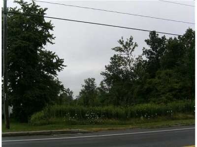
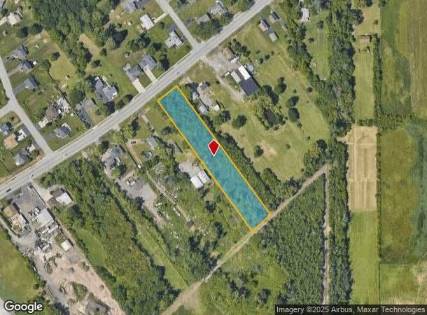
Packard Rd, Niagara Falls, NY 14305
NEARBY LISTINGS FOR SALE OR LEASE
Property Detail
Packard Rd
Buffalo-Cheektowaga-Niagara Falls, NY
STEC - PROSPERITY ACRES 22
293000-145-008-0004-022-000
Niagara
Commercialacreage
New York
X
22.000
36063C0326E
1.50 AC
2016
Niagara Falls
2024
Buffalo/Niagara Falls
020200
DEMOGRAPHICS near Packard Rd
1 Mile
3 Mile
5 Mile
2024 Total Population
2,183
48,259
77,048
2029 Population
2,170
47,588
76,353
Pop Growth 2024-2029
(0.60%)
(1.39%)
(0.90%)
Average Age
43
41
42
2024 Total Households
915
21,406
33,643
HH Growth 2024-2029
(0.55%)
(1.45%)
(0.92%)
Median Household Inc
$51,650
$46,211
$52,122
Avg Household Size
2.30
2.20
2.20
2024 Avg HH Vehicles
2.00
1.00
1.00
Median Home Value
$192,613
$96,287
$141,173
Median Year Built
1974
1951
1954
Nearby Places
Map Layers
Map Styles
 Street
 Aerial
- Restaurants
- Banks
- Shops
- Fitness
- Groceries
PUBLIC TRANSPORTATION
COMMUTER RAIL
Niagara Falls Station (Toronto - New York - VIA Rail)
DRIVE
WALK
Distance
Niagara Falls Station (Toronto - New York - VIA Rail)
9 min
4.3 mi
Niagara Falls Amtrak Station (Empire Service - Amtrak, Maple Leaf - Amtrak)
DRIVE
WALK
Distance
Niagara Falls Amtrak Station (Empire Service - Amtrak, Maple Leaf - Amtrak)
9 min
4.6 mi
AIRPORT
Niagara Falls International
DRIVE
WALK
Distance
Niagara Falls International
7 min
3.2 mi
Buffalo Niagara International
DRIVE
WALK
Distance
Buffalo Niagara International
36 min
23.8 mi
Freight Ports
Port of Toledo
DRIVE
WALK
Distance
Port of Toledo
370 min
301.3 mi
Nearby Properties
Address
Land Use
TOTAL SIZE
Lot Size
Zoning
Address
Land Use
TOTAL SIZE
Lot Size
Zoning
137,958 SF
1 AC
Address
Land Use
TOTAL SIZE
Lot Size
Zoning
34.59 AC
I2
Address
Land Use
TOTAL SIZE
Lot Size
Zoning
22.40 AC
INS
Address
Land Use
TOTAL SIZE
Lot Size
Zoning
86,660 SF
11.60 AC
I2
Address
Land Use
TOTAL SIZE
Lot Size
Zoning
441,749 SF
20.54 AC
I2
Address
Land Use
TOTAL SIZE
Lot Size
Zoning
375,735 SF
6.90 AC
OS
Address
Land Use
TOTAL SIZE
Lot Size
Zoning
61.20 AC
02 - SINGL
Address
Land Use
TOTAL SIZE
Lot Size
Zoning
7.50 AC
05 - COMME
Address
Land Use
TOTAL SIZE
Lot Size
Zoning
410,860 SF
35.20 AC
05 - COMME
Address
Land Use
TOTAL SIZE
Lot Size
Zoning
64,006 SF
447.28 AC
OS
Address
Land Use
TOTAL SIZE
Lot Size
Zoning
0.30 AC
R1-C
Address
Land Use
TOTAL SIZE
Lot Size
Zoning
160.52 AC
06 - INDUS
Address
Land Use
TOTAL SIZE
Lot Size
Zoning
36.90 AC
06 - INDUS
Address
Land Use
TOTAL SIZE
Lot Size
Zoning
240,000 SF
35.50 AC
05 - COMME
Address
Land Use
TOTAL SIZE
Lot Size
Zoning
247.60 AC
Address
Land Use
TOTAL SIZE
Lot Size
Zoning
59,474 SF
10.14 AC
06 - INDUS
Address
Land Use
TOTAL SIZE
Lot Size
Zoning
325.10 AC
06 - INDUS
Address
Land Use
TOTAL SIZE
Lot Size
Zoning
211,484 SF
18.30 AC
C3
Address
Land Use
TOTAL SIZE
Lot Size
Zoning
36,120 SF
83.58 AC
I1
Address
Land Use
TOTAL SIZE
Lot Size
Zoning
10,647 SF
14 AC
C3
Address
Land Use
TOTAL SIZE
Lot Size
Zoning
33.14 AC
C3
Address
Land Use
TOTAL SIZE
Lot Size
Zoning
6,369 SF
12.58 AC
C3
Address
Land Use
TOTAL SIZE
Lot Size
Zoning
117,095 SF
8.91 AC
C3
Address
Land Use
TOTAL SIZE
Lot Size
Zoning
1,200 SF
49.80 AC
05 - COMME
Address
Land Use
TOTAL SIZE
Lot Size
Zoning
135,830 SF
2.44 AC
R2-A
Address
Land Use
TOTAL SIZE
Lot Size
Zoning
131,133 SF
14.60 AC
05 - COMME
Address
Land Use
TOTAL SIZE
Lot Size
Zoning
101,390 SF
12.16 AC
C3
Address
Land Use
TOTAL SIZE
Lot Size
Zoning
8.40 AC
Address
Land Use
TOTAL SIZE
Lot Size
Zoning
125.33 AC
C1-A
Address
Land Use
TOTAL SIZE
Lot Size
Zoning
The World's #1 Commercial Real Estate Marketplace
Connect with us
© 2025 CoStar Group
The information above has been obtained from sources believed reliable. While we do not doubt its accuracy we have not verified it and make no guarantee, warranty or representation about it. It is your responsibility to independently confirm its accuracy and completeness. Any projections, opinions, assumptions, or estimates used are for example only and do not represent the current or future performance of the property. The value of this transaction to you depends on tax and other factors which should be evaluated by your tax, financial, and legal advisors. You and your advisors should conduct a careful, independent investigation of the property to determine to your satisfaction the suitability of the property for your needs.