Property Record
Palisades, Whitesboro, TX 76273

Property Detail
Palisades
Sherman-Denison, TX
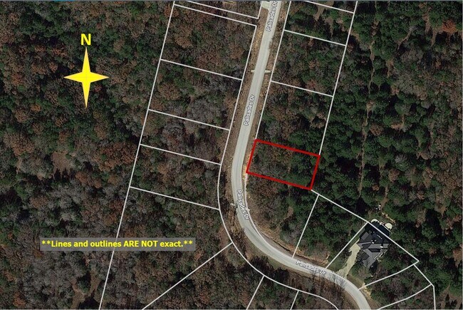
PALISADES ADDN PHASE II, BLOCK D, LOT 4, ACRES .241
365039
GRAYSON
Residentialacreage
Texas
B and X Area of moderate flood hazard, usually the area between the limits of the 100-year and 500-year floods.
4
2024
0.24 AC
2025
Texas North Area
001104
Other Market Areas
NEARBY LISTINGS FOR SALE OR LEASE
-
-
View all Whitesboro listings for sale on LoopNet.com
DEMOGRAPHICS near Palisades
1 mile
3 mile
5 mile
2025 Total Population
448
1,183
4,136
2030 Population
516
1,364
4,711
Pop Growth 2025-2030
+ 15.18%
+ 15.30%
+ 13.90%
Average Age
47
47
48
2025 Total Households
187
493
1,830
HH Growth 2025-2030
+ 14.97%
+ 15.21%
+ 14.04%
Median Household Inc
$126,613
$126,372
$74,443
Avg Household Size
2.40
2.40
2.20
2025 Avg HH Vehicles
3.00
3.00
2.00
Median Home Value
$350,000
$349,375
$250,000
Median Year Built
2011
2011
2003
Nearby Places
Map Layers
Map Styles
 Street
 Aerial
Layers
 Traffic
 Biking
Places
Listings with unknown addresses are not visible on the map
- Restaurants
- Banks
- Shops
- Fitness
- Groceries
SALE & LEASE HISTORY
LISTING DATE
SALE/LEASE

May 17, 2021
For Sale
Nearby Properties
Address
Land Use
TOTAL SIZE
Lot Size
Zoning
Address
Land Use
TOTAL SIZE
Lot Size
Zoning
525 AC
Address
Land Use
TOTAL SIZE
Lot Size
Zoning
3,457 SF
127.51 AC
Address
Land Use
TOTAL SIZE
Lot Size
Zoning
582.69 AC
Address
Land Use
TOTAL SIZE
Lot Size
Zoning
15,221 SF
39.77 AC
Address
Land Use
TOTAL SIZE
Lot Size
Zoning
124,025 SF
11.64 AC
Address
Land Use
TOTAL SIZE
Lot Size
Zoning
Address
Land Use
TOTAL SIZE
Lot Size
Zoning
13,568 SF
8.39 AC
Address
Land Use
TOTAL SIZE
Lot Size
Zoning
2,551 SF
109.24 AC
Address
Land Use
TOTAL SIZE
Lot Size
Zoning
195.91 AC
Address
Land Use
TOTAL SIZE
Lot Size
Zoning
Address
Land Use
TOTAL SIZE
Lot Size
Zoning
4,019 SF
Address
Land Use
TOTAL SIZE
Lot Size
Zoning
5,816 SF
48.70 AC
Address
Land Use
TOTAL SIZE
Lot Size
Zoning
8,643 SF
13.65 AC
Address
Land Use
TOTAL SIZE
Lot Size
Zoning
Address
Land Use
TOTAL SIZE
Lot Size
Zoning
3,790 SF
25.42 AC
Address
Land Use
TOTAL SIZE
Lot Size
Zoning
5,045 SF
354.23 AC
Address
Land Use
TOTAL SIZE
Lot Size
Zoning
10.57 AC
Address
Land Use
TOTAL SIZE
Lot Size
Zoning
91.52 AC
Address
Land Use
TOTAL SIZE
Lot Size
Zoning
4,379 SF
34.92 AC
Address
Land Use
TOTAL SIZE
Lot Size
Zoning
2,927 SF
0.17 AC
Address
Land Use
TOTAL SIZE
Lot Size
Zoning
17.41 AC
Address
Land Use
TOTAL SIZE
Lot Size
Zoning
2,895 SF
10.01 AC
Address
Land Use
TOTAL SIZE
Lot Size
Zoning
2,697 SF
103.92 AC
Address
Land Use
TOTAL SIZE
Lot Size
Zoning
3,753 SF
0.22 AC
Address
Land Use
TOTAL SIZE
Lot Size
Zoning
2,732 SF
10.10 AC
Address
Land Use
TOTAL SIZE
Lot Size
Zoning
3,922 SF
13.01 AC
Address
Land Use
TOTAL SIZE
Lot Size
Zoning
5,700 SF
2.77 AC
Address
Land Use
TOTAL SIZE
Lot Size
Zoning
3,930 SF
36.98 AC
Address
Land Use
TOTAL SIZE
Lot Size
Zoning
2,550 SF
0.32 AC
The World's #1 Commercial Real Estate Marketplace
Connect with us
© 2026 CoStar Group
The information above has been obtained from sources believed reliable. While we do not doubt its accuracy we have not verified it and make no guarantee, warranty or representation about it. It is your responsibility to independently confirm its accuracy and completeness. Any projections, opinions, assumptions, or estimates used are for example only and do not represent the current or future performance of the property. The value of this transaction to you depends on tax and other factors which should be evaluated by your tax, financial, and legal advisors. You and your advisors should conduct a careful, independent investigation of the property to determine to your satisfaction the suitability of the property for your needs.