Property Record
Palms Rd, Columbus, MI 48063
NEARBY LISTINGS FOR SALE OR LEASE
Property Detail
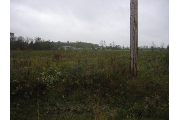
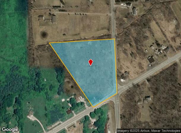
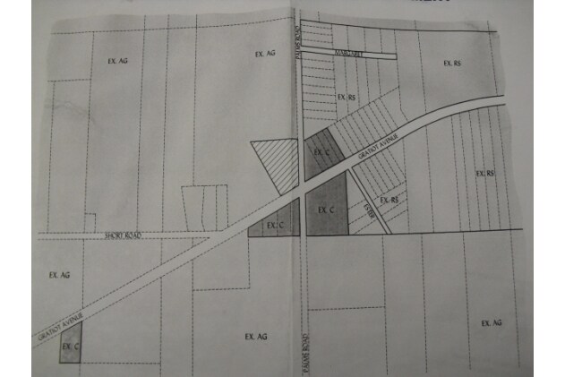
Palms Rd
16-023-2004-500
BEG S 3D 38M 16S E 1615' FROM NE SEC COR, TH S 3D 38M 16S E 530.36', TH S 58D 4M W 250', TH N 31D 56M W 272.35', TH N 85D 30M 29S E 564.97' TO BEG SECTION 23 T5N R15E 5.53 A
Residentialacreage
St. Clair
X
Michigan
26147C0425D
5.53 AC
2025
St Clair & Lapeer Counties
2025
Detroit
651600
Detroit-Warren-Dearborn, MI
DEMOGRAPHICS near Palms Rd
1 mile
3 mile
5 mile
2024 Total Population
341
3,590
8,343
2029 Population
338
3,557
8,237
Pop Growth 2024-2029
(0.88%)
(0.92%)
(1.27%)
Average Age
41
42
42
2024 Total Households
127
1,329
3,114
HH Growth 2024-2029
(0.79%)
(0.90%)
(1.35%)
Median Household Inc
$99,999
$95,783
$89,977
Avg Household Size
2.70
2.70
2.60
2024 Avg HH Vehicles
2.00
2.00
2.00
Median Home Value
$261,999
$263,644
$265,816
Median Year Built
1987
1988
1984
Nearby Places
Map Layers
Map Styles
 Street
 Aerial
Transit
 Traffic
 Biking
Places
Listings with unknown addresses are not visible on the map
- Restaurants
- Banks
- Shops
- Fitness
- Groceries
SALE & LEASE HISTORY
LISTING DATE
SALE/LEASE

Sep 24, 2016
For Sale
Dec 08, 2016
For Sale
Nearby Properties
Address
Land Use
TOTAL SIZE
Lot Size
Zoning
Address
Land Use
TOTAL SIZE
Lot Size
Zoning
1,100 SF
143.74 AC
MOBIL H
Address
Land Use
TOTAL SIZE
Lot Size
Zoning
37,571 SF
6.02 AC
Address
Land Use
TOTAL SIZE
Lot Size
Zoning
Address
Land Use
TOTAL SIZE
Lot Size
Zoning
3,804 SF
87.73 AC
AGRICUL
Address
Land Use
TOTAL SIZE
Lot Size
Zoning
6,100 SF
4.02 AC
RU
Address
Land Use
TOTAL SIZE
Lot Size
Zoning
236.67 AC
AGRICUL
Address
Land Use
TOTAL SIZE
Lot Size
Zoning
2,900 SF
45.82 AC
OPEN SP
Address
Land Use
TOTAL SIZE
Lot Size
Zoning
5,715 SF
8.23 AC
AGRICUL
Address
Land Use
TOTAL SIZE
Lot Size
Zoning
6,224 SF
2.19 AC
AGRICUL
Address
Land Use
TOTAL SIZE
Lot Size
Zoning
3,385 SF
6.47 AC
RS/OPSP
Address
Land Use
TOTAL SIZE
Lot Size
Zoning
1,796 SF
183 AC
AGRICUL
Address
Land Use
TOTAL SIZE
Lot Size
Zoning
1,458 SF
160 AC
RES/AG
Address
Land Use
TOTAL SIZE
Lot Size
Zoning
1,680 SF
148.59 AC
RESIDEN
Address
Land Use
TOTAL SIZE
Lot Size
Zoning
4,232 SF
100 AC
RU
Address
Land Use
TOTAL SIZE
Lot Size
Zoning
7,200 SF
6.50 AC
B-2
Address
Land Use
TOTAL SIZE
Lot Size
Zoning
3,176 SF
81.67 AC
AGRICUL
Address
Land Use
TOTAL SIZE
Lot Size
Zoning
4,968 SF
11.19 AC
RU
Address
Land Use
TOTAL SIZE
Lot Size
Zoning
2.24 AC
GEN.COM/RS
Address
Land Use
TOTAL SIZE
Lot Size
Zoning
3,599 SF
7.17 AC
RU
Address
Land Use
TOTAL SIZE
Lot Size
Zoning
13,236 SF
80 AC
AGRICUL
Address
Land Use
TOTAL SIZE
Lot Size
Zoning
3,987 SF
9.50 AC
RU
Address
Land Use
TOTAL SIZE
Lot Size
Zoning
7,196 SF
31.48 AC
B-2
Address
Land Use
TOTAL SIZE
Lot Size
Zoning
3,215 SF
22.24 AC
AGRICUL
Address
Land Use
TOTAL SIZE
Lot Size
Zoning
3,044 SF
8.23 AC
AGRICUL
Address
Land Use
TOTAL SIZE
Lot Size
Zoning
3,175 SF
5.96 AC
RESIDEN
Address
Land Use
TOTAL SIZE
Lot Size
Zoning
1,973 SF
76 AC
AGRICUL
Address
Land Use
TOTAL SIZE
Lot Size
Zoning
3,253 SF
40 AC
AGRICUL
Address
Land Use
TOTAL SIZE
Lot Size
Zoning
11,234 SF
28.35 AC
RU
Address
Land Use
TOTAL SIZE
Lot Size
Zoning
2,812 SF
4.79 AC
RU
Address
Land Use
TOTAL SIZE
Lot Size
Zoning
2,968 SF
4.56 AC
RU
The World's #1 Commercial Real Estate Marketplace
Connect with us
© 2026 CoStar Group
The information above has been obtained from sources believed reliable. While we do not doubt its accuracy we have not verified it and make no guarantee, warranty or representation about it. It is your responsibility to independently confirm its accuracy and completeness. Any projections, opinions, assumptions, or estimates used are for example only and do not represent the current or future performance of the property. The value of this transaction to you depends on tax and other factors which should be evaluated by your tax, financial, and legal advisors. You and your advisors should conduct a careful, independent investigation of the property to determine to your satisfaction the suitability of the property for your needs.