Property Record
6010 State Route 29, West Jefferson, OH 43162
NEARBY LISTINGS FOR SALE OR LEASE
Property Detail
6010 State Route 29
16-00045.000
Vms 12143
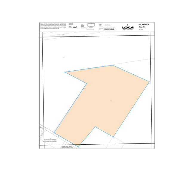
Agriculturalland
7.124A
X
Madison
39097C0175D
Ohio
2024
Madison County
2024
Columbus
040400
Columbus, OH
DEMOGRAPHICS near 6010 State Route 29
1 Mile
3 Mile
5 Mile
2024 Total Population
56
5,877
13,098
2029 Population
60
6,378
13,855
Pop Growth 2024-2029
+ 7.14%
+ 8.52%
+ 5.78%
Average Age
42
42
40
2024 Total Households
21
2,338
4,902
HH Growth 2024-2029
+ 9.52%
+ 8.85%
+ 6.36%
Median Household Inc
$82,500
$69,137
$77,246
Avg Household Size
2.50
2.50
2.60
2024 Avg HH Vehicles
2.00
2.00
2.00
Median Home Value
$289,999
$169,728
$181,686
Median Year Built
1973
1969
1974
Nearby Places
Map Layers
Map Styles
 Street
 Aerial
- Restaurants
- Banks
- Shops
- Fitness
- Groceries
PUBLIC TRANSPORTATION
AIRPORT
John Glenn Columbus International
DRIVE
WALK
Distance
John Glenn Columbus International
34 min
27.0 mi
Rickenbacker International
DRIVE
WALK
Distance
Rickenbacker International
41 min
31.8 mi
Freight Ports
Port of Toledo
DRIVE
WALK
Distance
Port of Toledo
186 min
135.8 mi
Nearby Properties
Address
Land Use
TOTAL SIZE
Lot Size
Zoning
Address
Land Use
TOTAL SIZE
Lot Size
Zoning
1,147,230 SF
147.79 AC
Address
Land Use
TOTAL SIZE
Lot Size
Zoning
1,294,720 SF
69.82 AC
Address
Land Use
TOTAL SIZE
Lot Size
Zoning
857,178 SF
83.34 AC
Address
Land Use
TOTAL SIZE
Lot Size
Zoning
1,200,990 SF
100.24 AC
Address
Land Use
TOTAL SIZE
Lot Size
Zoning
Address
Land Use
TOTAL SIZE
Lot Size
Zoning
418,380 SF
63.21 AC
Address
Land Use
TOTAL SIZE
Lot Size
Zoning
1,144,526 SF
63.77 AC
Address
Land Use
TOTAL SIZE
Lot Size
Zoning
835,355 SF
33.23 AC
Address
Land Use
TOTAL SIZE
Lot Size
Zoning
452,981 SF
46.63 AC
Address
Land Use
TOTAL SIZE
Lot Size
Zoning
842,920 SF
59.08 AC
Address
Land Use
TOTAL SIZE
Lot Size
Zoning
743,200 SF
49.10 AC
Address
Land Use
TOTAL SIZE
Lot Size
Zoning
842,920 SF
39.93 AC
Address
Land Use
TOTAL SIZE
Lot Size
Zoning
832,200 SF
61.64 AC
Address
Land Use
TOTAL SIZE
Lot Size
Zoning
66,296 SF
60 AC
Address
Land Use
TOTAL SIZE
Lot Size
Zoning
747,000 SF
37.46 AC
Address
Land Use
TOTAL SIZE
Lot Size
Zoning
687,960 SF
48.53 AC
Address
Land Use
TOTAL SIZE
Lot Size
Zoning
543,750 SF
36.71 AC
Address
Land Use
TOTAL SIZE
Lot Size
Zoning
173,250 SF
21.29 AC
Address
Land Use
TOTAL SIZE
Lot Size
Zoning
146,770 SF
70.05 AC
Address
Land Use
TOTAL SIZE
Lot Size
Zoning
342,000 SF
40.23 AC
Address
Land Use
TOTAL SIZE
Lot Size
Zoning
292,193 SF
24.67 AC
Address
Land Use
TOTAL SIZE
Lot Size
Zoning
254,374 SF
22.75 AC
Address
Land Use
TOTAL SIZE
Lot Size
Zoning
209,334 SF
37.55 AC
Address
Land Use
TOTAL SIZE
Lot Size
Zoning
72,640 SF
15 AC
Address
Land Use
TOTAL SIZE
Lot Size
Zoning
127.90 AC
Address
Land Use
TOTAL SIZE
Lot Size
Zoning
82,588 SF
40.43 AC
Address
Land Use
TOTAL SIZE
Lot Size
Zoning
1,794 SF
74.20 AC
Address
Land Use
TOTAL SIZE
Lot Size
Zoning
Address
Land Use
TOTAL SIZE
Lot Size
Zoning
2,275 SF
313.92 AC
Address
Land Use
TOTAL SIZE
Lot Size
Zoning
2,112 SF
301.83 AC
The World's #1 Commercial Real Estate Marketplace
Connect with us
© 2026 CoStar Group
The information above has been obtained from sources believed reliable. While we do not doubt its accuracy we have not verified it and make no guarantee, warranty or representation about it. It is your responsibility to independently confirm its accuracy and completeness. Any projections, opinions, assumptions, or estimates used are for example only and do not represent the current or future performance of the property. The value of this transaction to you depends on tax and other factors which should be evaluated by your tax, financial, and legal advisors. You and your advisors should conduct a careful, independent investigation of the property to determine to your satisfaction the suitability of the property for your needs.