Property Record
Patterson Ave, Winston Salem, NC 27105
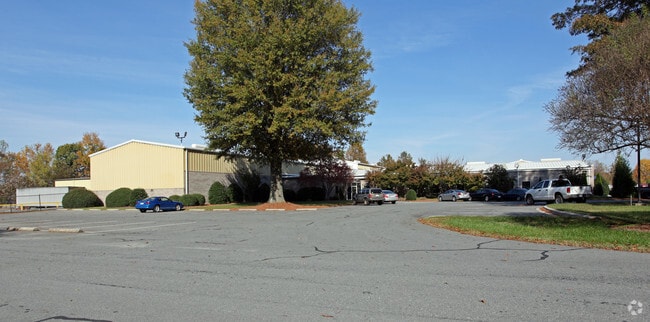
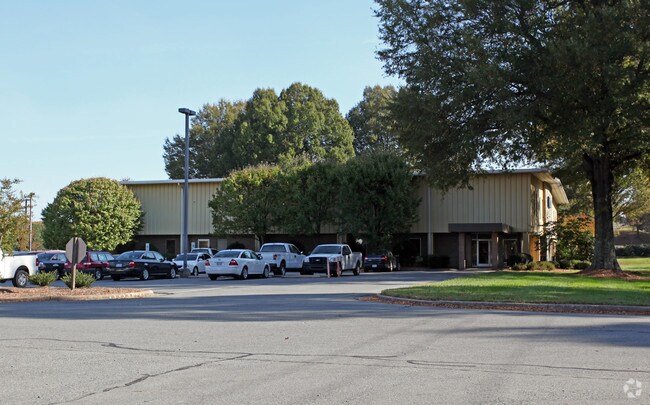
Property Detail
Patterson Ave
Winston-Salem, NC
LO:002 BL:4841
6828-56-1801
FORSYTH
Industrialacreage
North Carolina
GI
2
AE The base floodplain where base flood elevations are provided. AE Zones are now used on new format FIRMs instead of A1-A30 Zones.
4.69 AC
2024
NW Forsyth County
2025
Greensboro/Winston-Salem
001500
NEARBY LISTINGS FOR SALE OR LEASE
-
-
View all Winston Salem listings for sale on LoopNet.com
DEMOGRAPHICS near Patterson Ave
1 mile
3 mile
5 mile
2025 Total Population
1,686
41,288
98,458
2030 Population
1,732
42,846
102,239
Pop Growth 2025-2030
+ 2.73%
+ 3.77%
+ 3.84%
Average Age
38
37
38
2025 Total Households
784
16,416
38,944
HH Growth 2025-2030
+ 2.81%
+ 4.04%
+ 4.08%
Median Household Inc
$49,617
$49,953
$57,739
Avg Household Size
2.00
2.30
2.30
2025 Avg HH Vehicles
2.00
2.00
2.00
Median Home Value
$183,223
$199,442
$229,421
Median Year Built
1975
1982
1978
Nearby Places
Map Layers
Map Styles
 Street
 Aerial
Layers
 Traffic
 Biking
Places
Listings with unknown addresses are not visible on the map
- Restaurants
- Banks
- Shops
- Fitness
- Groceries
PUBLIC TRANSPORTATION
AIRPORT
Piedmont Triad International
Drive
Walk
Distance
Piedmont Triad International
42 min
26.6 mi
Freight Ports
Virginia Port Authority - Richmond
Drive
Walk
Distance
Virginia Port Authority - Richmond
269 min
230.2 mi
Nearby Properties
Address
Land Use
TOTAL SIZE
Lot Size
Zoning
Address
Land Use
TOTAL SIZE
Lot Size
Zoning
412,075 SF
94.76 AC
CPO,GI,RS9
Address
Land Use
TOTAL SIZE
Lot Size
Zoning
329,963 SF
58.84 AC
RM18-S
Address
Land Use
TOTAL SIZE
Lot Size
Zoning
153,937 SF
34.63 AC
RM12-S
Address
Land Use
TOTAL SIZE
Lot Size
Zoning
245,828 SF
28.02 AC
GB
Address
Land Use
TOTAL SIZE
Lot Size
Zoning
152,968 SF
32.40 AC
RM18
Address
Land Use
TOTAL SIZE
Lot Size
Zoning
127,566 SF
35.86 AC
C-L
Address
Land Use
TOTAL SIZE
Lot Size
Zoning
85,354 SF
29.13 AC
RM18-S
Address
Land Use
TOTAL SIZE
Lot Size
Zoning
178,192 SF
28.15 AC
RM18
Address
Land Use
TOTAL SIZE
Lot Size
Zoning
91,905 SF
21.18 AC
RM18-S
Address
Land Use
TOTAL SIZE
Lot Size
Zoning
106,821 SF
14.95 AC
RM12-S
Address
Land Use
TOTAL SIZE
Lot Size
Zoning
224,895 SF
31.67 AC
HB-S
Address
Land Use
TOTAL SIZE
Lot Size
Zoning
209,521 SF
20.73 AC
HB-S,RS9
Address
Land Use
TOTAL SIZE
Lot Size
Zoning
741,857 SF
53.71 AC
GB-L
Address
Land Use
TOTAL SIZE
Lot Size
Zoning
12,132 SF
57.50 AC
RM18
Address
Land Use
TOTAL SIZE
Lot Size
Zoning
711,274 SF
38.24 AC
LI
Address
Land Use
TOTAL SIZE
Lot Size
Zoning
120,256 SF
43.62 AC
GB-S,IP
Address
Land Use
TOTAL SIZE
Lot Size
Zoning
90,740 SF
17.28 AC
RM18
Address
Land Use
TOTAL SIZE
Lot Size
Zoning
106,941 SF
10.91 AC
RM12-S
Address
Land Use
TOTAL SIZE
Lot Size
Zoning
111,873 SF
23.10 AC
RM18
Address
Land Use
TOTAL SIZE
Lot Size
Zoning
99,460 SF
17.17 AC
RM18
Address
Land Use
TOTAL SIZE
Lot Size
Zoning
72,782 SF
15.72 AC
RM12-S,RS9
Address
Land Use
TOTAL SIZE
Lot Size
Zoning
67,643 SF
19.19 AC
RM12-S
Address
Land Use
TOTAL SIZE
Lot Size
Zoning
113,060 SF
16.61 AC
HB-S,RS9
Address
Land Use
TOTAL SIZE
Lot Size
Zoning
34,316 SF
6.50 AC
GB
Address
Land Use
TOTAL SIZE
Lot Size
Zoning
92,721 SF
22.79 AC
HB
Address
Land Use
TOTAL SIZE
Lot Size
Zoning
81,392 SF
15.76 AC
GB
Address
Land Use
TOTAL SIZE
Lot Size
Zoning
89,957 SF
14.65 AC
RM18
Address
Land Use
TOTAL SIZE
Lot Size
Zoning
93,541 SF
10.75 AC
RM18
Address
Land Use
TOTAL SIZE
Lot Size
Zoning
89,408 SF
10.57 AC
GI
Address
Land Use
TOTAL SIZE
Lot Size
Zoning
95,375 SF
20.15 AC
RS9
The World's #1 Commercial Real Estate Marketplace
Connect with us
© 2026 CoStar Group
The information above has been obtained from sources believed reliable. While we do not doubt its accuracy we have not verified it and make no guarantee, warranty or representation about it. It is your responsibility to independently confirm its accuracy and completeness. Any projections, opinions, assumptions, or estimates used are for example only and do not represent the current or future performance of the property. The value of this transaction to you depends on tax and other factors which should be evaluated by your tax, financial, and legal advisors. You and your advisors should conduct a careful, independent investigation of the property to determine to your satisfaction the suitability of the property for your needs.