Property Record
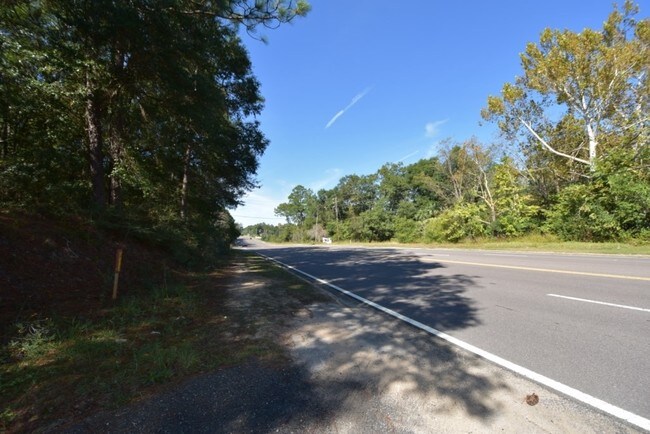
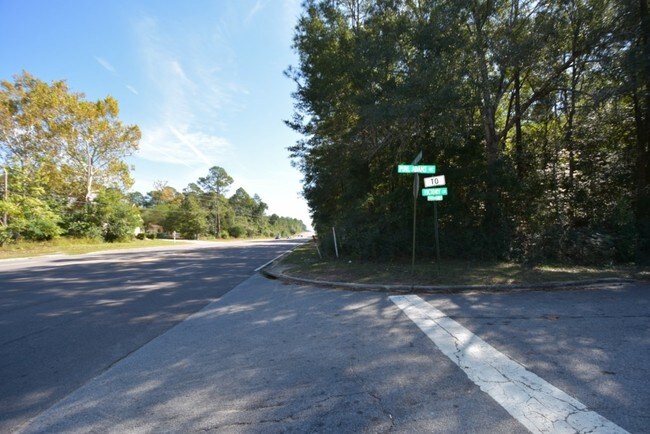
Pearl Adams Rd, Crestview, FL 32536


Property Detail
Pearl Adams Rd
Crestview-Fort Walton Beach-Destin, FL
BEG NW COR SEC S1431.18 FT SE ALG HWY 1029.1 FT TO BEG S10 DEG W232.87 FT E296.06 FT N30 DEG W243.41 FT NW ALG S R/W HWY 133.57 FT TO BEG OR 1149-1623
16-3N-23-0000-0013-002A
OKALOOSA
Commercialacreage
Florida
C-1
2a
B and X Area of moderate flood hazard, usually the area between the limits of the 100-year and 500-year floods.
1.05 AC
2025
Fort Walton Beach
2025
Other Market Areas
020500
NEARBY LISTINGS FOR SALE OR LEASE
DEMOGRAPHICS near Pearl Adams Rd
1 mile
3 mile
5 mile
2025 Total Population
6,089
28,947
50,291
2030 Population
6,344
29,997
51,738
Pop Growth 2025-2030
+ 4.19%
+ 3.63%
+ 2.88%
Average Age
37
37
37
2025 Total Households
2,078
10,547
17,806
HH Growth 2025-2030
+ 4.48%
+ 3.53%
+ 2.74%
Median Household Inc
$61,409
$72,471
$81,835
Avg Household Size
2.60
2.60
2.70
2025 Avg HH Vehicles
2.00
2.00
2.00
Median Home Value
$189,185
$293,981
$313,762
Median Year Built
1988
1996
1998
Nearby Places
Map Layers
Map Styles
 Street
 Aerial
Layers
 Traffic
 Biking
Places
Listings with unknown addresses are not visible on the map
- Restaurants
- Banks
- Shops
- Fitness
- Groceries
PUBLIC TRANSPORTATION
AIRPORT
Eglin AFB/Destin-Ft Walton Beach
Drive
Walk
Distance
Eglin AFB/Destin-Ft Walton Beach
49 min
26.7 mi
Freight Ports
Port of Panama City
Drive
Walk
Distance
Port of Panama City
110 min
83.5 mi
SALE & LEASE HISTORY
LISTING DATE
SALE/LEASE

Mar 24, 2017
For Sale
Nearby Properties
Address
Land Use
TOTAL SIZE
Lot Size
Zoning
Address
Land Use
TOTAL SIZE
Lot Size
Zoning
368,602 SF
29.05 AC
Address
Land Use
TOTAL SIZE
Lot Size
Zoning
188,733 SF
7.90 AC
R-1
Address
Land Use
TOTAL SIZE
Lot Size
Zoning
143,873 SF
20.26 AC
Address
Land Use
TOTAL SIZE
Lot Size
Zoning
309,767 SF
328.77 AC
Address
Land Use
TOTAL SIZE
Lot Size
Zoning
76,136 SF
7.45 AC
Address
Land Use
TOTAL SIZE
Lot Size
Zoning
179,054 SF
22.90 AC
Address
Land Use
TOTAL SIZE
Lot Size
Zoning
267,567 SF
66.39 AC
Address
Land Use
TOTAL SIZE
Lot Size
Zoning
13,976 SF
19.04 AC
C-1
Address
Land Use
TOTAL SIZE
Lot Size
Zoning
297,438 SF
39.75 AC
Address
Land Use
TOTAL SIZE
Lot Size
Zoning
136,672 SF
13.63 AC
C-1
Address
Land Use
TOTAL SIZE
Lot Size
Zoning
150,810 SF
22.68 AC
Address
Land Use
TOTAL SIZE
Lot Size
Zoning
61,672 SF
5.65 AC
Address
Land Use
TOTAL SIZE
Lot Size
Zoning
346,810 SF
26 AC
Address
Land Use
TOTAL SIZE
Lot Size
Zoning
7,615 SF
70.60 AC
Address
Land Use
TOTAL SIZE
Lot Size
Zoning
80,274 SF
12.60 AC
Address
Land Use
TOTAL SIZE
Lot Size
Zoning
71,382 SF
2.55 AC
Address
Land Use
TOTAL SIZE
Lot Size
Zoning
79,992 SF
7.26 AC
Address
Land Use
TOTAL SIZE
Lot Size
Zoning
24,868 SF
2.03 AC
Address
Land Use
TOTAL SIZE
Lot Size
Zoning
87,672 SF
15.69 AC
Address
Land Use
TOTAL SIZE
Lot Size
Zoning
193,986 SF
65 AC
Address
Land Use
TOTAL SIZE
Lot Size
Zoning
128,128 SF
30.01 AC
Address
Land Use
TOTAL SIZE
Lot Size
Zoning
179,963 SF
22.48 AC
Address
Land Use
TOTAL SIZE
Lot Size
Zoning
26,634 SF
2.72 AC
Address
Land Use
TOTAL SIZE
Lot Size
Zoning
106,131 SF
6.50 AC
Address
Land Use
TOTAL SIZE
Lot Size
Zoning
62,274 SF
7 AC
Address
Land Use
TOTAL SIZE
Lot Size
Zoning
54,986 SF
2.84 AC
Address
Land Use
TOTAL SIZE
Lot Size
Zoning
51,432 SF
3.95 AC
Address
Land Use
TOTAL SIZE
Lot Size
Zoning
40,754 SF
23.67 AC
Address
Land Use
TOTAL SIZE
Lot Size
Zoning
70,918 SF
14.91 AC
Address
Land Use
TOTAL SIZE
Lot Size
Zoning
139,185 SF
14.95 AC
The World's #1 Commercial Real Estate Marketplace
Connect with us
© 2026 CoStar Group
The information above has been obtained from sources believed reliable. While we do not doubt its accuracy we have not verified it and make no guarantee, warranty or representation about it. It is your responsibility to independently confirm its accuracy and completeness. Any projections, opinions, assumptions, or estimates used are for example only and do not represent the current or future performance of the property. The value of this transaction to you depends on tax and other factors which should be evaluated by your tax, financial, and legal advisors. You and your advisors should conduct a careful, independent investigation of the property to determine to your satisfaction the suitability of the property for your needs.